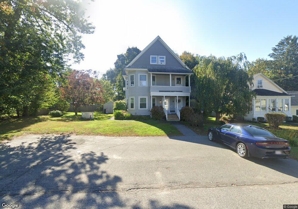
42 Bay State Rd North Andover, MA 01845
Estimated Value: $826,000 - $861,000
5
Beds
3
Baths
2,848
Sq Ft
$297/Sq Ft
Est. Value
About This Home
This home is located at 42 Bay State Rd, North Andover, MA 01845 and is currently estimated at $844,775, approximately $296 per square foot. 42 Bay State Rd is a home located in Essex County with nearby schools including Kittredge Elementary School, North Andover Middle School, and North Andover High School.
Ownership History
Date
Name
Owned For
Owner Type
Purchase Details
Closed on
Dec 27, 2017
Sold by
Tamagnine Marie J Est
Bought by
Upton Timothy E and Upton Leah R
Current Estimated Value
Home Financials for this Owner
Home Financials are based on the most recent Mortgage that was taken out on this home.
Original Mortgage
$333,750
Outstanding Balance
$281,717
Interest Rate
3.95%
Mortgage Type
New Conventional
Estimated Equity
$563,058
Purchase Details
Closed on
Jan 1, 1980
Bought by
Tamagnine James E and Tamagnine Marie J
Create a Home Valuation Report for This Property
The Home Valuation Report is an in-depth analysis detailing your home's value as well as a comparison with similar homes in the area
Home Values in the Area
Average Home Value in this Area
Purchase History
| Date | Buyer | Sale Price | Title Company |
|---|---|---|---|
| Upton Timothy E | $445,000 | -- | |
| Tamagnine James E | -- | -- |
Source: Public Records
Mortgage History
| Date | Status | Borrower | Loan Amount |
|---|---|---|---|
| Open | Upton Timothy E | $333,750 |
Source: Public Records
Tax History Compared to Growth
Tax History
| Year | Tax Paid | Tax Assessment Tax Assessment Total Assessment is a certain percentage of the fair market value that is determined by local assessors to be the total taxable value of land and additions on the property. | Land | Improvement |
|---|---|---|---|---|
| 2025 | $8,082 | $717,800 | $306,800 | $411,000 |
| 2024 | $7,459 | $672,600 | $288,800 | $383,800 |
| 2023 | $6,818 | $557,000 | $265,300 | $291,700 |
| 2022 | $6,662 | $492,400 | $238,200 | $254,200 |
| 2021 | $6,413 | $452,600 | $216,600 | $236,000 |
| 2020 | $6,219 | $452,600 | $216,600 | $236,000 |
| 2019 | $6,359 | $474,200 | $216,600 | $257,600 |
| 2018 | $6,890 | $474,200 | $216,600 | $257,600 |
| 2017 | $6,062 | $424,500 | $181,600 | $242,900 |
| 2016 | $5,785 | $405,400 | $178,100 | $227,300 |
| 2015 | $4,887 | $339,600 | $172,000 | $167,600 |
Source: Public Records
Map
Nearby Homes
- 19 Fernview Ave Unit 6
- 19 Fernview Ave Unit 5
- 25 Fernview Ave Unit 8
- 23 Fernview Ave Unit 1
- 35 Fernview Ave Unit 5
- 16 Court St
- 40 Fernview Ave Unit 11
- 52 Fernview Ave Unit 7
- 90 Edgelawn Ave Unit 1
- 180 Chickering Rd Unit 310C
- 98 Mill Pond
- 75 Edgelawn Ave Unit 1
- 112 Mill Pond
- 70 Farrwood Ave Unit 7
- 115 Mill Pond
- 116 Mill Pond
- 11 W Bradstreet Rd
- 168 Greene St
- 387 Massachusetts Ave
- 3 Great Pond Rd
- 36 Bay State Rd
- 48 Bay State Rd
- 28 Bay State Rd
- 42-44 Bay State Rd
- 47 Bay State Rd
- 35 Bay State Rd
- 56 Bay State Rd
- 361 Chickering Rd
- 53 Bay State Rd
- 83 Phillips Common
- 75 Phillips Common
- 22 Bay State Rd
- 25 Bay State Rd Unit B
- 25 Bay State Rd Unit A
- 40 Beacon Hill Blvd
- 48 Beacon Hill Blvd
- 67 Phillips Common
- 28 Beacon Hill Blvd
- 204 Osgood St
- 89 Phillips Common