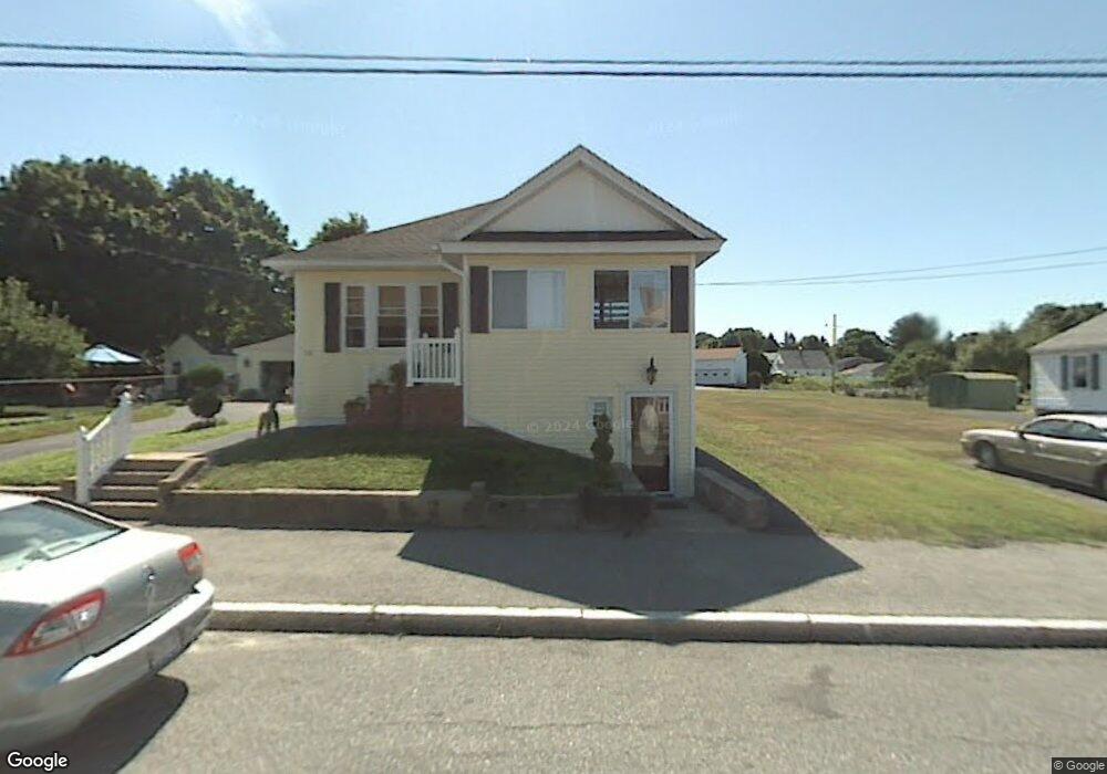
42 Benedict Rd Worcester, MA 01604
Hamilton NeighborhoodEstimated Value: $448,000 - $570,000
3
Beds
2
Baths
1,610
Sq Ft
$315/Sq Ft
Est. Value
About This Home
This home is located at 42 Benedict Rd, Worcester, MA 01604 and is currently estimated at $507,526, approximately $315 per square foot. 42 Benedict Rd is a home located in Worcester County with nearby schools including Jacob Hiatt Magnet School, Chandler Magnet, and Rice Square Elementary School.
Ownership History
Date
Name
Owned For
Owner Type
Purchase Details
Closed on
Jul 20, 2007
Sold by
Carlson Joseph P
Bought by
Carlson Candice F and Carlson Joseph P
Current Estimated Value
Purchase Details
Closed on
Jun 23, 1997
Sold by
Aiello Frances
Bought by
Carlson Joseph P
Home Financials for this Owner
Home Financials are based on the most recent Mortgage that was taken out on this home.
Original Mortgage
$108,385
Interest Rate
7.87%
Mortgage Type
Purchase Money Mortgage
Create a Home Valuation Report for This Property
The Home Valuation Report is an in-depth analysis detailing your home's value as well as a comparison with similar homes in the area
Home Values in the Area
Average Home Value in this Area
Purchase History
| Date | Buyer | Sale Price | Title Company |
|---|---|---|---|
| Carlson Candice F | -- | -- | |
| Carlson Joseph P | $109,900 | -- |
Source: Public Records
Mortgage History
| Date | Status | Borrower | Loan Amount |
|---|---|---|---|
| Previous Owner | Carlson Joseph P | $108,385 |
Source: Public Records
Tax History Compared to Growth
Tax History
| Year | Tax Paid | Tax Assessment Tax Assessment Total Assessment is a certain percentage of the fair market value that is determined by local assessors to be the total taxable value of land and additions on the property. | Land | Improvement |
|---|---|---|---|---|
| 2025 | $6,441 | $488,300 | $118,900 | $369,400 |
| 2024 | $6,271 | $456,100 | $118,900 | $337,200 |
| 2023 | $6,074 | $423,600 | $103,400 | $320,200 |
| 2022 | $5,609 | $368,800 | $82,700 | $286,100 |
| 2021 | $5,535 | $340,000 | $66,200 | $273,800 |
| 2020 | $5,399 | $317,600 | $66,200 | $251,400 |
| 2019 | $5,305 | $294,700 | $59,700 | $235,000 |
| 2018 | $5,272 | $278,800 | $59,700 | $219,100 |
| 2017 | $5,080 | $264,300 | $59,700 | $204,600 |
| 2016 | $5,183 | $251,500 | $44,300 | $207,200 |
| 2015 | $5,048 | $251,500 | $44,300 | $207,200 |
| 2014 | $4,914 | $251,500 | $44,300 | $207,200 |
Source: Public Records
Map
Nearby Homes
- 42 Ancona Rd
- 135 Orient St
- 620 Franklin St
- 167 Orient St
- 194 Norfolk St
- 308 Plantation St
- 1 Envelope Terrace Unit 116
- 70 Harrington Way
- 10 Imperial Rd
- 43 Wilson St
- 3 Ingleside Ave
- 28 Granby Rd
- 37 Adams St
- 29 Chilmark St
- 13 Waite St
- 16-16.5 Caprera Rd
- 10 Ellsmere St
- 68 Dartmouth St
- 360 Hamilton St
- 340 Hamilton St
- 39 Ancona Rd
- 38 Benedict Rd
- 31 Trent Rd
- 45 Benedict Rd
- 44 Ancona Rd
- 36 Benedict Rd
- 40 Ancona Rd
- 40 Ancona Rd Unit 1
- 41 Benedict Rd
- 43 Benedict Rd
- 39 Benedict Rd
- 34 Benedict Rd
- 46 Ancona Rd
- 46 Ancona Rd Unit 1st Floor
- 47 Benedict Rd
- 36 Emerson St
- 31 Ancona Rd
- 35 Benedict Rd
- 34 Ancona Rd
- 39 Montgomery Ave