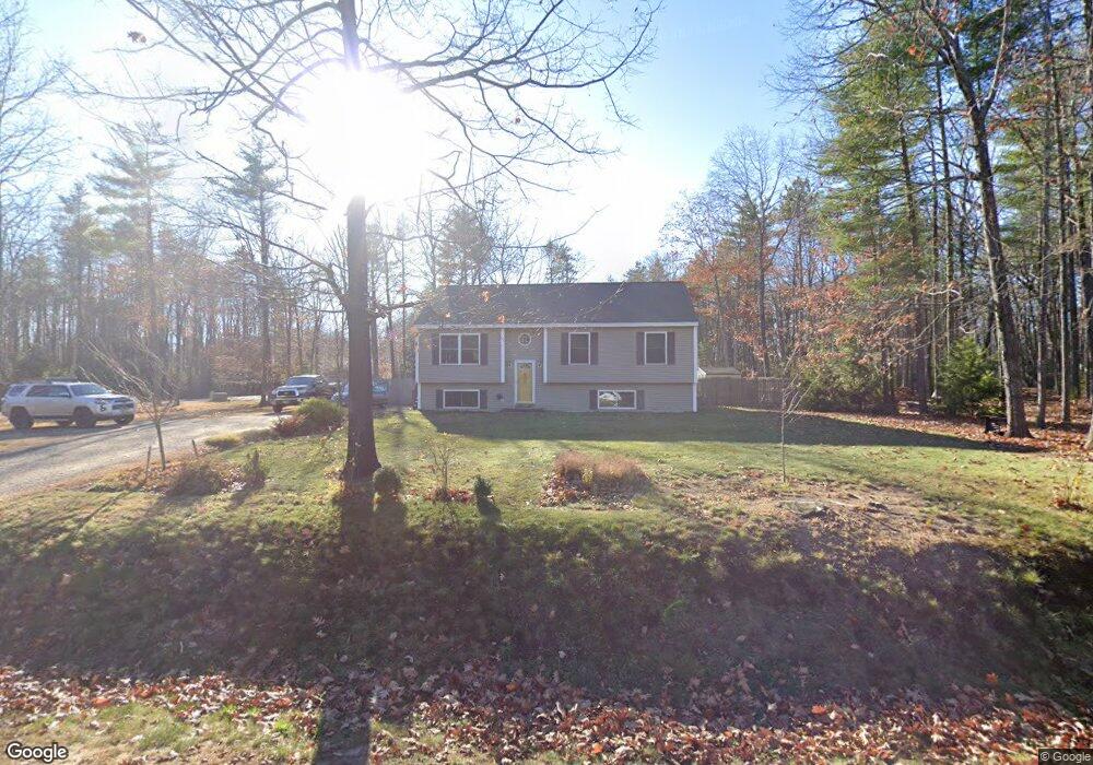
42 Boulder Dr Gorham, ME 04038
Estimated Value: $468,004 - $538,000
3
Beds
2
Baths
1,225
Sq Ft
$409/Sq Ft
Est. Value
About This Home
This home is located at 42 Boulder Dr, Gorham, ME 04038 and is currently estimated at $501,001, approximately $408 per square foot. 42 Boulder Dr is a home with nearby schools including Great Falls Elementary School, Gorham Middle School, and Gorham High School.
Ownership History
Date
Name
Owned For
Owner Type
Purchase Details
Closed on
Jul 5, 2007
Sold by
Gilbert Homes Inc
Bought by
Nadeau Larry and Devoe Gary
Current Estimated Value
Home Financials for this Owner
Home Financials are based on the most recent Mortgage that was taken out on this home.
Original Mortgage
$255,780
Interest Rate
6.39%
Mortgage Type
Unknown
Create a Home Valuation Report for This Property
The Home Valuation Report is an in-depth analysis detailing your home's value as well as a comparison with similar homes in the area
Home Values in the Area
Average Home Value in this Area
Purchase History
| Date | Buyer | Sale Price | Title Company |
|---|---|---|---|
| Nadeau Larry | -- | -- |
Source: Public Records
Mortgage History
| Date | Status | Borrower | Loan Amount |
|---|---|---|---|
| Open | Nadeau Larry | $275,146 | |
| Closed | Nadeau Larry | $264,400 | |
| Closed | Nadeau Larry | $255,780 |
Source: Public Records
Tax History
| Year | Tax Paid | Tax Assessment Tax Assessment Total Assessment is a certain percentage of the fair market value that is determined by local assessors to be the total taxable value of land and additions on the property. | Land | Improvement |
|---|---|---|---|---|
| 2025 | $5,273 | $356,300 | $114,700 | $241,600 |
| 2024 | $5,238 | $356,300 | $114,700 | $241,600 |
| 2023 | $4,899 | $356,300 | $114,700 | $241,600 |
| 2022 | $4,578 | $356,300 | $114,700 | $241,600 |
| 2021 | $4,270 | $220,100 | $87,300 | $132,800 |
| 2020 | $4,182 | $220,100 | $87,300 | $132,800 |
| 2019 | $4,171 | $220,100 | $87,300 | $132,800 |
| 2018 | $4,006 | $220,100 | $87,300 | $132,800 |
| 2017 | $3,764 | $220,100 | $87,300 | $132,800 |
| 2016 | $3,745 | $220,300 | $87,500 | $132,800 |
| 2015 | $3,591 | $220,300 | $87,500 | $132,800 |
| 2014 | $3,842 | $220,800 | $102,300 | $118,500 |
| 2013 | $3,820 | $220,800 | $102,300 | $118,500 |
Source: Public Records
Map
Nearby Homes
- 116 Dingley Spring Rd
- 4 Musket Dr
- 696 Fort Hill Rd
- 42 Brandons Way
- 697 Fort Hill Rd
- 63 Ossipee Trail E
- 66 Ossipee Trail East Trail E
- 68 Woodbrey Ln
- 866 Parker Farm Lot B Rd
- 866 Parker Farm Lot A Rd
- 761 Fort Hill Rd
- LOT #34 Woodbrey Ln
- 27 Ossipee Trail E Unit 1
- 866 Parker Farm Rd Unit A
- 866 Parker Farm Rd Unit B
- 35 Rust Rd
- 29 Woodbrey Ln
- LOT #65 Eastern Ln
- 24 Eastern Ln
- LOT #6 Eastern Ln
Your Personal Tour Guide
Ask me questions while you tour the home.