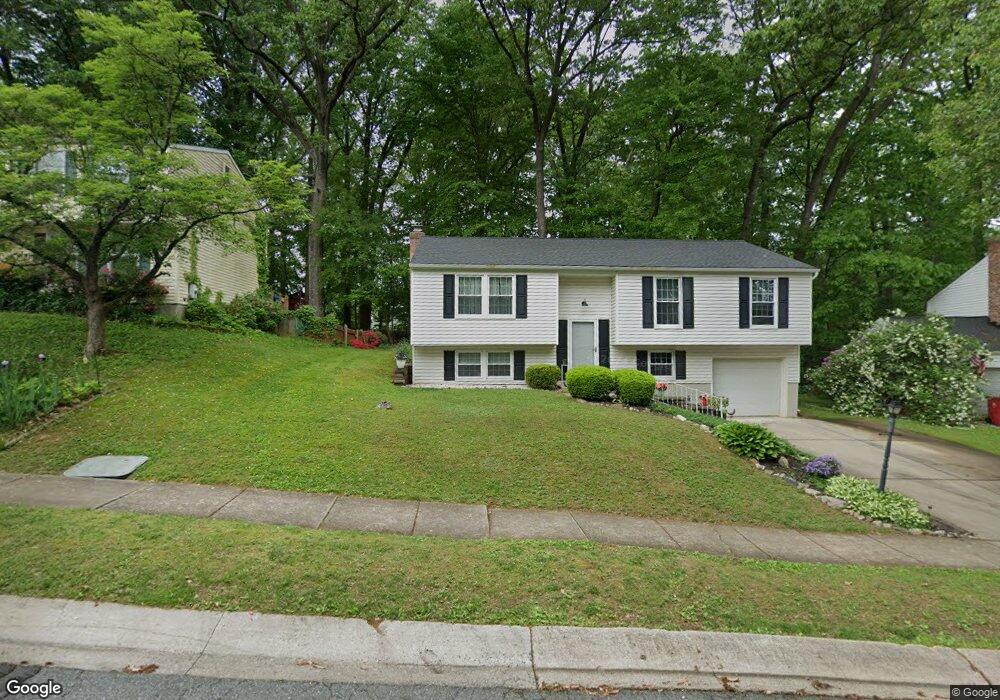
42 Boxthorn Rd Abingdon, MD 21009
Estimated Value: $322,000 - $403,000
--
Bed
2
Baths
1,182
Sq Ft
$300/Sq Ft
Est. Value
About This Home
This home is located at 42 Boxthorn Rd, Abingdon, MD 21009 and is currently estimated at $354,330, approximately $299 per square foot. 42 Boxthorn Rd is a home located in Harford County with nearby schools including William S. James Elementary School, Patterson Mill Middle School, and Patterson Mill High School.
Ownership History
Date
Name
Owned For
Owner Type
Purchase Details
Closed on
Apr 10, 2017
Sold by
Wade Michael S and Wade Christine M
Bought by
Wade Michael S and Wade Christine M
Current Estimated Value
Purchase Details
Closed on
May 3, 1991
Sold by
Ford Jason E
Bought by
Wade Michael S and Wade Christine M
Home Financials for this Owner
Home Financials are based on the most recent Mortgage that was taken out on this home.
Original Mortgage
$107,100
Interest Rate
9.47%
Purchase Details
Closed on
Dec 8, 1987
Sold by
Logan Ronald W and Logan Wf
Bought by
Ford Jason E
Home Financials for this Owner
Home Financials are based on the most recent Mortgage that was taken out on this home.
Original Mortgage
$96,700
Interest Rate
10.6%
Create a Home Valuation Report for This Property
The Home Valuation Report is an in-depth analysis detailing your home's value as well as a comparison with similar homes in the area
Home Values in the Area
Average Home Value in this Area
Purchase History
| Date | Buyer | Sale Price | Title Company |
|---|---|---|---|
| Wade Michael S | -- | None Available | |
| Wade Michael S | $119,000 | -- | |
| Ford Jason E | $107,500 | -- |
Source: Public Records
Mortgage History
| Date | Status | Borrower | Loan Amount |
|---|---|---|---|
| Closed | Wade Michael S | $107,100 | |
| Previous Owner | Ford Jason E | $96,700 |
Source: Public Records
Tax History Compared to Growth
Tax History
| Year | Tax Paid | Tax Assessment Tax Assessment Total Assessment is a certain percentage of the fair market value that is determined by local assessors to be the total taxable value of land and additions on the property. | Land | Improvement |
|---|---|---|---|---|
| 2025 | $2,881 | $284,133 | $0 | $0 |
| 2024 | $2,674 | $267,767 | $0 | $0 |
| 2023 | $2,674 | $251,400 | $83,400 | $168,000 |
| 2022 | $2,674 | $245,300 | $0 | $0 |
| 2021 | $2,690 | $239,200 | $0 | $0 |
| 2020 | $2,690 | $233,100 | $83,400 | $149,700 |
| 2019 | $2,681 | $232,300 | $0 | $0 |
| 2018 | $2,647 | $231,500 | $0 | $0 |
| 2017 | $2,638 | $230,700 | $0 | $0 |
| 2016 | -- | $227,300 | $0 | $0 |
| 2015 | $2,813 | $223,900 | $0 | $0 |
| 2014 | $2,813 | $220,500 | $0 | $0 |
Source: Public Records
Map
Nearby Homes
- 2853 Browning Ct
- 2807 Emmorton Rd
- 2916 Carlyle Ct
- 2932 Carlyle Ct
- 111 Cinnamon Tree Dr
- 2910 Ruskin Ct
- 2608 Laurel Valley Garth
- 2921 Shelley Ct
- 2931 Shelley Ct
- 2601 Merrick Way
- 129 Long Meadow Ct
- 2902 Preston Ln
- 2521 Merrick Ct
- 2530 Merrick Ct
- 104 Singer Rd
- 2605 Colpepper Rd
- 134 Spruce Woods Ct
- 2414 Laurel Bush Rd
- 307 Tall Pines Ct Unit 3
- 3109 Eden Dr
- 40 Boxthorn Rd
- 44 Boxthorn Rd
- 38 Boxthorn Rd
- 46 Boxthorn Rd
- 38 Mitchell Dr
- 36 Mitchell Dr
- 45 Boxthorn Rd
- 43 Boxthorn Rd
- 40 Mitchell Dr
- 36 Boxthorn Rd
- 41 Boxthorn Rd
- 48 Boxthorn Rd
- 2800 Merrick Way
- 49 Boxthorn Rd
- 34 Mitchell Dr
- 2732 Merrick Way
- 39 Boxthorn Rd
- 42 Mitchell Dr
- 34 Boxthorn Rd
- 50 Boxthorn Rd