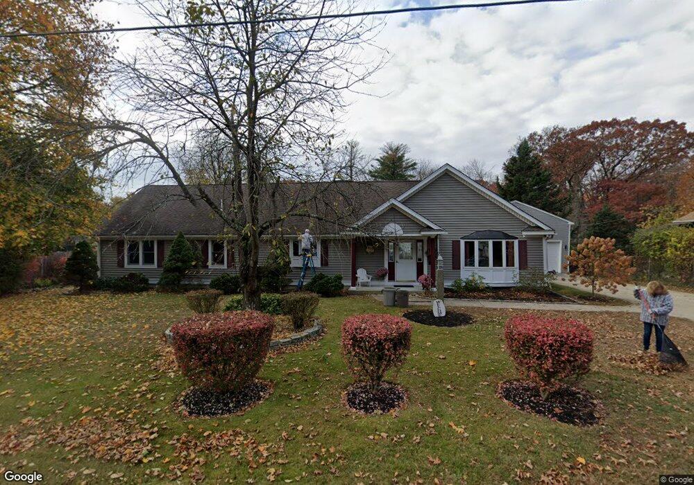
42 Brandy Brow Rd Haverhill, MA 01830
Estimated Value: $599,000 - $635,000
3
Beds
2
Baths
1,847
Sq Ft
$333/Sq Ft
Est. Value
About This Home
This home is located at 42 Brandy Brow Rd, Haverhill, MA 01830 and is currently estimated at $614,697, approximately $332 per square foot. 42 Brandy Brow Rd is a home located in Essex County with nearby schools including Pentucket Lake Elementary School, John G. Whittier Middle School, and Haverhill High School.
Ownership History
Date
Name
Owned For
Owner Type
Purchase Details
Closed on
Dec 30, 2004
Sold by
Fincl Cendant Mobility
Bought by
Call Neil R
Current Estimated Value
Purchase Details
Closed on
Mar 31, 2003
Sold by
Carroll William J
Bought by
Williams Darryl D and Williams Deborah S
Purchase Details
Closed on
Dec 23, 1996
Sold by
Est Pollister Robert and Muldowney Nancy J
Bought by
Carroll William J
Create a Home Valuation Report for This Property
The Home Valuation Report is an in-depth analysis detailing your home's value as well as a comparison with similar homes in the area
Home Values in the Area
Average Home Value in this Area
Purchase History
| Date | Buyer | Sale Price | Title Company |
|---|---|---|---|
| Call Neil R | $342,500 | -- | |
| Fincl Cendant Mobility | $342,500 | -- | |
| Williams Darryl D | $310,000 | -- | |
| Carroll William J | $109,900 | -- |
Source: Public Records
Mortgage History
| Date | Status | Borrower | Loan Amount |
|---|---|---|---|
| Open | Carroll William J | $274,500 |
Source: Public Records
Tax History Compared to Growth
Tax History
| Year | Tax Paid | Tax Assessment Tax Assessment Total Assessment is a certain percentage of the fair market value that is determined by local assessors to be the total taxable value of land and additions on the property. | Land | Improvement |
|---|---|---|---|---|
| 2025 | $5,260 | $491,100 | $190,000 | $301,100 |
| 2024 | $4,803 | $451,400 | $178,600 | $272,800 |
| 2023 | $4,711 | $422,500 | $178,600 | $243,900 |
| 2022 | $4,569 | $359,200 | $163,400 | $195,800 |
| 2021 | $4,528 | $336,900 | $155,800 | $181,100 |
| 2020 | $4,379 | $322,000 | $148,200 | $173,800 |
| 2019 | $4,386 | $314,400 | $140,600 | $173,800 |
| 2018 | $4,207 | $295,000 | $133,000 | $162,000 |
| 2017 | $4,328 | $288,700 | $129,200 | $159,500 |
| 2016 | $3,987 | $259,600 | $104,500 | $155,100 |
| 2015 | $3,939 | $256,600 | $104,500 | $152,100 |
Source: Public Records
Map
Nearby Homes
- 897 Amesbury Rd
- 186 Brandy Brow Rd
- 0 Mountain View Ave
- 48 Little Pond Rd
- 14 Corliss Hill Rd
- 53 Old Amesbury Line Rd
- 36 Orchard St
- 24 Union St
- 18 River Rd
- 2 River Rd
- 0 W Main St
- 6 Vendome St Unit 6
- 20 Grove St Unit 20
- 2-4 Central St
- 37 School St
- 4 Rear Mechanic St
- 128 Newton Rd Unit 20
- 128 Newton Rd Unit 29
- 120 Newton Rd Unit 2D
- 48 Newton Rd
- 36 Brandy Brow Rd
- 48 Brandy Brow Rd
- 45 Brandy Brow Rd
- 41 Brock Rd
- 56 Brandy Brow Rd
- 30 Brandy Brow Rd
- 53 Brandy Brow Rd
- 27 Brandy Brow Rd
- 33 Brock Rd
- 52 Brock Rd
- 22 Brandy Brow Rd
- 10 Debbie Terrace
- 14 Brandy Brow Rd
- 19 Brandy Brow Rd
- 32 Brock Rd
- 70 Brandy Brow Rd
- 9 Verdun Rd
- 42 Verdun Rd
- 9 Debbie Terrace
- 8 Debbie Terrace