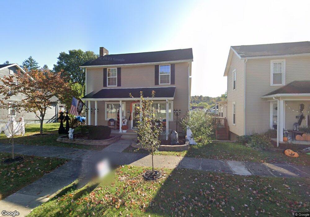
42 Broad St Glouster, OH 45732
Estimated Value: $91,000 - $162,000
3
Beds
1
Bath
1,848
Sq Ft
$66/Sq Ft
Est. Value
About This Home
This home is located at 42 Broad St, Glouster, OH 45732 and is currently estimated at $122,499, approximately $66 per square foot. 42 Broad St is a home located in Athens County with nearby schools including Trimble Elementary School, Trimble Middle School, and Trimble High School.
Ownership History
Date
Name
Owned For
Owner Type
Purchase Details
Closed on
Aug 3, 2017
Sold by
William Cyrus Jones
Bought by
Kittle Reuben and Kittle Tonya
Current Estimated Value
Home Financials for this Owner
Home Financials are based on the most recent Mortgage that was taken out on this home.
Original Mortgage
$43,740
Outstanding Balance
$36,468
Interest Rate
3.93%
Estimated Equity
$86,031
Purchase Details
Closed on
May 25, 2016
Sold by
Mckinley Tim
Bought by
Jones William Cyrus and Jones William Cyrus
Home Financials for this Owner
Home Financials are based on the most recent Mortgage that was taken out on this home.
Original Mortgage
$30,000
Interest Rate
3.71%
Mortgage Type
Credit Line Revolving
Purchase Details
Closed on
Feb 1, 1989
Create a Home Valuation Report for This Property
The Home Valuation Report is an in-depth analysis detailing your home's value as well as a comparison with similar homes in the area
Purchase History
| Date | Buyer | Sale Price | Title Company |
|---|---|---|---|
| Kittle Reuben | -- | -- | |
| Jones William Cyrus | $42,900 | Attorney | |
| -- | $37,000 | -- |
Source: Public Records
Mortgage History
| Date | Status | Borrower | Loan Amount |
|---|---|---|---|
| Open | Kittle Reuben | $43,740 | |
| Closed | Kittle Reuben | -- | |
| Previous Owner | Jones William Cyrus | $30,000 |
Source: Public Records
Tax History
| Year | Tax Paid | Tax Assessment Tax Assessment Total Assessment is a certain percentage of the fair market value that is determined by local assessors to be the total taxable value of land and additions on the property. | Land | Improvement |
|---|---|---|---|---|
| 2024 | $1,477 | $30,150 | $1,610 | $28,540 |
| 2023 | $1,454 | $30,150 | $1,610 | $28,540 |
| 2022 | $1,314 | $25,880 | $1,610 | $24,270 |
| 2021 | $1,339 | $25,880 | $1,610 | $24,270 |
| 2020 | $1,311 | $25,880 | $1,610 | $24,270 |
| 2019 | $1,281 | $24,380 | $1,430 | $22,950 |
| 2018 | $1,391 | $24,380 | $1,430 | $22,950 |
| 2017 | $1,918 | $24,380 | $1,430 | $22,950 |
| 2016 | $1,347 | $22,910 | $1,430 | $21,480 |
| 2015 | $1,790 | $22,910 | $1,430 | $21,480 |
| 2014 | $1,790 | $22,910 | $1,430 | $21,480 |
| 2013 | $1,611 | $23,060 | $1,360 | $21,700 |
Source: Public Records
Map
Nearby Homes
Your Personal Tour Guide
Ask me questions while you tour the home.