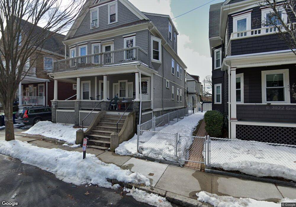
42 Bromfield Rd Somerville, MA 02144
Estimated Value: $1,388,000 - $1,686,299
6
Beds
3
Baths
3,297
Sq Ft
$464/Sq Ft
Est. Value
About This Home
Unit 1 is a partially furnished 4 large Bedrooms; 1 Bathroom; Living room; Kitchen with gas stove and oven, dishwasher and disposal, microwave with 2 refrigerators. Front and Rear porches. 2 driveway parking spaces included. Laundry washer and dryer in basement. One Block from Tufts University Campus. Convenient to MIT and Lesley University in Cambridge, MA. One mile from Davis Square in Somerville. NO FEE, if leased through management office. Available 9-1-2025, Rent $4,700/month until May 31, 2026; Rent $4,900/month from June 1, 2025 until May 31, 2027. Tenant pays utilities: gas, electric and water/sewer. E-mail property management office for viewing appointment.
Create a Home Valuation Report for This Property
The Home Valuation Report is an in-depth analysis detailing your home's value as well as a comparison with similar homes in the area
Home Values in the Area
Average Home Value in this Area
Property History
| Date | Event | Price | List to Sale | Price per Sq Ft |
|---|---|---|---|---|
| 02/10/2025 02/10/25 | Off Market | $5,000 | -- | -- |
| 02/03/2025 02/03/25 | For Rent | -- | -- | -- |
| 10/08/2024 10/08/24 | Off Market | $5,000 | -- | -- |
| 10/01/2024 10/01/24 | For Rent | $5,000 | -- | -- |
Tax History Compared to Growth
Tax History
| Year | Tax Paid | Tax Assessment Tax Assessment Total Assessment is a certain percentage of the fair market value that is determined by local assessors to be the total taxable value of land and additions on the property. | Land | Improvement |
|---|---|---|---|---|
| 2025 | $14,499 | $1,329,000 | $687,200 | $641,800 |
| 2024 | $13,861 | $1,317,600 | $687,200 | $630,400 |
| 2023 | $13,507 | $1,306,300 | $687,200 | $619,100 |
| 2022 | $12,720 | $1,249,500 | $654,400 | $595,100 |
| 2021 | $12,348 | $1,211,800 | $649,600 | $562,200 |
| 2020 | $11,899 | $1,179,300 | $650,100 | $529,200 |
| 2019 | $11,256 | $1,046,100 | $591,800 | $454,300 |
| 2018 | $10,348 | $914,900 | $538,000 | $376,900 |
| 2017 | $10,153 | $870,000 | $507,600 | $362,400 |
| 2016 | $9,815 | $783,300 | $453,300 | $330,000 |
| 2015 | $9,403 | $745,700 | $418,600 | $327,100 |
Source: Public Records
Map
Nearby Homes
- 26 Warner St
- 15 Colby St
- 23 Ossipee Rd
- 20 Electric Ave Unit 2
- 55 Packard Ave Unit 1
- 29 Packard Ave
- 159 Harvard St Unit 1R
- 74 Windsor Rd
- 12 Wellesley St
- 122 Burget Ave
- 39 Rogers Ave
- 11 Bonner Ave Unit 2
- 31 Rogers Ave
- 595 Broadway Unit 302
- 595 Broadway Unit 101
- 595 Broadway Unit 202
- 39 Bonner Ave Unit 39
- 9 Trout Ave
- 9 Trout Ave Unit 2
- 561 Broadway Unit C1
- 42 Bromfield Rd Unit 2
- 42 Bromfield Rd Unit 1
- 46 Bromfield Rd Unit 1A
- 38 Bromfield Rd
- 34 Bromfield Rd
- 34 Bromfield Rd Unit 2
- 34 Bromfield Rd Unit 1
- 165 College Ave
- 165 College Ave Unit 1
- 165 College Ave Unit 2
- 50 Bromfield Rd Unit 1
- 50 Bromfield Rd
- 167 College Ave
- 167 College Ave Unit 1-3
- 167 College Ave Unit 1
- 167 College Ave Unit 3
- 167 College Ave Unit 2
- 163 College Ave
- 163 College Ave Unit A/B
- 163 College Ave Unit A