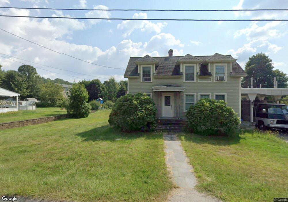
42 Brookside Rd Southbridge, MA 01550
Estimated Value: $382,168 - $427,000
3
Beds
2
Baths
1,832
Sq Ft
$222/Sq Ft
Est. Value
About This Home
This home is located at 42 Brookside Rd, Southbridge, MA 01550 and is currently estimated at $407,292, approximately $222 per square foot. 42 Brookside Rd is a home located in Worcester County with nearby schools including Trinity Catholic Academy.
Ownership History
Date
Name
Owned For
Owner Type
Purchase Details
Closed on
Feb 27, 2004
Sold by
Tremblay Hilda G and Armand Tremblay J
Bought by
Kenward Heather and Fuller Kevin
Current Estimated Value
Home Financials for this Owner
Home Financials are based on the most recent Mortgage that was taken out on this home.
Original Mortgage
$224,900
Outstanding Balance
$103,349
Interest Rate
5.65%
Mortgage Type
Purchase Money Mortgage
Estimated Equity
$303,943
Create a Home Valuation Report for This Property
The Home Valuation Report is an in-depth analysis detailing your home's value as well as a comparison with similar homes in the area
Home Values in the Area
Average Home Value in this Area
Purchase History
| Date | Buyer | Sale Price | Title Company |
|---|---|---|---|
| Kenward Heather | $224,900 | -- | |
| Kenward Heather | $224,900 | -- | |
| Tremblay Hilda G | -- | -- |
Source: Public Records
Mortgage History
| Date | Status | Borrower | Loan Amount |
|---|---|---|---|
| Open | Kenward Heather | $224,900 | |
| Closed | Kenward Heather | $224,900 |
Source: Public Records
Tax History Compared to Growth
Tax History
| Year | Tax Paid | Tax Assessment Tax Assessment Total Assessment is a certain percentage of the fair market value that is determined by local assessors to be the total taxable value of land and additions on the property. | Land | Improvement |
|---|---|---|---|---|
| 2025 | $4,819 | $328,700 | $39,500 | $289,200 |
| 2024 | $4,949 | $324,300 | $32,900 | $291,400 |
| 2023 | $4,698 | $296,600 | $32,900 | $263,700 |
| 2022 | $4,351 | $243,100 | $28,000 | $215,100 |
| 2021 | $4,220 | $217,100 | $28,000 | $189,100 |
| 2020 | $3,847 | $197,500 | $28,000 | $169,500 |
| 2018 | $3,629 | $174,900 | $24,900 | $150,000 |
| 2017 | $3,295 | $160,200 | $24,900 | $135,300 |
| 2016 | $3,300 | $163,300 | $24,900 | $138,400 |
| 2015 | $2,852 | $140,100 | $24,900 | $115,200 |
| 2014 | $2,854 | $145,300 | $24,900 | $120,400 |
Source: Public Records
Map
Nearby Homes
- 876 Worcester St
- 796 Charlton St
- Lot 7 Harrington Rd
- 421 Charlton St
- 10 Harrington Rd
- 150 Clemence Hill Rd
- 79 Fairlawn Ave
- 219 Charlton St
- 216 Fiske St
- 65 Green Ave
- 149 Berry Corner Rd
- 51 Green Ave
- 269 Mechanic St
- 97 Worcester St
- 89 Worcester St
- 0 Blood Rd
- 127 Cliff St
- 86 Berry Corner Rd
- 292 Cournoyer Blvd
- 249 Pleasant St
- 52 Brookside Rd
- 35 Brookside Rd
- 51 Brookside Rd
- 58 Brookside Rd
- 883 Charlton St
- 919 Charlton St
- 875 Charlton St
- 18 Brookside Rd
- 941 Charlton St
- 869 Charlton St
- 910 Charlton St
- 900 Charlton St
- 863 Charlton St
- 892 Charlton St
- 918 Charlton St
- 800 Worcester St
- 926 Charlton St
- 855 Charlton St Unit 1
- 794 Worcester St
- 880 Charlton St