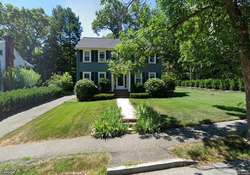
42 Calvin Rd Newtonville, MA 02460
Newtonville NeighborhoodEstimated Value: $1,531,000 - $1,823,000
5
Beds
3
Baths
2,184
Sq Ft
$769/Sq Ft
Est. Value
About This Home
This home is located at 42 Calvin Rd, Newtonville, MA 02460 and is currently estimated at $1,680,316, approximately $769 per square foot. 42 Calvin Rd is a home located in Middlesex County with nearby schools including Cabot Elementary School, F.A. Day Middle School, and Newton North High School.
Ownership History
Date
Name
Owned For
Owner Type
Purchase Details
Closed on
Jan 25, 2016
Sold by
Shen Lei and Wu Yujun
Bought by
Wu Yujun
Current Estimated Value
Purchase Details
Closed on
Jun 25, 2010
Sold by
Weisman Laurence and Oneill Mary F
Bought by
Shen Lei and Wu Yujun
Purchase Details
Closed on
Jun 12, 2009
Sold by
Oneil Mary F
Bought by
Oneil Mary F and Weisman Laurence
Purchase Details
Closed on
Jun 21, 2004
Sold by
Weisman Laurence and Oneill Mary F
Bought by
Oneill Mary F
Create a Home Valuation Report for This Property
The Home Valuation Report is an in-depth analysis detailing your home's value as well as a comparison with similar homes in the area
Home Values in the Area
Average Home Value in this Area
Purchase History
| Date | Buyer | Sale Price | Title Company |
|---|---|---|---|
| Wu Yujun | -- | -- | |
| Shen Lei | $780,000 | -- | |
| Oneil Mary F | -- | -- | |
| Oneill Mary F | -- | -- |
Source: Public Records
Tax History Compared to Growth
Tax History
| Year | Tax Paid | Tax Assessment Tax Assessment Total Assessment is a certain percentage of the fair market value that is determined by local assessors to be the total taxable value of land and additions on the property. | Land | Improvement |
|---|---|---|---|---|
| 2025 | $12,828 | $1,309,000 | $1,049,500 | $259,500 |
| 2024 | $12,377 | $1,268,100 | $1,018,900 | $249,200 |
| 2023 | $11,752 | $1,154,400 | $782,000 | $372,400 |
| 2022 | $11,245 | $1,068,900 | $724,100 | $344,800 |
| 2021 | $10,850 | $1,008,400 | $683,100 | $325,300 |
| 2020 | $10,528 | $1,008,400 | $683,100 | $325,300 |
| 2019 | $10,231 | $979,000 | $663,200 | $315,800 |
| 2018 | $9,787 | $904,500 | $600,000 | $304,500 |
| 2017 | $9,489 | $853,300 | $566,000 | $287,300 |
| 2016 | $9,076 | $797,500 | $529,000 | $268,500 |
| 2015 | $8,653 | $745,300 | $494,400 | $250,900 |
Source: Public Records
Map
Nearby Homes
- 33 Birch Hill Rd
- 123 Mount Vernon St Unit 2
- 22 Walnut Place Unit 1
- 70 Bigelow Rd
- 935 Washington St Unit 8
- 935 Washington St (Rear Facing) Unit 11
- 911 Washington St
- 12 Wiswall St
- 4 Wiswall St
- 4 Hosmer Cir
- 318 Austin St Unit A
- 27 Cross St Unit 27
- 43 Walker St
- 154 Beaumont Ave
- 61 Lakeview Ave
- 300 Cabot St
- 39 Valentine Park
- 46 Ellis Rd
- 32-34 Rossmere St
- 10 Washington Park