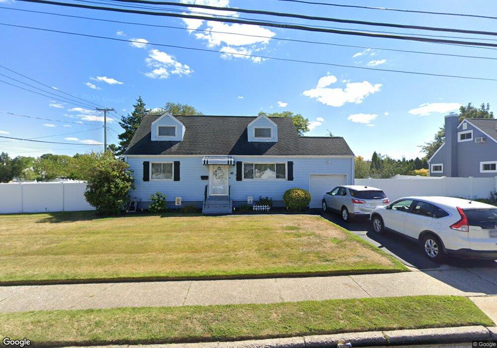
42 Clark St West Babylon, NY 11704
Estimated Value: $590,228 - $647,000
3
Beds
1
Bath
1,300
Sq Ft
$478/Sq Ft
Est. Value
About This Home
This home is located at 42 Clark St, West Babylon, NY 11704 and is currently estimated at $621,057, approximately $477 per square foot. 42 Clark St is a home located in Suffolk County with nearby schools including Robert Moses Middle School and North Babylon High School.
Ownership History
Date
Name
Owned For
Owner Type
Purchase Details
Closed on
May 21, 2012
Sold by
Simpson Theresa Ann
Bought by
Barrette Michael and Barrette Kerri L
Current Estimated Value
Home Financials for this Owner
Home Financials are based on the most recent Mortgage that was taken out on this home.
Original Mortgage
$229,042
Outstanding Balance
$162,362
Interest Rate
4.4%
Mortgage Type
FHA
Estimated Equity
$458,695
Create a Home Valuation Report for This Property
The Home Valuation Report is an in-depth analysis detailing your home's value as well as a comparison with similar homes in the area
Home Values in the Area
Average Home Value in this Area
Purchase History
| Date | Buyer | Sale Price | Title Company |
|---|---|---|---|
| Barrette Michael | $235,000 | Bightwaters Abstracts |
Source: Public Records
Mortgage History
| Date | Status | Borrower | Loan Amount |
|---|---|---|---|
| Open | Barrette Michael | $229,042 |
Source: Public Records
Tax History
| Year | Tax Paid | Tax Assessment Tax Assessment Total Assessment is a certain percentage of the fair market value that is determined by local assessors to be the total taxable value of land and additions on the property. | Land | Improvement |
|---|---|---|---|---|
| 2024 | $8,844 | $2,850 | $450 | $2,400 |
| 2023 | $8,844 | $2,850 | $450 | $2,400 |
| 2022 | $7,564 | $2,850 | $450 | $2,400 |
| 2021 | $7,564 | $2,850 | $450 | $2,400 |
| 2020 | $7,832 | $2,850 | $450 | $2,400 |
| 2019 | $7,832 | $0 | $0 | $0 |
| 2018 | $7,516 | $2,850 | $450 | $2,400 |
| 2017 | $7,516 | $2,850 | $450 | $2,400 |
| 2016 | $7,485 | $2,850 | $450 | $2,400 |
| 2015 | -- | $2,850 | $450 | $2,400 |
| 2014 | -- | $2,850 | $450 | $2,400 |
Source: Public Records
Map
Nearby Homes
- 313 Warren St
- 221 Young St
- 185 Throop St
- 155 Throop St
- 175 Van Buren St
- 214 Van Buren St
- 652 Empire Ave
- 295 Silver St
- 249 Hampton Rd
- 629 Lakeway Dr
- 102A Claremont Ave
- 751 Centerwood St
- 130 Claremont Ave
- 1259 America Ave
- 135 Westchester Ave
- 114 Westchester Ave
- 43 Westchester Ave
- 93 Vermont Ave
- 610 Windmill Ave
- 1286 America Ave
Your Personal Tour Guide
Ask me questions while you tour the home.