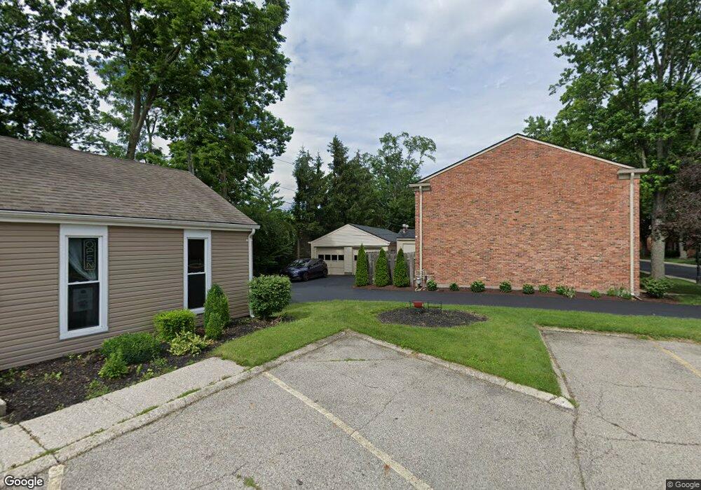
42 Cranston Ct Unit 2 Dayton, OH 45458
Estimated Value: $160,000 - $186,000
3
Beds
2
Baths
1,200
Sq Ft
$144/Sq Ft
Est. Value
About This Home
This home is located at 42 Cranston Ct Unit 2, Dayton, OH 45458 and is currently estimated at $172,458, approximately $143 per square foot. 42 Cranston Ct Unit 2 is a home located in Montgomery County with nearby schools including Primary Village South, Cline Elementary, and Magsig Middle School.
Ownership History
Date
Name
Owned For
Owner Type
Purchase Details
Closed on
Aug 11, 2022
Sold by
Damico Bruno B
Bought by
42 Cranston Llc
Current Estimated Value
Purchase Details
Closed on
Sep 10, 2020
Sold by
Damico Bruno B and Damico Sue Ellen
Bought by
Damico Bruno B and Damico Sua Ellen
Purchase Details
Closed on
Sep 7, 2007
Sold by
Damico Michael A and Damico Jonalyn L
Bought by
Damico Angelo and Damico Bruno
Purchase Details
Closed on
Dec 23, 1997
Sold by
Damico Bruno and Damico Angelo
Bought by
Minchew Brian T and Minchew Gina L
Create a Home Valuation Report for This Property
The Home Valuation Report is an in-depth analysis detailing your home's value as well as a comparison with similar homes in the area
Home Values in the Area
Average Home Value in this Area
Purchase History
| Date | Buyer | Sale Price | Title Company |
|---|---|---|---|
| 42 Cranston Llc | -- | Ruffolo John M | |
| 42 Cranstom Llc | -- | John John M | |
| Damico Bruno B | -- | None Available | |
| Damico Angelo | -- | Attorney | |
| Minchew Brian T | -- | -- |
Source: Public Records
Tax History Compared to Growth
Tax History
| Year | Tax Paid | Tax Assessment Tax Assessment Total Assessment is a certain percentage of the fair market value that is determined by local assessors to be the total taxable value of land and additions on the property. | Land | Improvement |
|---|---|---|---|---|
| 2024 | $2,668 | $44,780 | $9,640 | $35,140 |
| 2023 | $2,668 | $44,780 | $9,640 | $35,140 |
| 2022 | $2,203 | $29,270 | $6,300 | $22,970 |
| 2021 | $2,209 | $29,270 | $6,300 | $22,970 |
| 2020 | $2,206 | $29,270 | $6,300 | $22,970 |
| 2019 | $1,893 | $22,390 | $6,300 | $16,090 |
| 2018 | $1,684 | $22,390 | $6,300 | $16,090 |
| 2017 | $1,667 | $22,390 | $6,300 | $16,090 |
| 2016 | $1,952 | $24,790 | $6,300 | $18,490 |
| 2015 | $1,932 | $24,790 | $6,300 | $18,490 |
| 2014 | $1,932 | $24,790 | $6,300 | $18,490 |
| 2012 | -- | $25,930 | $6,300 | $19,630 |
Source: Public Records
Map
Nearby Homes
- 170 S Main St Unit C
- 92 E Ridgeway Dr
- 61 Lynn Rae Cir
- 20 Gershwin Dr
- 40 Cemetery Dr
- 155 Bristol Dr
- 121 Woodfield Place
- 156 Mallard Glen Dr Unit 4
- 306 Monarch Rd
- 325 Annette Dr
- 284 Tauber Dr
- 140 Mallard Glen Dr Unit 3
- 296 Tauber Dr
- 311 E Franklin St
- 7687 Normandy Ln
- 352 Sentinel Oak Dr
- 129 Bradstreet Rd
- 7767 Brams Hill Dr Unit 7767
- 435 Clareridge Ln
- 694 Spring Ridge Place
- 46 Cranston Ct Unit 4
- 44 Cranston Ct Unit 3
- 50 Cranston Ct Unit 5
- 40 Cranston Ct Unit 1
- 54 Cranston Ct Unit 7
- 45 Cranston Ct Unit 19
- 43 Cranston Ct Unit 18
- 53 Cranston Ct Unit 22
- 41 Cranston Ct Unit 17
- 51 Cranston Ct Unit 21
- 11 Westerly Ln Unit 11
- 56 Cranston Ct Unit 8
- 55 Cranston Ct Unit 23
- 57 Cranston Ct Unit 24
- 9 Westerly Ln Unit 9
- 7 Westerly Ln Unit 7
- 13 Westerly Ln Unit 13
- 60 Cranston Ct Unit 9
- 61 Cranston Ct Unit 25
- 62 Cranston Ct Unit 10