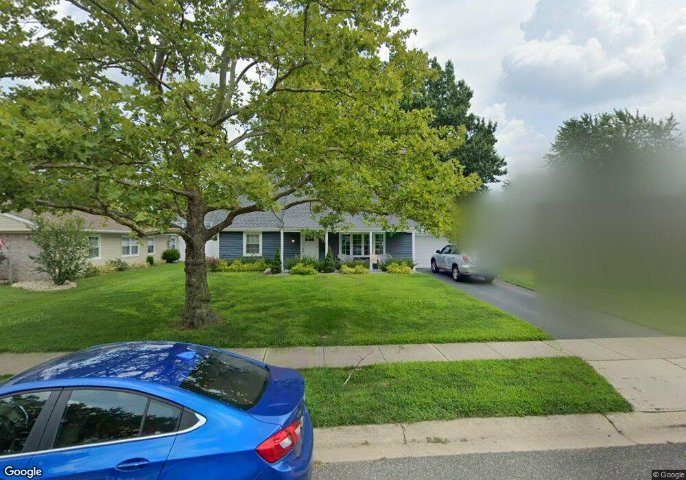
42 Deborah Ln Matawan, NJ 07747
Estimated Value: $629,000 - $649,000
4
Beds
2
Baths
1,649
Sq Ft
$387/Sq Ft
Est. Value
About This Home
This home is located at 42 Deborah Ln, Matawan, NJ 07747 and is currently estimated at $637,600, approximately $386 per square foot. 42 Deborah Ln is a home located in Monmouth County with nearby schools including Matawan Reg High School, St Benedict School, and St. Joseph Elementary School.
Ownership History
Date
Name
Owned For
Owner Type
Purchase Details
Closed on
Aug 11, 2006
Sold by
Whiting Richard M
Bought by
Wolff John B and Wolff Jennifer L
Current Estimated Value
Home Financials for this Owner
Home Financials are based on the most recent Mortgage that was taken out on this home.
Original Mortgage
$275,000
Outstanding Balance
$166,179
Interest Rate
6.88%
Mortgage Type
New Conventional
Estimated Equity
$471,421
Create a Home Valuation Report for This Property
The Home Valuation Report is an in-depth analysis detailing your home's value as well as a comparison with similar homes in the area
Home Values in the Area
Average Home Value in this Area
Purchase History
| Date | Buyer | Sale Price | Title Company |
|---|---|---|---|
| Wolff John B | $395,000 | -- |
Source: Public Records
Mortgage History
| Date | Status | Borrower | Loan Amount |
|---|---|---|---|
| Open | Wolff John B | $275,000 |
Source: Public Records
Tax History
| Year | Tax Paid | Tax Assessment Tax Assessment Total Assessment is a certain percentage of the fair market value that is determined by local assessors to be the total taxable value of land and additions on the property. | Land | Improvement |
|---|---|---|---|---|
| 2025 | $10,216 | $573,700 | $406,800 | $166,900 |
| 2024 | $9,745 | $505,500 | $341,700 | $163,800 |
Source: Public Records
Map
Nearby Homes
- 40 Deborah Ln
- 46 Deborah Ln
- 186 Deerfield Ln
- 182 Deerfield Ln
- 36 Deborah Ln
- 50 Deborah Ln
- 45 Deborah Ln
- 41 Deborah Ln
- 194 Deerfield Ln
- 47 Deborah Ln
- 37 Deborah Ln
- 178 Deerfield Ln
- 32 Deborah Ln
- 51 Deborah Ln
- 168 Deerfield Ln
- 196 Deerfield Ln
- 33 Deborah Ln
- 132 Deerfield Ln
- 187 Deerfield Ln
- 183 Deerfield Ln
Your Personal Tour Guide
Ask me questions while you tour the home.