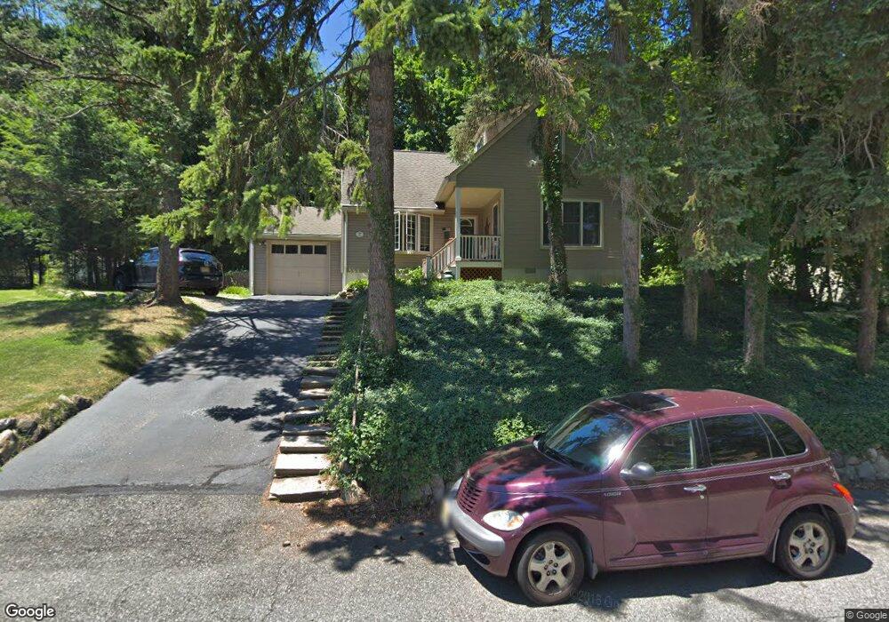
42 Devine Dr Mahwah, NJ 07430
Estimated Value: $603,191 - $762,000
Studio
--
Bath
1,899
Sq Ft
$361/Sq Ft
Est. Value
About This Home
This home is located at 42 Devine Dr, Mahwah, NJ 07430 and is currently estimated at $685,548, approximately $361 per square foot. 42 Devine Dr is a home located in Bergen County with nearby schools including Mahwah High School and ONESCHOOL GLOBAL-NEW YORK.
Ownership History
Date
Name
Owned For
Owner Type
Purchase Details
Closed on
Mar 8, 2021
Sold by
Brooks Wendy N and Hoensch Carol A
Bought by
Brooks Wendy N
Current Estimated Value
Home Financials for this Owner
Home Financials are based on the most recent Mortgage that was taken out on this home.
Original Mortgage
$230,000
Interest Rate
2.96%
Mortgage Type
New Conventional
Purchase Details
Closed on
Mar 12, 2020
Sold by
Brooks Paul J
Bought by
Brooks Wendy N and Hoensch Carol A
Home Financials for this Owner
Home Financials are based on the most recent Mortgage that was taken out on this home.
Original Mortgage
$225,000
Interest Rate
3.4%
Mortgage Type
New Conventional
Purchase Details
Closed on
Mar 9, 2020
Sold by
Brooks Paul J and Brooks Wendy N
Bought by
Brooks Paul J and Brooks Wendy N
Home Financials for this Owner
Home Financials are based on the most recent Mortgage that was taken out on this home.
Original Mortgage
$225,000
Interest Rate
3.4%
Mortgage Type
New Conventional
Purchase Details
Closed on
Jul 31, 1997
Sold by
Estate Of Hilda Hoensch
Bought by
Brooks Paul J and Brooks Wendy N
Home Financials for this Owner
Home Financials are based on the most recent Mortgage that was taken out on this home.
Original Mortgage
$128,000
Interest Rate
7.56%
Create a Home Valuation Report for This Property
The Home Valuation Report is an in-depth analysis detailing your home's value as well as a comparison with similar homes in the area
Home Values in the Area
Average Home Value in this Area
Purchase History
| Date | Buyer | Sale Price | Title Company |
|---|---|---|---|
| Brooks Wendy N | -- | First American Title Ins Co | |
| Brooks Wendy N | -- | Prime Time Title | |
| Brooks Wendy N | -- | None Available | |
| Brooks Paul J | -- | Chicago Title Insurance Co | |
| Brooks Paul J | $160,000 | -- |
Source: Public Records
Mortgage History
| Date | Status | Borrower | Loan Amount |
|---|---|---|---|
| Previous Owner | Brooks Wendy N | $230,000 | |
| Previous Owner | Brooks Paul J | $225,000 | |
| Previous Owner | Brooks Paul J | $128,000 |
Source: Public Records
Tax History
| Year | Tax Paid | Tax Assessment Tax Assessment Total Assessment is a certain percentage of the fair market value that is determined by local assessors to be the total taxable value of land and additions on the property. | Land | Improvement |
|---|---|---|---|---|
| 2025 | $7,517 | $364,200 | $229,200 | $135,000 |
| 2024 | $7,419 | $364,200 | $229,200 | $135,000 |
| 2023 | $7,182 | $364,200 | $229,200 | $135,000 |
| 2022 | $7,182 | $364,200 | $229,200 | $135,000 |
| 2021 | $6,705 | $364,200 | $229,200 | $135,000 |
| 2020 | $6,934 | $364,200 | $229,200 | $135,000 |
| 2019 | $6,705 | $364,200 | $229,200 | $135,000 |
| 2018 | $6,610 | $364,200 | $229,200 | $135,000 |
| 2017 | $6,505 | $364,200 | $229,200 | $135,000 |
| 2016 | $6,363 | $364,200 | $229,200 | $135,000 |
| 2015 | $6,275 | $364,200 | $229,200 | $135,000 |
| 2014 | $6,170 | $364,200 | $229,200 | $135,000 |
Source: Public Records
Map
Nearby Homes
- 142 Island Rd
- 17 Maple Ave
- 0 Avenue B
- 134 Arthur Ct
- 63 W Airmount Rd
- 23 Olney Rd
- 1194 Chedworth Cir Unit 7J
- 130 Reich Ave
- 1060 Chedworth Cir
- 12 Alcott Rd
- 16 Gardner St
- 5 Foxwood Ave
- 77 Parkside Dr
- 2384 Quill Ct
- 51 Black Oak Ln
- 224 Miller Rd
- 1 Interstate St
- 59 Prairie Ave
- 474 Green Mountain Rd
- 35 Hillside Ave
Your Personal Tour Guide
Ask me questions while you tour the home.