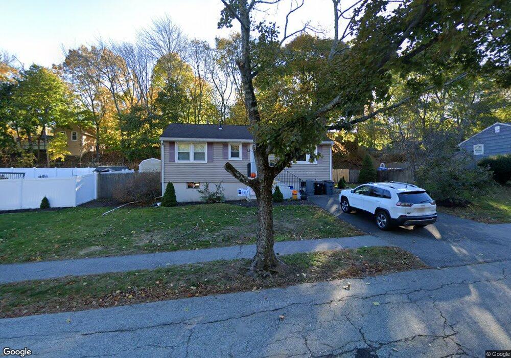
42 Downing Rd Peabody, MA 01960
Estimated Value: $604,999 - $659,000
3
Beds
2
Baths
928
Sq Ft
$678/Sq Ft
Est. Value
About This Home
This home is located at 42 Downing Rd, Peabody, MA 01960 and is currently estimated at $629,000, approximately $677 per square foot. 42 Downing Rd is a home located in Essex County with nearby schools including Peabody Veterans Memorial High School and St John The Baptist School.
Ownership History
Date
Name
Owned For
Owner Type
Purchase Details
Closed on
Feb 2, 2018
Sold by
Merryman Andrea
Bought by
Ogles Nicholas
Current Estimated Value
Home Financials for this Owner
Home Financials are based on the most recent Mortgage that was taken out on this home.
Original Mortgage
$265,000
Outstanding Balance
$225,713
Interest Rate
4.22%
Estimated Equity
$403,287
Purchase Details
Closed on
Jul 28, 2005
Sold by
Oconnell David R and Oconnell Lynnette
Bought by
Ogles Nicholas
Home Financials for this Owner
Home Financials are based on the most recent Mortgage that was taken out on this home.
Original Mortgage
$256,000
Interest Rate
5.67%
Mortgage Type
Purchase Money Mortgage
Purchase Details
Closed on
Nov 2, 1998
Sold by
Podradchik Abraham and Podradchik Ilene R
Bought by
Oconnell David R
Create a Home Valuation Report for This Property
The Home Valuation Report is an in-depth analysis detailing your home's value as well as a comparison with similar homes in the area
Home Values in the Area
Average Home Value in this Area
Purchase History
| Date | Buyer | Sale Price | Title Company |
|---|---|---|---|
| Ogles Nicholas | -- | -- | |
| Ogles Nicholas | $320,000 | -- | |
| Oconnell David R | $155,000 | -- |
Source: Public Records
Mortgage History
| Date | Status | Borrower | Loan Amount |
|---|---|---|---|
| Open | Oconnell David R | $265,000 | |
| Previous Owner | Oconnell David R | $234,000 | |
| Previous Owner | Oconnell David R | $256,000 |
Source: Public Records
Tax History Compared to Growth
Tax History
| Year | Tax Paid | Tax Assessment Tax Assessment Total Assessment is a certain percentage of the fair market value that is determined by local assessors to be the total taxable value of land and additions on the property. | Land | Improvement |
|---|---|---|---|---|
| 2025 | $4,648 | $501,900 | $297,500 | $204,400 |
| 2024 | $4,541 | $497,900 | $297,500 | $200,400 |
| 2023 | $4,590 | $482,100 | $248,000 | $234,100 |
| 2022 | $4,212 | $417,000 | $215,600 | $201,400 |
| 2021 | $4,209 | $401,200 | $196,000 | $205,200 |
| 2020 | $4,022 | $374,500 | $196,000 | $178,500 |
| 2019 | $3,706 | $336,600 | $196,000 | $140,600 |
| 2018 | $3,673 | $320,500 | $175,000 | $145,500 |
| 2017 | $3,154 | $268,200 | $175,000 | $93,200 |
| 2016 | $3,023 | $253,600 | $175,000 | $78,600 |
| 2015 | $3,161 | $257,000 | $175,000 | $82,000 |
Source: Public Records
Map
Nearby Homes
- 58 Trask Rd
- 4 Price Rd
- 17 Trask Rd
- 1 Reed Rd
- 2 Crestwood Ln
- 351 Lowell St
- 2 & 2R Prospect St
- 21 Hawthorne Cir
- 14 Raylen Ave
- 19 Arnold Ave
- 36 Forest St
- 4R Forest St
- 68 Prospect St Unit 14
- 12 Ledgewood Way Unit 26
- 8 Ledgewood Way Unit 20
- 8 Ledgewood Way Unit 17
- 0 Willowdale Ave Unit 73387007
- 7 Ledgewood Way Unit 11
- 165 Newbury St Unit 4
- 14 Bourbon St Unit 25