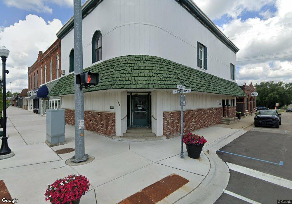
42 E M 55 West Branch, MI 48661
Estimated Value: $140,000 - $199,000
--
Bed
--
Bath
4,590
Sq Ft
$37/Sq Ft
Est. Value
About This Home
This home is located at 42 E M 55, West Branch, MI 48661 and is currently estimated at $168,106, approximately $36 per square foot. 42 E M 55 is a home located in Ogemaw County with nearby schools including Surline Elementary School, Surline Middle School, and Ogemaw Heights High School.
Ownership History
Date
Name
Owned For
Owner Type
Purchase Details
Closed on
Jun 30, 2022
Sold by
Green David W
Bought by
Bank West Shore
Current Estimated Value
Purchase Details
Closed on
Sep 25, 2013
Sold by
Firstbank
Bought by
Green David W
Home Financials for this Owner
Home Financials are based on the most recent Mortgage that was taken out on this home.
Original Mortgage
$40,000
Interest Rate
4.5%
Mortgage Type
New Conventional
Purchase Details
Closed on
Sep 20, 2012
Sold by
Branch Firstbank West
Bought by
Madsen Nahs Sandra Lynn and Nahs Sandra Lynn
Purchase Details
Closed on
Aug 18, 1998
Bought by
Madsen Sandra L and Nahs Cody W
Create a Home Valuation Report for This Property
The Home Valuation Report is an in-depth analysis detailing your home's value as well as a comparison with similar homes in the area
Home Values in the Area
Average Home Value in this Area
Purchase History
| Date | Buyer | Sale Price | Title Company |
|---|---|---|---|
| Bank West Shore | $1,750,000 | -- | |
| Green David W | $50,000 | -- | |
| Madsen Nahs Sandra Lynn | $55,924 | -- | |
| Madsen Sandra L | $75,000 | -- |
Source: Public Records
Mortgage History
| Date | Status | Borrower | Loan Amount |
|---|---|---|---|
| Previous Owner | Green David W | $40,000 |
Source: Public Records
Tax History Compared to Growth
Tax History
| Year | Tax Paid | Tax Assessment Tax Assessment Total Assessment is a certain percentage of the fair market value that is determined by local assessors to be the total taxable value of land and additions on the property. | Land | Improvement |
|---|---|---|---|---|
| 2025 | $2,693 | $78,700 | $0 | $0 |
| 2024 | $8 | $72,200 | $0 | $0 |
| 2023 | $726 | $59,400 | $0 | $0 |
| 2022 | $1,650 | $42,000 | $0 | $0 |
| 2021 | $1,556 | $38,100 | $0 | $0 |
| 2020 | $1,576 | $40,600 | $0 | $0 |
| 2019 | $1,481 | $35,500 | $0 | $0 |
| 2018 | $1,607 | $39,800 | $0 | $0 |
| 2017 | $1,520 | $42,000 | $0 | $0 |
| 2016 | $1,493 | $37,400 | $0 | $0 |
| 2015 | $1,513 | $41,300 | $0 | $0 |
| 2014 | $373 | $37,300 | $0 | $0 |
Source: Public Records
Map
Nearby Homes
- 1380 S Campbell Rd
- x Oleskie Trail
- 409 S Morrison Rd
- 1240 Quigley Rd
- 0 Whitetail Ct Unit 165
- 57 E Boehm Rd
- 1820 N Ogemaw Trail
- 2011 S Ogemaw Trail
- 2388 Dam Rd
- 1872 Indianwood Trail
- 2371 Pilatus Ct
- 2190 Fox Run
- 2249 Fox Run
- 0 Arthur Ct Unit 1926554
- 0 Arthur Ct Unit 1926537
- 0 Arthur Ct Unit 1926536
- 0 Arthur Ct Unit 1926540
- 0 Arthur Ct Unit 1926549
- 0 Arthur Ct Unit 1926541
- 0 Arthur Ct Unit 17 1926507
- 42 E M 55
- 122 E M 55
- 101 E M 55
- 122 M-55
- 1953 Michigan 33
- 164 E M 55
- 164 Michigan 55
- 205 E M 55
- 00 M-55 Lot #2
- 00 M-55 Lot #3
- 0 E M 55 Unit 1760490
- 0 E M 55 Unit 1761451
- 0 E M 55 Unit 1760248
- 0 E M 55 Unit 1760632
- 0 E M 55 Unit 1760448
- 0 E M 55 Unit 1763886
- 0 E M 55 Unit PARCEL 5 1800944
- 0 E M 55 Unit PARCEL 3
- 0 E M 55 Unit PARCEL 4
- 00 E M 55