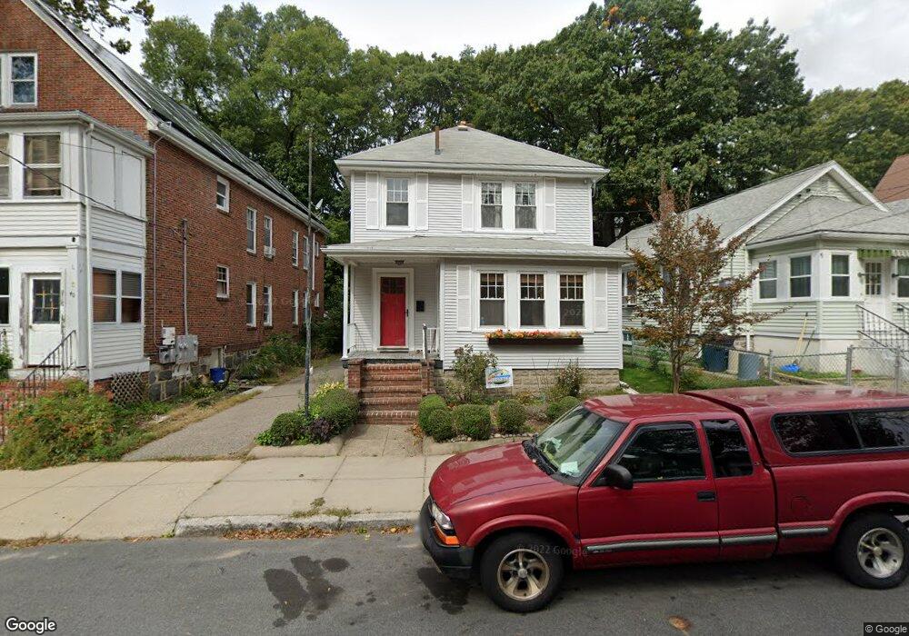
42 Eldridge Rd Jamaica Plain, MA 02130
Jamaica Plain NeighborhoodEstimated Value: $742,000 - $788,000
3
Beds
1
Bath
1,316
Sq Ft
$579/Sq Ft
Est. Value
About This Home
This home is located at 42 Eldridge Rd, Jamaica Plain, MA 02130 and is currently estimated at $761,696, approximately $578 per square foot. 42 Eldridge Rd is a home located in Suffolk County with nearby schools including Brooke Charter School Roslindale, The Croft School - Jamaica Plain, and St. Clare High School.
Ownership History
Date
Name
Owned For
Owner Type
Purchase Details
Closed on
Aug 11, 2011
Sold by
Willmer Brian Re and Holsti Matthew A
Bought by
King Kangti
Current Estimated Value
Home Financials for this Owner
Home Financials are based on the most recent Mortgage that was taken out on this home.
Original Mortgage
$110,000
Outstanding Balance
$9,057
Interest Rate
4.51%
Mortgage Type
Purchase Money Mortgage
Estimated Equity
$752,639
Purchase Details
Closed on
Dec 22, 2003
Sold by
Downey Katharyn G Est
Bought by
Holsti Matthew A and Willmer Brian
Home Financials for this Owner
Home Financials are based on the most recent Mortgage that was taken out on this home.
Original Mortgage
$272,000
Interest Rate
5.96%
Mortgage Type
Purchase Money Mortgage
Create a Home Valuation Report for This Property
The Home Valuation Report is an in-depth analysis detailing your home's value as well as a comparison with similar homes in the area
Home Values in the Area
Average Home Value in this Area
Purchase History
| Date | Buyer | Sale Price | Title Company |
|---|---|---|---|
| King Kangti | $334,000 | -- | |
| Holsti Matthew A | $340,000 | -- |
Source: Public Records
Mortgage History
| Date | Status | Borrower | Loan Amount |
|---|---|---|---|
| Open | King Kangti | $110,000 | |
| Previous Owner | Holsti Matthew A | $239,500 | |
| Previous Owner | Holsti Matthew A | $272,000 |
Source: Public Records
Tax History Compared to Growth
Tax History
| Year | Tax Paid | Tax Assessment Tax Assessment Total Assessment is a certain percentage of the fair market value that is determined by local assessors to be the total taxable value of land and additions on the property. | Land | Improvement |
|---|---|---|---|---|
| 2025 | $7,160 | $618,300 | $224,400 | $393,900 |
| 2024 | $6,400 | $587,200 | $212,300 | $374,900 |
| 2023 | $5,892 | $548,600 | $198,300 | $350,300 |
| 2022 | $5,475 | $503,200 | $181,900 | $321,300 |
| 2021 | $5,212 | $488,500 | $176,600 | $311,900 |
| 2020 | $4,934 | $467,200 | $169,300 | $297,900 |
| 2019 | $4,668 | $442,900 | $143,800 | $299,100 |
| 2018 | $4,144 | $395,400 | $143,800 | $251,600 |
| 2017 | $4,107 | $387,800 | $143,800 | $244,000 |
| 2016 | $4,182 | $380,200 | $143,800 | $236,400 |
| 2015 | $4,086 | $337,400 | $137,300 | $200,100 |
| 2014 | $3,717 | $295,500 | $137,300 | $158,200 |
Source: Public Records
Map
Nearby Homes
- 31 Rodman St Unit 2
- 31 Rodman St Unit 1
- 18-20 Northbourne Rd Unit 18
- 158 Wachusett St Unit 3
- 50 Southbourne Rd
- 140 Wachusett St
- 178 Hyde Park Ave Unit 3
- 348-350 Hyde Park Ave Unit 2
- 143-171 Hyde Park Ave Unit 169A
- 19 Delford St
- 19 Delford St Unit 1
- 4012 Washington St
- 71 Wyvern St
- 24 Waterman Rd
- 36 Neponset Ave Unit 1
- 4031 Washington St
- 105 Neponset Ave Unit 105
- 103 Neponset Ave Unit 103A
- 103-105 Neponset Ave
- 64 Hyde Park Ave Unit 3
- 42 Eldridge Rd Unit 1
- 44 Eldridge Rd
- 40 Eldridge Rd
- 40 Eldridge Rd Unit 2
- 46 Eldridge Rd
- 46 Eldridge Rd
- 32 Eldridge Rd
- 32 Eldridge Rd Unit C
- 32 Eldridge Rd Unit 2
- 32 Eldridge Rd Unit 3
- 32 Eldridge Rd Unit 1
- 50 Eldridge Rd
- 50 Eldridge Rd Unit 1
- 25 Rodman St
- 27 Rodman St
- 35 Eldridge Rd Unit 210
- 35 Eldridge Rd Unit 207
- 35 Eldridge Rd Unit 206
- 35 Eldridge Rd Unit 205
- 35 Eldridge Rd Unit 204