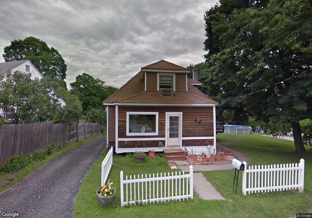
42 Ensign Ave Pittsfield, MA 01201
Estimated Value: $226,000 - $273,000
4
Beds
1
Bath
1,262
Sq Ft
$199/Sq Ft
Est. Value
About This Home
This home is located at 42 Ensign Ave, Pittsfield, MA 01201 and is currently estimated at $250,724, approximately $198 per square foot. 42 Ensign Ave is a home located in Berkshire County with nearby schools including Allendale Elementary School, Theodore Herberg Middle School, and Pittsfield High School.
Ownership History
Date
Name
Owned For
Owner Type
Purchase Details
Closed on
Jun 27, 2012
Sold by
Boulais 3Rd James F
Bought by
Boulais Arlene M
Current Estimated Value
Home Financials for this Owner
Home Financials are based on the most recent Mortgage that was taken out on this home.
Original Mortgage
$105,000
Outstanding Balance
$45,044
Interest Rate
3.78%
Mortgage Type
New Conventional
Estimated Equity
$205,680
Purchase Details
Closed on
Nov 25, 1998
Sold by
Obrien Ronald J
Bought by
Boulais Arlene M and Boulais James F
Home Financials for this Owner
Home Financials are based on the most recent Mortgage that was taken out on this home.
Original Mortgage
$64,600
Interest Rate
6.83%
Mortgage Type
Purchase Money Mortgage
Purchase Details
Closed on
May 20, 1994
Sold by
Obrien Kevin B and Obrien Joseph F
Bought by
Obrien Ronald J
Create a Home Valuation Report for This Property
The Home Valuation Report is an in-depth analysis detailing your home's value as well as a comparison with similar homes in the area
Home Values in the Area
Average Home Value in this Area
Purchase History
| Date | Buyer | Sale Price | Title Company |
|---|---|---|---|
| Boulais Arlene M | -- | -- | |
| Boulais Arlene M | -- | -- | |
| Boulais Arlene M | $68,000 | -- | |
| Boulais Arlene M | $68,000 | -- | |
| Obrien Ronald J | $40,000 | -- | |
| Obrien Ronald J | $40,000 | -- |
Source: Public Records
Mortgage History
| Date | Status | Borrower | Loan Amount |
|---|---|---|---|
| Open | Boulais Arlene M | $105,000 | |
| Closed | Obrien Ronald J | $105,000 | |
| Previous Owner | Obrien Ronald J | $22,874 | |
| Previous Owner | Obrien Ronald J | $64,600 |
Source: Public Records
Tax History Compared to Growth
Tax History
| Year | Tax Paid | Tax Assessment Tax Assessment Total Assessment is a certain percentage of the fair market value that is determined by local assessors to be the total taxable value of land and additions on the property. | Land | Improvement |
|---|---|---|---|---|
| 2025 | $2,804 | $156,300 | $65,000 | $91,300 |
| 2024 | $2,648 | $143,500 | $65,000 | $78,500 |
| 2023 | $2,416 | $131,900 | $60,000 | $71,900 |
| 2022 | $2,255 | $121,500 | $60,000 | $61,500 |
| 2021 | $2,289 | $118,900 | $60,000 | $58,900 |
| 2020 | $2,072 | $105,100 | $48,000 | $57,100 |
| 2019 | $1,956 | $100,700 | $40,000 | $60,700 |
| 2018 | $1,973 | $98,600 | $40,000 | $58,600 |
| 2017 | $1,941 | $98,900 | $38,000 | $60,900 |
| 2016 | $1,837 | $97,900 | $38,000 | $59,900 |
| 2015 | $1,768 | $97,900 | $38,000 | $59,900 |
Source: Public Records
Map
Nearby Homes
- 11 Stanley Ave
- 40 Roland St
- 81 Dartmouth St Unit 205
- 81 Dartmouth St Unit 102
- 41 Perrine Ave
- 156 Draper Ave
- LOT 20 Plunkett St
- 46 Bossidy Dr
- 326 Dalton Ave
- 52 Bossidy Dr
- 52 Brown St
- 38 Allengate Ave
- 48 Brown St
- 24 Glenwood Ave
- 29 Glenwood Ave
- 25 Kensington Ave
- 14 Allessio St
- 330 Connecticut Ave
- 26 Springside Ave
- 98 Lincoln St
- 170 E Park Terrace
- 211 Benedict Rd
- 32 Ensign Ave
- 203 Benedict Rd
- 44 Stanley Ave
- 225 Benedict Rd
- 167 E Park Terrace
- 163 E Park Terrace
- 55 Stanley Ave
- 47 Stanley Ave
- 26 Ensign Ave
- 0 Ensign Ave
- 27 Ensign Ave
- 161 E Park Terrace
- 233 Benedict Rd
- 41 Stanley Ave
- 214 Benedict Rd
- 153 E Park Terrace
- 218 Benedict Rd
- 206 Benedict Rd