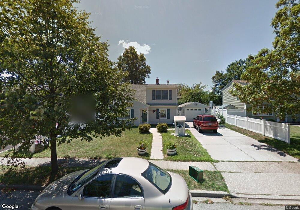
42 Griddle Ln Levittown, NY 11756
Estimated Value: $754,704 - $779,000
--
Bed
2
Baths
1,840
Sq Ft
$417/Sq Ft
Est. Value
About This Home
This home is located at 42 Griddle Ln, Levittown, NY 11756 and is currently estimated at $766,852, approximately $416 per square foot. 42 Griddle Ln is a home located in Nassau County with nearby schools including Michael F. Stokes Elementary School, J Fred Sparke Elementary School, and Island Trees Middle School.
Ownership History
Date
Name
Owned For
Owner Type
Purchase Details
Closed on
Sep 5, 2003
Sold by
Murphy Michael
Bought by
Durkin Robert
Current Estimated Value
Purchase Details
Closed on
Dec 11, 1998
Sold by
Mcdonald Matilda J
Bought by
Murphy Michael and Murphy Andrea
Purchase Details
Closed on
May 30, 1995
Sold by
Krauter Lynn Est
Bought by
Mcdonald Matilda
Create a Home Valuation Report for This Property
The Home Valuation Report is an in-depth analysis detailing your home's value as well as a comparison with similar homes in the area
Home Values in the Area
Average Home Value in this Area
Purchase History
| Date | Buyer | Sale Price | Title Company |
|---|---|---|---|
| Durkin Robert | $305,000 | -- | |
| Murphy Michael | $162,000 | -- | |
| Mcdonald Matilda | -- | -- |
Source: Public Records
Tax History Compared to Growth
Tax History
| Year | Tax Paid | Tax Assessment Tax Assessment Total Assessment is a certain percentage of the fair market value that is determined by local assessors to be the total taxable value of land and additions on the property. | Land | Improvement |
|---|---|---|---|---|
| 2025 | $12,302 | $526 | $191 | $335 |
| 2024 | $3,934 | $541 | $197 | $344 |
| 2023 | $10,642 | $554 | $202 | $352 |
| 2022 | $10,642 | $550 | $200 | $350 |
| 2021 | $12,293 | $605 | $197 | $408 |
| 2020 | $9,893 | $703 | $567 | $136 |
| 2019 | $11,333 | $753 | $368 | $385 |
| 2018 | $11,575 | $803 | $0 | $0 |
| 2017 | $4,821 | $523 | $523 | $0 |
| 2016 | $7,344 | $523 | $523 | $0 |
| 2015 | $2,960 | $632 | $523 | $109 |
| 2014 | $2,960 | $632 | $523 | $109 |
| 2013 | $2,722 | $632 | $523 | $109 |
Source: Public Records
Map
Nearby Homes