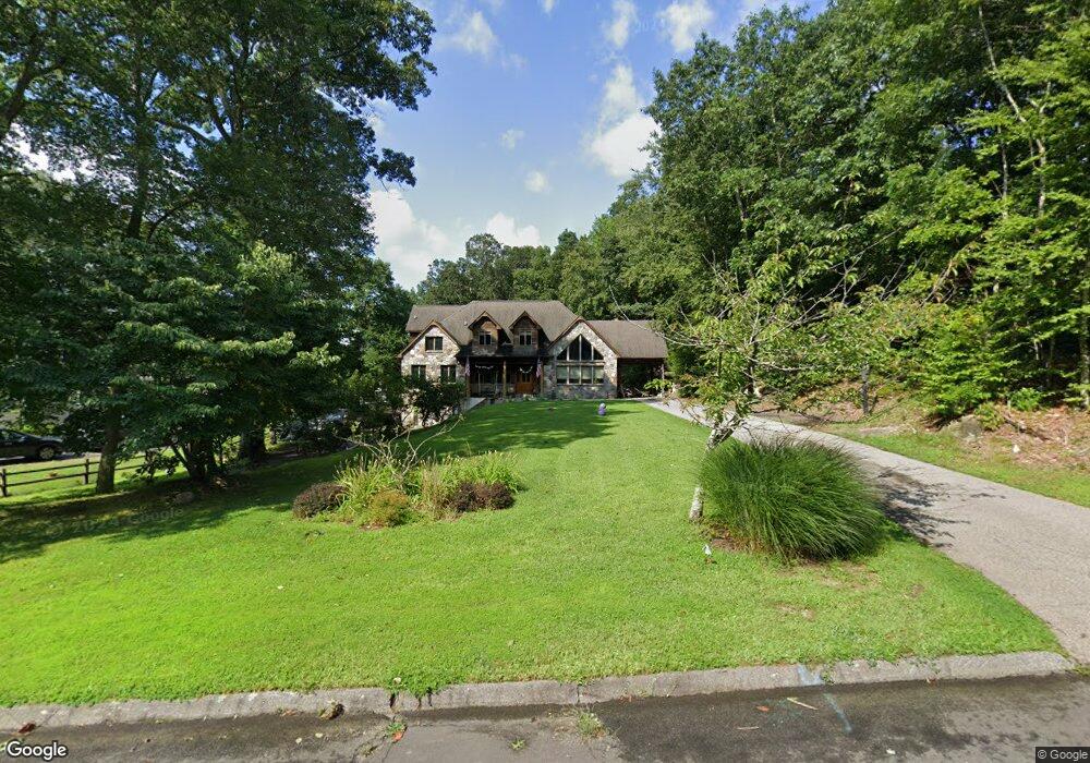
42 Grouse Cir East Lyme, CT 06333
Estimated Value: $602,000 - $701,000
3
Beds
3
Baths
2,904
Sq Ft
$227/Sq Ft
Est. Value
About This Home
This home is located at 42 Grouse Cir, East Lyme, CT 06333 and is currently estimated at $658,049, approximately $226 per square foot. 42 Grouse Cir is a home located in New London County with nearby schools including East Lyme Middle School, East Lyme High School, and Carelot Children's Center - East Lyme.
Ownership History
Date
Name
Owned For
Owner Type
Purchase Details
Closed on
Oct 13, 1994
Sold by
Nazarko Ct Prop Inc
Bought by
Vage Chandravathi and Vage Satyanarayana
Current Estimated Value
Purchase Details
Closed on
Sep 5, 1991
Sold by
Hud
Bought by
Dodge Brian and Amanti Kathleen
Purchase Details
Closed on
May 4, 1987
Sold by
Kintz Thomas
Bought by
Vanwoert Richard
Create a Home Valuation Report for This Property
The Home Valuation Report is an in-depth analysis detailing your home's value as well as a comparison with similar homes in the area
Home Values in the Area
Average Home Value in this Area
Purchase History
| Date | Buyer | Sale Price | Title Company |
|---|---|---|---|
| Vage Chandravathi | $218,000 | -- | |
| Dodge Brian | $96,000 | -- | |
| Vanwoert Richard | $97,000 | -- |
Source: Public Records
Mortgage History
| Date | Status | Borrower | Loan Amount |
|---|---|---|---|
| Open | Vanwoert Richard | $20,000 | |
| Open | Vanwoert Richard | $200,000 |
Source: Public Records
Tax History Compared to Growth
Tax History
| Year | Tax Paid | Tax Assessment Tax Assessment Total Assessment is a certain percentage of the fair market value that is determined by local assessors to be the total taxable value of land and additions on the property. | Land | Improvement |
|---|---|---|---|---|
| 2025 | $9,694 | $346,080 | $92,960 | $253,120 |
| 2024 | $9,119 | $346,080 | $92,960 | $253,120 |
| 2023 | $8,610 | $346,080 | $92,960 | $253,120 |
| 2022 | $8,251 | $346,080 | $92,960 | $253,120 |
| 2021 | $8,136 | $285,390 | $88,340 | $197,050 |
| 2020 | $8,094 | $285,390 | $88,340 | $197,050 |
| 2019 | $8,045 | $285,390 | $88,340 | $197,050 |
| 2018 | $7,805 | $285,390 | $88,340 | $197,050 |
| 2017 | $7,466 | $285,390 | $88,340 | $197,050 |
| 2016 | $7,163 | $282,450 | $83,650 | $198,800 |
| 2015 | $6,979 | $282,450 | $83,650 | $198,800 |
| 2014 | $6,787 | $282,450 | $83,650 | $198,800 |
Source: Public Records
Map
Nearby Homes
- 48 Quailcrest Rd
- 12 Brookfield Dr
- 0 Cedarbrook Ln Unit 24110327
- 43 Mayfield Terrace
- 14 Irvingdell Place
- 18 Sandpiper Ln
- 15 Rocco Dr
- 29 Rocco Dr
- 0 Chesterfield Rd
- 50 Gurley Rd
- 10 Filosi Rd
- 32 Upper Pattagansett Rd Unit 8
- 231 Boston Post Rd Unit 9
- 138 Boston Post Rd Unit 10
- 138 Boston Post Rd Unit 11
- 138 Boston Post Rd Unit 16
- 138 Boston Post Rd Unit 17
- 138 Boston Post Rd Unit 3
- 1 Hathaway Rd
- 267 Waterford Pkwy N