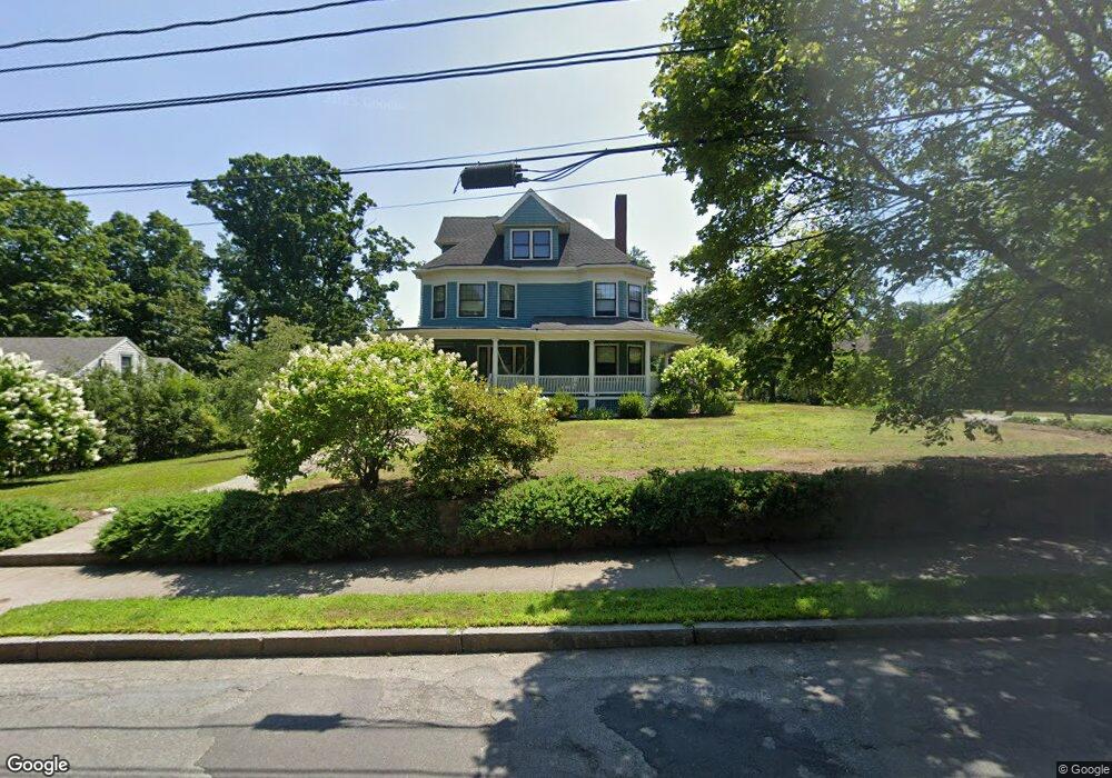
42 Grove St Auburndale, MA 02466
Auburndale NeighborhoodEstimated Value: $1,805,000 - $2,051,992
4
Beds
2
Baths
3,086
Sq Ft
$635/Sq Ft
Est. Value
About This Home
This home is located at 42 Grove St, Auburndale, MA 02466 and is currently estimated at $1,958,998, approximately $634 per square foot. 42 Grove St is a home located in Middlesex County with nearby schools including Williams Elementary School, Charles E Brown Middle School, and Newton South High School.
Ownership History
Date
Name
Owned For
Owner Type
Purchase Details
Closed on
Nov 26, 1993
Sold by
Hill Winnifred M
Bought by
Pina Vincent C and Pina Carol L
Current Estimated Value
Home Financials for this Owner
Home Financials are based on the most recent Mortgage that was taken out on this home.
Original Mortgage
$296,150
Interest Rate
6.72%
Mortgage Type
Purchase Money Mortgage
Create a Home Valuation Report for This Property
The Home Valuation Report is an in-depth analysis detailing your home's value as well as a comparison with similar homes in the area
Home Values in the Area
Average Home Value in this Area
Purchase History
| Date | Buyer | Sale Price | Title Company |
|---|---|---|---|
| Pina Vincent C | $329,100 | -- |
Source: Public Records
Mortgage History
| Date | Status | Borrower | Loan Amount |
|---|---|---|---|
| Open | Pina Vincent C | $40,500 | |
| Closed | Pina Vincent C | $296,150 |
Source: Public Records
Tax History Compared to Growth
Tax History
| Year | Tax Paid | Tax Assessment Tax Assessment Total Assessment is a certain percentage of the fair market value that is determined by local assessors to be the total taxable value of land and additions on the property. | Land | Improvement |
|---|---|---|---|---|
| 2025 | $17,530 | $1,788,800 | $1,003,100 | $785,700 |
| 2024 | $16,950 | $1,736,700 | $973,900 | $762,800 |
| 2023 | $16,109 | $1,582,400 | $761,600 | $820,800 |
| 2022 | $15,414 | $1,465,200 | $705,200 | $760,000 |
| 2021 | $14,874 | $1,382,300 | $665,300 | $717,000 |
| 2020 | $14,431 | $1,382,300 | $665,300 | $717,000 |
| 2019 | $14,024 | $1,342,000 | $645,900 | $696,100 |
| 2018 | $13,454 | $1,243,400 | $578,700 | $664,700 |
| 2017 | $13,044 | $1,173,000 | $545,900 | $627,100 |
| 2016 | $12,476 | $1,096,300 | $510,200 | $586,100 |
| 2015 | $11,754 | $1,012,400 | $476,800 | $535,600 |
Source: Public Records
Map
Nearby Homes
- 224 Auburn St Unit 224
- 224 Auburn St Unit A
- 226 Auburn St Unit 226
- 17 Lasell St
- 283 Melrose St
- 2202 Commonwealth Ave Unit 2
- 2202 Commonwealth Ave Unit 1
- 62-64 Rowe St Unit B
- 27 Oakwood Rd
- 13 Weir St
- 283 Woodland Rd
- 1639 Washington St
- 51 Bourne St
- 1754 Washington St
- 17 Gilbert St
- 17 Crescent St
- 160 Pine St Unit 12
- 10 Crescent St Unit 1
- 10 Crescent St Unit 2
- 0 Duncan Rd Unit 72925240
- 42 Grove St Unit 42
- 36 Grove St
- 50 Grove St Unit 52
- 50 Grove St Unit 52
- 50 Grove St Unit 50
- 39 Grove St
- 40 Groveland St
- 35 Groveland St
- 35 Groveland St Unit None
- 35 Grove St
- 116 Central St
- 49 Grove St Unit 3
- 49 Grove St Unit 8
- 49 Grove St Unit 7
- 49 Grove St Unit 6
- 49 Grove St Unit 5
- 49 Grove St Unit 4
- 49 Grove St Unit 2
- 49 Grove St Unit 1
- 49 Grove St Unit 4,49