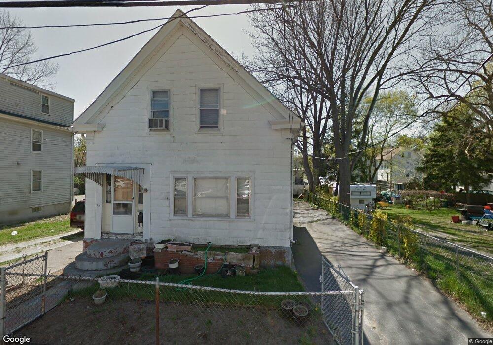
42 Grove St Taunton, MA 02780
Whittenton NeighborhoodEstimated Value: $380,000 - $430,000
4
Beds
2
Baths
1,415
Sq Ft
$289/Sq Ft
Est. Value
About This Home
This home is located at 42 Grove St, Taunton, MA 02780 and is currently estimated at $408,894, approximately $288 per square foot. 42 Grove St is a home located in Bristol County with nearby schools including H. H. Galligan School, Taunton High School, and John F. Parker Middle School.
Ownership History
Date
Name
Owned For
Owner Type
Purchase Details
Closed on
Jun 18, 2019
Sold by
Keoduangsy Lucky D
Bought by
Keoduangsy Lucky D and Keoduangsy Phoubieng
Current Estimated Value
Home Financials for this Owner
Home Financials are based on the most recent Mortgage that was taken out on this home.
Original Mortgage
$189,600
Outstanding Balance
$166,367
Interest Rate
4%
Mortgage Type
New Conventional
Estimated Equity
$242,527
Purchase Details
Closed on
May 1, 1997
Sold by
Tribou Rlty and Mckean Robert C
Bought by
Keoduangsy Lucky D
Home Financials for this Owner
Home Financials are based on the most recent Mortgage that was taken out on this home.
Original Mortgage
$74,650
Interest Rate
7.85%
Mortgage Type
Purchase Money Mortgage
Create a Home Valuation Report for This Property
The Home Valuation Report is an in-depth analysis detailing your home's value as well as a comparison with similar homes in the area
Home Values in the Area
Average Home Value in this Area
Purchase History
| Date | Buyer | Sale Price | Title Company |
|---|---|---|---|
| Keoduangsy Lucky D | -- | -- | |
| Keoduangsy Lucky D | $74,900 | -- |
Source: Public Records
Mortgage History
| Date | Status | Borrower | Loan Amount |
|---|---|---|---|
| Open | Keoduangsy Lucky D | $189,600 | |
| Previous Owner | Keoduangsy Lucky D | $119,394 | |
| Previous Owner | Keoduangsy Lucky D | $74,650 |
Source: Public Records
Tax History Compared to Growth
Tax History
| Year | Tax Paid | Tax Assessment Tax Assessment Total Assessment is a certain percentage of the fair market value that is determined by local assessors to be the total taxable value of land and additions on the property. | Land | Improvement |
|---|---|---|---|---|
| 2025 | $3,496 | $319,600 | $85,800 | $233,800 |
| 2024 | $3,250 | $290,400 | $85,800 | $204,600 |
| 2023 | $3,244 | $269,200 | $85,800 | $183,400 |
| 2022 | $3,047 | $231,200 | $67,700 | $163,500 |
| 2021 | $2,890 | $203,500 | $54,700 | $148,800 |
| 2020 | $2,788 | $187,600 | $54,700 | $132,900 |
| 2019 | $2,484 | $157,600 | $58,800 | $98,800 |
| 2018 | $2,397 | $152,500 | $57,500 | $95,000 |
| 2017 | $2,146 | $136,600 | $54,500 | $82,100 |
| 2016 | $2,129 | $135,800 | $56,000 | $79,800 |
| 2015 | $2,143 | $142,800 | $58,700 | $84,100 |
| 2014 | $2,044 | $139,900 | $54,600 | $85,300 |
Source: Public Records
Map
Nearby Homes
- 44 Grove St
- 46 Grove St
- 45 Grove St
- 51 N Pleasant St
- 38 Grove St
- 47 N Pleasant St
- 53 N Pleasant St
- 54 Adams St
- 49 Grove St
- 55 N Pleasant St
- 55 N Pleasant St Unit 2
- 56 Adams St
- 56 Adams St Unit 2
- 43 N Pleasant St
- 58 Adams St
- 58 Adams St Unit 2
- 45 N Pleasant St
- 45 N Pleasant St Unit 2
- 45 N Pleasant St Unit 1
- 53 Grove St