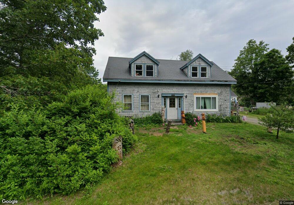
42 Head of the Tide Rd Belfast, ME 04915
Estimated Value: $243,000 - $511,000
2
Beds
1
Bath
863
Sq Ft
$390/Sq Ft
Est. Value
About This Home
This home is located at 42 Head of the Tide Rd, Belfast, ME 04915 and is currently estimated at $336,721, approximately $390 per square foot. 42 Head of the Tide Rd is a home located in Waldo County with nearby schools including Cornerspring Children's House and The School At Sweetser - Belfast.
Ownership History
Date
Name
Owned For
Owner Type
Purchase Details
Closed on
Sep 24, 2015
Sold by
Richards Jeffrey D and Hussey Deborah L
Bought by
Wilson Jacqueline K
Current Estimated Value
Home Financials for this Owner
Home Financials are based on the most recent Mortgage that was taken out on this home.
Original Mortgage
$102,551
Outstanding Balance
$80,712
Interest Rate
3.97%
Mortgage Type
Commercial
Estimated Equity
$256,009
Purchase Details
Closed on
Dec 6, 2005
Sold by
Glover Carl A and Glover Jean
Bought by
Richards Jeffrey D and Hussey Deborah L
Purchase Details
Closed on
Nov 15, 2005
Sold by
Richards Jeffrey D
Bought by
Richards Jeffrey D and Hussey Deborah L
Create a Home Valuation Report for This Property
The Home Valuation Report is an in-depth analysis detailing your home's value as well as a comparison with similar homes in the area
Home Values in the Area
Average Home Value in this Area
Purchase History
| Date | Buyer | Sale Price | Title Company |
|---|---|---|---|
| Wilson Jacqueline K | -- | -- | |
| Richards Jeffrey D | -- | -- | |
| Richards Jeffrey D | -- | -- |
Source: Public Records
Mortgage History
| Date | Status | Borrower | Loan Amount |
|---|---|---|---|
| Open | Wilson Jacqueline K | $102,551 |
Source: Public Records
Tax History Compared to Growth
Tax History
| Year | Tax Paid | Tax Assessment Tax Assessment Total Assessment is a certain percentage of the fair market value that is determined by local assessors to be the total taxable value of land and additions on the property. | Land | Improvement |
|---|---|---|---|---|
| 2024 | $2,683 | $174,200 | $61,100 | $113,100 |
| 2023 | $2,157 | $107,300 | $40,300 | $67,000 |
| 2022 | $2,234 | $104,400 | $40,300 | $64,100 |
| 2021 | $2,297 | $104,400 | $40,300 | $64,100 |
| 2020 | $2,356 | $101,100 | $40,300 | $60,800 |
| 2019 | $2,265 | $98,900 | $40,300 | $58,600 |
| 2018 | $2,245 | $98,900 | $40,300 | $58,600 |
| 2017 | $2,166 | $98,900 | $40,300 | $58,600 |
| 2016 | $1,924 | $84,000 | $25,400 | $58,600 |
| 2015 | $1,882 | $84,000 | $25,400 | $58,600 |
| 2014 | $1,819 | $84,000 | $25,400 | $58,600 |
| 2013 | $1,747 | $84,000 | $25,400 | $58,600 |
Source: Public Records
Map
Nearby Homes
- 050-C-1 W Waldo Rd
- 99 Waterville Rd
- 243 Waterville Rd
- 62 City Point Rd
- 86 Oak Hill Rd
- 17 Marsh Rd
- 128 Shepard Rd
- 000 Merriam Rd
- 0 Robbins Rd Unit 1634953
- 388 High St
- 20 Springbrook Dr Unit TH-6
- 225 Waldo Ave
- 0 Patterson Hill Rd Unit Lot 2 1614981
- 159 Waldo Ave
- 55 Londonderry Ln
- 100 Belmont Ave Unit 2
- 37 Jacobs Rd
- 51 Bridge St
- 6 Daniel Dr
- 227 High St
- 4 W Waldo Rd
- 8 W Waldo Rd
- 38 Head of the Tide Rd
- 46 Head of the Tide Rd
- 35 Head of the Tide Rd
- 5 W Waldo Rd
- 5 W Waldo Rd
- 12 W Waldo Rd
- 9 W Waldo Rd
- 47 Head of the Tide Rd
- 33 Head of the Tide Rd
- 50 Head of the Tide Rd
- 34 Head of the Tide Rd
- 52 Head of the Tide Rd
- 30 Head of the Tide Rd
- 30 Head of Tide
- 54 Head of the Tide Rd
- 16 W Waldo Rd
- 51 Head of the Tide Rd
- 15 W Waldo Rd