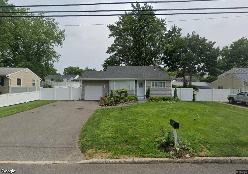
42 Huron St Port Jefferson Station, NY 11776
Estimated Value: $445,000 - $570,000
3
Beds
2
Baths
1,500
Sq Ft
$357/Sq Ft
Est. Value
About This Home
This home is located at 42 Huron St, Port Jefferson Station, NY 11776 and is currently estimated at $534,819, approximately $356 per square foot. 42 Huron St is a home located in Suffolk County with nearby schools including John F Kennedy Middle School and Comsewogue High School.
Ownership History
Date
Name
Owned For
Owner Type
Purchase Details
Closed on
Jan 3, 2018
Sold by
Tonsof Llc
Bought by
42 Huron Llc
Current Estimated Value
Purchase Details
Closed on
Jan 17, 2003
Sold by
Farhi Isac and Farhi Carmela
Bought by
Sommer Russell F and Sommer Brenda J
Home Financials for this Owner
Home Financials are based on the most recent Mortgage that was taken out on this home.
Original Mortgage
$254,450
Interest Rate
5.98%
Mortgage Type
FHA
Purchase Details
Closed on
Mar 23, 1999
Sold by
Leszek Robert and Leszek Gina
Bought by
Farhi Carmela and Farhi Isac
Purchase Details
Closed on
Mar 18, 1997
Sold by
Watson Lauren
Bought by
Leszek Robert and Leszek Gina
Create a Home Valuation Report for This Property
The Home Valuation Report is an in-depth analysis detailing your home's value as well as a comparison with similar homes in the area
Home Values in the Area
Average Home Value in this Area
Purchase History
| Date | Buyer | Sale Price | Title Company |
|---|---|---|---|
| 42 Huron Llc | $308,000 | -- | |
| Sommer Russell F | $259,990 | -- | |
| Farhi Carmela | $126,000 | -- | |
| Leszek Robert | $98,000 | Safe Harbor Title Agency |
Source: Public Records
Mortgage History
| Date | Status | Borrower | Loan Amount |
|---|---|---|---|
| Previous Owner | Sommer Russell F | $254,450 |
Source: Public Records
Tax History Compared to Growth
Tax History
| Year | Tax Paid | Tax Assessment Tax Assessment Total Assessment is a certain percentage of the fair market value that is determined by local assessors to be the total taxable value of land and additions on the property. | Land | Improvement |
|---|---|---|---|---|
| 2024 | $9,259 | $2,150 | $150 | $2,000 |
| 2023 | $9,259 | $2,150 | $150 | $2,000 |
| 2022 | $8,457 | $2,150 | $150 | $2,000 |
| 2021 | $8,457 | $2,150 | $150 | $2,000 |
| 2020 | $8,513 | $2,150 | $150 | $2,000 |
| 2019 | $8,513 | $0 | $0 | $0 |
| 2018 | $7,025 | $2,150 | $150 | $2,000 |
| 2017 | $7,025 | $2,150 | $150 | $2,000 |
| 2016 | $6,968 | $2,150 | $150 | $2,000 |
| 2015 | -- | $2,150 | $150 | $2,000 |
| 2014 | -- | $2,150 | $150 | $2,000 |
Source: Public Records
Map
Nearby Homes
- 58A Superior St
- 1 Dillon Ave
- 484 Bicycle Path
- 20 Revere Cir
- 110 Clinton Ave
- 27 Parkridge Cir
- 1506 Nicole Dr
- 1704 Nicole Dr
- 10 Orchid Dr
- 132 Clinton Ave
- 1405 Constance Ln
- 507 Constance Ln
- 903 Constance Ln
- 138 Greene Ave
- 5 Lincoln St
- 6 13th St
- 122 Stuyvesant Dr
- 3 Lilac Ln
- 117 Stuyvesant Dr
- 10 Woodbine St