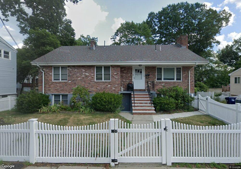
42 Itasca St Mattapan, MA 02126
Southern Mattapan NeighborhoodEstimated Value: $501,000 - $768,000
4
Beds
2
Baths
2,201
Sq Ft
$304/Sq Ft
Est. Value
About This Home
This home is located at 42 Itasca St, Mattapan, MA 02126 and is currently estimated at $668,257, approximately $303 per square foot. 42 Itasca St is a home located in Suffolk County with nearby schools including KIPP Academy Boston Charter School and Berea Sda Academy.
Ownership History
Date
Name
Owned For
Owner Type
Purchase Details
Closed on
Jul 28, 2023
Sold by
Cynthia May Mcconaga T and Cynthia Fisette
Bought by
Brown Windel and Barnes Ezra
Current Estimated Value
Purchase Details
Closed on
Oct 26, 2022
Sold by
Mcconaga Cynthia M
Bought by
M Mcconaga 2022 T C
Purchase Details
Closed on
Feb 1, 2011
Sold by
Mcconaga Cynthia M and Mcconaga William
Bought by
Boston City Of
Create a Home Valuation Report for This Property
The Home Valuation Report is an in-depth analysis detailing your home's value as well as a comparison with similar homes in the area
Home Values in the Area
Average Home Value in this Area
Purchase History
| Date | Buyer | Sale Price | Title Company |
|---|---|---|---|
| Brown Windel | -- | None Available | |
| M Mcconaga 2022 T C | -- | None Available | |
| Boston City Of | $883 | -- |
Source: Public Records
Tax History
| Year | Tax Paid | Tax Assessment Tax Assessment Total Assessment is a certain percentage of the fair market value that is determined by local assessors to be the total taxable value of land and additions on the property. | Land | Improvement |
|---|---|---|---|---|
| 2025 | $6,542 | $564,900 | $225,100 | $339,800 |
| 2024 | $6,234 | $571,900 | $209,800 | $362,100 |
| 2023 | $5,794 | $539,500 | $197,900 | $341,600 |
| 2022 | $5,870 | $539,500 | $197,900 | $341,600 |
| 2021 | $5,234 | $490,500 | $179,900 | $310,600 |
| 2020 | $5,180 | $490,500 | $183,700 | $306,800 |
| 2019 | $4,797 | $455,100 | $137,100 | $318,000 |
| 2018 | $4,259 | $406,400 | $137,100 | $269,300 |
| 2017 | $4,139 | $390,800 | $137,100 | $253,700 |
| 2016 | $3,907 | $355,200 | $137,100 | $218,100 |
| 2015 | $3,490 | $288,200 | $114,300 | $173,900 |
| 2014 | $3,358 | $266,900 | $114,300 | $152,600 |
Source: Public Records
Map
Nearby Homes
- 116 Almont St
- 60 and 64 Monterey Ave
- 20 Monterey Ave
- 14-14R Kennebec St
- 58 Mattapan St
- 72 Wellington Hill St
- 36-38 Hallowell St
- 567B Norfolk St
- 231 Itasca St
- 62 Westmore Rd
- 95 Woodhaven St
- 72 Livermore St
- 10 Brockton St
- 16 Clarkwood St Unit 2
- 16 Clarkwood St Unit 1
- 16 Clarkwood St Unit 3
- 4 Crossman St Unit 4
- 11 French St
- 165-167 Delhi St
- 770 Cummins Hwy Unit 1
Your Personal Tour Guide
Ask me questions while you tour the home.