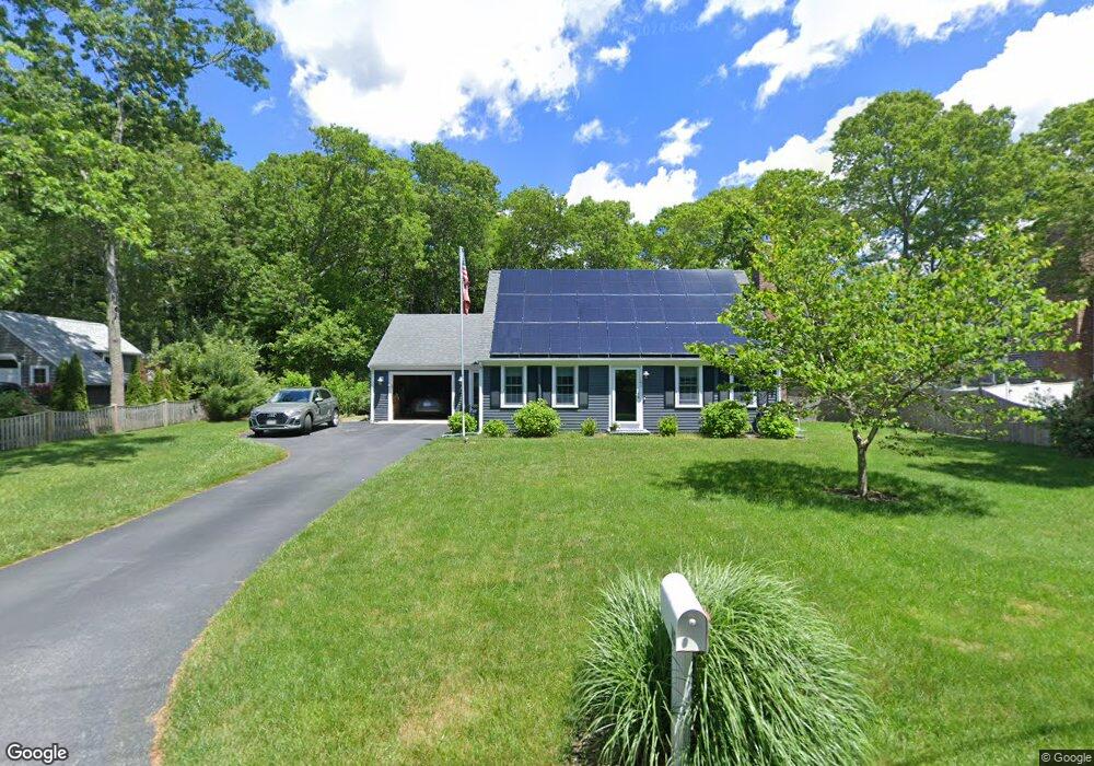
42 Kiahs Way East Sandwich, MA 02537
Estimated Value: $588,470 - $661,000
2
Beds
2
Baths
1,501
Sq Ft
$423/Sq Ft
Est. Value
About This Home
This home is located at 42 Kiahs Way, East Sandwich, MA 02537 and is currently estimated at $634,368, approximately $422 per square foot. 42 Kiahs Way is a home located in Barnstable County with nearby schools including Sandwich Middle High School, Sandwich Montessori School, and Riverview School.
Ownership History
Date
Name
Owned For
Owner Type
Purchase Details
Closed on
Dec 1, 2003
Sold by
Day Andrew G and Day Marilyn E
Bought by
Loring David A and Loring Patricia S
Current Estimated Value
Home Financials for this Owner
Home Financials are based on the most recent Mortgage that was taken out on this home.
Original Mortgage
$253,800
Outstanding Balance
$119,328
Interest Rate
6.09%
Mortgage Type
Purchase Money Mortgage
Estimated Equity
$515,040
Purchase Details
Closed on
Nov 30, 1999
Sold by
Burkhardt Walter W and Burkhardt Sandra B
Bought by
Day Andrew G and Day Marilyn E
Purchase Details
Closed on
Aug 19, 1996
Sold by
Levin Monroe L Est
Bought by
Burkhardt Walter W and Burkhardt Sandra B
Create a Home Valuation Report for This Property
The Home Valuation Report is an in-depth analysis detailing your home's value as well as a comparison with similar homes in the area
Home Values in the Area
Average Home Value in this Area
Purchase History
| Date | Buyer | Sale Price | Title Company |
|---|---|---|---|
| Loring David A | $282,000 | -- | |
| Day Andrew G | $165,900 | -- | |
| Burkhardt Walter W | $130,000 | -- |
Source: Public Records
Mortgage History
| Date | Status | Borrower | Loan Amount |
|---|---|---|---|
| Open | Burkhardt Walter W | $253,800 | |
| Previous Owner | Burkhardt Walter W | $160,000 |
Source: Public Records
Tax History Compared to Growth
Tax History
| Year | Tax Paid | Tax Assessment Tax Assessment Total Assessment is a certain percentage of the fair market value that is determined by local assessors to be the total taxable value of land and additions on the property. | Land | Improvement |
|---|---|---|---|---|
| 2025 | $5,121 | $484,500 | $154,400 | $330,100 |
| 2024 | $4,728 | $437,800 | $137,800 | $300,000 |
| 2023 | $4,621 | $401,800 | $125,300 | $276,500 |
| 2022 | $4,407 | $334,900 | $111,900 | $223,000 |
| 2021 | $4,214 | $306,000 | $107,600 | $198,400 |
| 2020 | $4,197 | $293,300 | $105,100 | $188,200 |
| 2019 | $3,998 | $279,200 | $103,100 | $176,100 |
| 2018 | $3,765 | $263,500 | $99,600 | $163,900 |
| 2017 | $3,724 | $249,400 | $96,400 | $153,000 |
| 2016 | $3,538 | $244,500 | $95,400 | $149,100 |
| 2015 | $3,382 | $228,200 | $85,900 | $142,300 |
Source: Public Records
Map
Nearby Homes
- 77 Kiahs Way
- 186 Quaker Meeting House Rd
- 17 Kensington Dr
- 9 Crestview Drive Extension
- 2 Marie Ln
- 21 Manor Dr
- 7 Highfield Dr
- 58 Southpoint Dr Unit J
- 20 Crestview Dr
- 376 Route 6a Unit 17
- 363 Service Rd
- 59 Southpoint Dr Unit 59
- 5 Whiffletree Cir
- 5 Aviators Ln
- 49 Atkins Rd
- 49 Atkins Rd
- 159 Great Hill Rd
- 420 Massachusetts 6a
- 390 Massachusetts 6a
- 23 Old Fields Rd