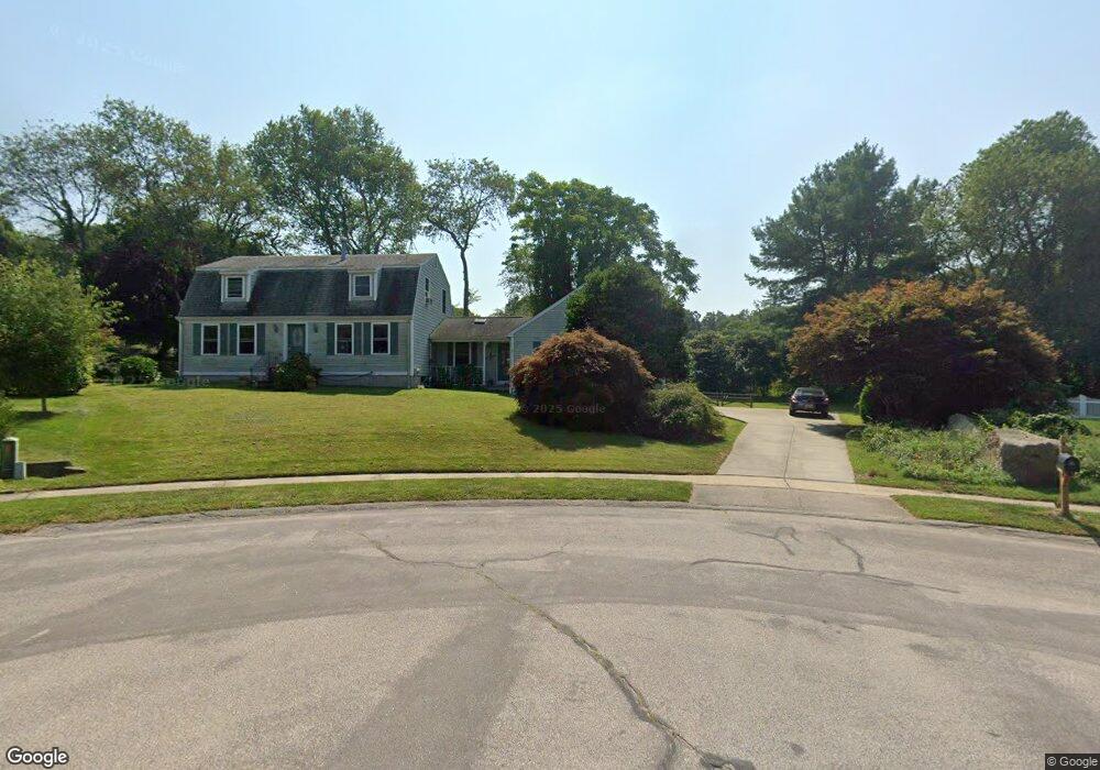
42 Kingswood Ct Wakefield, RI 02879
Estimated Value: $729,186 - $867,000
3
Beds
3
Baths
2,107
Sq Ft
$369/Sq Ft
Est. Value
About This Home
This home is located at 42 Kingswood Ct, Wakefield, RI 02879 and is currently estimated at $776,797, approximately $368 per square foot. 42 Kingswood Ct is a home located in Washington County with nearby schools including South Kingstown High School, Monsignor Matthew Clarke Catholic Regional School, and Bradley School-South.
Ownership History
Date
Name
Owned For
Owner Type
Purchase Details
Closed on
Apr 23, 1999
Sold by
Ferdinand Kathleen M
Bought by
Taylor George P and Taylor Melissa A
Current Estimated Value
Purchase Details
Closed on
Jul 11, 1988
Sold by
Pat Realty & Devel
Bought by
Riggert T David
Create a Home Valuation Report for This Property
The Home Valuation Report is an in-depth analysis detailing your home's value as well as a comparison with similar homes in the area
Home Values in the Area
Average Home Value in this Area
Purchase History
| Date | Buyer | Sale Price | Title Company |
|---|---|---|---|
| Taylor George P | $178,000 | -- | |
| Riggert T David | $148,500 | -- |
Source: Public Records
Mortgage History
| Date | Status | Borrower | Loan Amount |
|---|---|---|---|
| Open | Riggert T David | $119,000 | |
| Closed | Riggert T David | $79,000 | |
| Closed | Riggert T David | $50,000 | |
| Open | Riggert T David | $240,000 |
Source: Public Records
Tax History Compared to Growth
Tax History
| Year | Tax Paid | Tax Assessment Tax Assessment Total Assessment is a certain percentage of the fair market value that is determined by local assessors to be the total taxable value of land and additions on the property. | Land | Improvement |
|---|---|---|---|---|
| 2025 | $5,352 | $598,700 | $235,600 | $363,100 |
| 2024 | $5,337 | $483,000 | $174,300 | $308,700 |
| 2023 | $5,337 | $483,000 | $174,300 | $308,700 |
| 2022 | $5,289 | $483,000 | $174,300 | $308,700 |
| 2021 | $5,235 | $362,300 | $134,100 | $228,200 |
| 2020 | $5,235 | $362,300 | $134,100 | $228,200 |
| 2019 | $5,235 | $362,300 | $134,100 | $228,200 |
| 2018 | $5,209 | $332,200 | $128,200 | $204,000 |
| 2017 | $5,086 | $332,200 | $128,200 | $204,000 |
| 2016 | $5,013 | $332,200 | $128,200 | $204,000 |
| 2015 | $4,684 | $301,800 | $116,600 | $185,200 |
| 2014 | $4,672 | $301,800 | $116,600 | $185,200 |
Source: Public Records
Map
Nearby Homes
- 70 Broad Rock Rd
- 40 Amos St
- 73 Camden Ct
- 128 Camden Ct
- 3 Larkin St
- 156 River St Unit B
- 45 Cherry Ln Unit C
- 38 Eisenhower Place
- 10 Hendricks St
- 128 North Rd
- 39 Hazard Ave
- 37 Columbia St
- 48 Stone Bridge Dr
- 98 Meadow Ave
- 228 Rodman St
- 31 Winter St
- 918 Saugatucket Rd
- 128 Rodman St
- 30 Sweet Meadows Ct Unit 26
- 53 Rocky Brook Way
- 38 Kingswood Ct
- 128 Old Mountain Rd Unit A
- 128 Old Mountain Rd Unit B
- 128 Old Mountain Rd Unit C
- 128 Old Mountain Rd
- 21 Blooming Place
- 41 Kingswood Ct
- 32 Kingswood Ct
- 27 Kingswood Ct
- 24 Kingswood Ct
- 5 Blooming Place
- 134 Old Mountain Rd
- 133 Broad Rock Rd
- 121 Broad Rock Rd
- 116 Old Mountain Rd
- 12 Kingswood Ct
- 109 Broad Rock Rd
- 104 Old Mountain Rd
- 95 Broad Rock Rd
- 11 Penny Ln