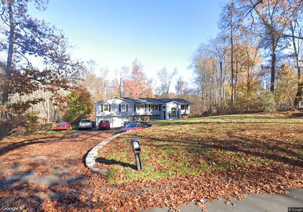
42 Knollcrest Dr Brookfield, CT 06804
Estimated Value: $579,000 - $783,000
4
Beds
3
Baths
2,553
Sq Ft
$284/Sq Ft
Est. Value
About This Home
This home is located at 42 Knollcrest Dr, Brookfield, CT 06804 and is currently estimated at $724,580, approximately $283 per square foot. 42 Knollcrest Dr is a home located in Fairfield County with nearby schools including Center Elementary School, Whisconier Middle School, and Rio Mesa High School.
Ownership History
Date
Name
Owned For
Owner Type
Purchase Details
Closed on
Sep 14, 2025
Sold by
Khan Shakoor and Khan Bibi S
Bought by
Shakoor and Shakoor Shazeeda Khan
Current Estimated Value
Purchase Details
Closed on
Mar 12, 1997
Sold by
Powers Peter M
Bought by
Khan Shakoor and Khan Bibi S
Home Financials for this Owner
Home Financials are based on the most recent Mortgage that was taken out on this home.
Original Mortgage
$137,600
Interest Rate
7.79%
Mortgage Type
Purchase Money Mortgage
Create a Home Valuation Report for This Property
The Home Valuation Report is an in-depth analysis detailing your home's value as well as a comparison with similar homes in the area
Home Values in the Area
Average Home Value in this Area
Purchase History
| Date | Buyer | Sale Price | Title Company |
|---|---|---|---|
| Shakoor | -- | -- | |
| Khan Shakoor | $172,000 | -- | |
| Khan Shakoor | $172,000 | -- |
Source: Public Records
Mortgage History
| Date | Status | Borrower | Loan Amount |
|---|---|---|---|
| Previous Owner | Khan Shakoor | $137,600 |
Source: Public Records
Tax History Compared to Growth
Tax History
| Year | Tax Paid | Tax Assessment Tax Assessment Total Assessment is a certain percentage of the fair market value that is determined by local assessors to be the total taxable value of land and additions on the property. | Land | Improvement |
|---|---|---|---|---|
| 2025 | $12,358 | $427,160 | $94,500 | $332,660 |
| 2024 | $11,918 | $427,160 | $94,500 | $332,660 |
| 2023 | $11,474 | $427,160 | $94,500 | $332,660 |
| 2022 | $11,055 | $427,160 | $94,500 | $332,660 |
| 2021 | $9,404 | $318,070 | $105,000 | $213,070 |
| 2020 | $9,182 | $318,070 | $105,000 | $213,070 |
| 2019 | $9,269 | $318,070 | $105,000 | $213,070 |
| 2018 | $9,014 | $318,070 | $105,000 | $213,070 |
| 2017 | $8,680 | $318,070 | $105,000 | $213,070 |
| 2016 | $8,770 | $332,210 | $114,360 | $217,850 |
| 2015 | $8,538 | $332,210 | $114,360 | $217,850 |
| 2014 | $8,538 | $332,210 | $114,360 | $217,850 |
Source: Public Records
Map
Nearby Homes
- 46 W Whisconier Rd
- 112 A Stony Hill Rd
- 5 Woodland Hills Terrace
- 23 Sunset Hill Rd
- 126 Stony Hill Rd
- 27 Rollingwood Dr
- 20 Chatham Ct Unit 20
- 2 Old Grays Bridge Rd
- 20 Andover Ct Unit 20
- 53 Tower Rd
- 140 Whisconier Rd
- 48 High Ridge Rd
- 4 Pond View Dr
- 12 Oak Crest Dr
- 6 Old Woods Rd
- 4 Old Woods Rd
- 2 Autumn's Way
- 23 Farrell Rd
- 24 Westview Ln Unit 24
- 16 Farrell Rd
- 44 Knollcrest Dr
- 40 Knollcrest Dr
- 46 Knollcrest Dr
- 38 Knollcrest Dr
- 31 Knollcrest Dr
- 3 Blueberry Dr
- 48 Knollcrest Dr
- 2 Red Barn Ln
- 33 Knollcrest Dr
- 31 Powder Horn Hill
- 29 Powder Horn Hill
- 36 Knollcrest Dr
- 1 Red Barn Ln
- 27 Knollcrest Dr
- 4 Red Barn Ln
- 33 Powder Horn Hill
- 39 Knollcrest Dr
- 27 Powder Horn Hill
- 1 Blueberry Dr
- 17 Knollcrest Dr