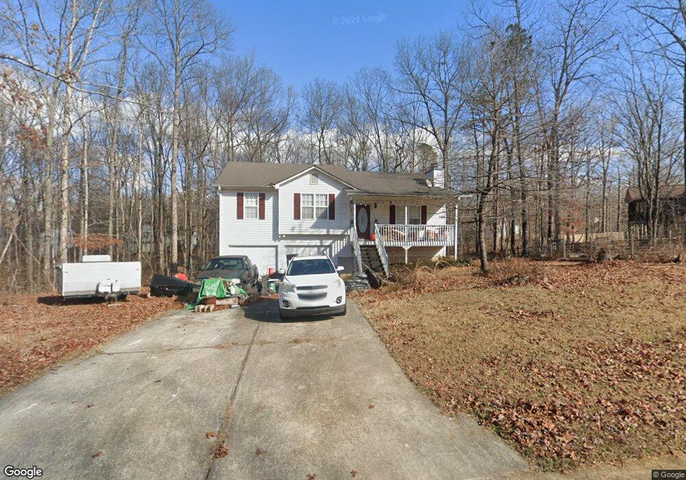
42 Miles Way Rockmart, GA 30153
Estimated Value: $243,000 - $266,000
3
Beds
2
Baths
1,259
Sq Ft
$202/Sq Ft
Est. Value
About This Home
This home is located at 42 Miles Way, Rockmart, GA 30153 and is currently estimated at $253,847, approximately $201 per square foot. 42 Miles Way is a home located in Paulding County with nearby schools including Sara M. Ragsdale Elementary School, Carl Scoggins Sr. Middle School, and Paulding County High School.
Ownership History
Date
Name
Owned For
Owner Type
Purchase Details
Closed on
Oct 30, 2003
Sold by
Gubancsik Brandon A and Gubancsik Ashley M
Bought by
Thomason Joseph and Thomason Jasie
Current Estimated Value
Home Financials for this Owner
Home Financials are based on the most recent Mortgage that was taken out on this home.
Original Mortgage
$110,000
Outstanding Balance
$50,996
Interest Rate
6%
Mortgage Type
New Conventional
Estimated Equity
$202,851
Purchase Details
Closed on
Jun 29, 2001
Sold by
Raketraw Jason W
Bought by
Gubancsik Brandon A and Gubancsik Ashley M
Home Financials for this Owner
Home Financials are based on the most recent Mortgage that was taken out on this home.
Original Mortgage
$114,025
Interest Rate
6.89%
Mortgage Type
New Conventional
Create a Home Valuation Report for This Property
The Home Valuation Report is an in-depth analysis detailing your home's value as well as a comparison with similar homes in the area
Home Values in the Area
Average Home Value in this Area
Purchase History
| Date | Buyer | Sale Price | Title Company |
|---|---|---|---|
| Thomason Joseph | $110,000 | -- | |
| Gubancsik Brandon A | $114,400 | -- |
Source: Public Records
Mortgage History
| Date | Status | Borrower | Loan Amount |
|---|---|---|---|
| Open | Thomason Joseph | $110,000 | |
| Previous Owner | Gubancsik Brandon A | $114,025 |
Source: Public Records
Tax History Compared to Growth
Tax History
| Year | Tax Paid | Tax Assessment Tax Assessment Total Assessment is a certain percentage of the fair market value that is determined by local assessors to be the total taxable value of land and additions on the property. | Land | Improvement |
|---|---|---|---|---|
| 2024 | $2,373 | $98,644 | $12,000 | $86,644 |
| 2023 | $2,586 | $101,716 | $12,000 | $89,716 |
| 2022 | $1,996 | $78,428 | $12,000 | $66,428 |
| 2021 | $1,872 | $66,292 | $6,000 | $60,292 |
| 2020 | $1,707 | $59,340 | $6,000 | $53,340 |
| 2019 | $1,591 | $54,672 | $6,000 | $48,672 |
| 2018 | $1,417 | $48,880 | $6,000 | $42,880 |
| 2017 | $1,275 | $43,600 | $6,000 | $37,600 |
| 2016 | $1,146 | $39,760 | $6,000 | $33,760 |
| 2015 | $864 | $29,920 | $6,000 | $23,920 |
| 2014 | $713 | $24,440 | $6,000 | $18,440 |
| 2013 | -- | $18,520 | $8,000 | $10,520 |
Source: Public Records
Map
Nearby Homes
- 233 Winterville Dr
- 409 Benjamin Dr
- 75 Rabbit Creek Path
- 706 Holly Springs Rd
- 0 Ayers Rd
- 375 Old Brock Rd
- 413 Old Brock Rd
- 101 Tide Water Way
- 52 Tide Water Way
- 129 Woodwind Dr
- 50 Old Oak Trace
- 89 Farm Brook Ln
- 373 Farm Brook Ln
- 259 Fairview Ln
- 516 Barnwood Dr
- 61 Fairfax Dr
- 194 Spring Leaf Dr
- 186 Puckett Rd
- 78 Miles Way
- 210 Benjamin Dr
- 39 Sidney Ct
- 27 Miles Way
- 57 Miles Way
- 13 Sidney Ct
- 13 Sidney Ct
- 67 Sidney Ct
- 0 Benjamin Dr Unit 7487055
- 0 Benjamin Dr Unit 7323190
- 0 Benjamin Dr Unit 8569303
- 0 Benjamin Dr Unit 8450132
- 0 Benjamin Dr Unit 8432544
- 0 Benjamin Dr Unit 8070209
- 0 Benjamin Dr Unit 7631568
- 0 Benjamin Dr Unit 8703103
- 0 Benjamin Dr Unit 8477933
- 0 Benjamin Dr Unit 7585373
- 93 Miles Way
- 81 Sidney Ct