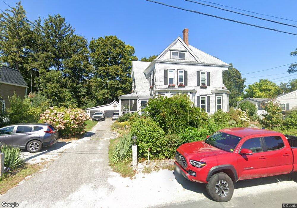
42 Myrtle St Unit 44 Braintree, MA 02184
East Braintree NeighborhoodEstimated Value: $988,000 - $1,360,000
7
Beds
5
Baths
4,802
Sq Ft
$238/Sq Ft
Est. Value
About This Home
This home is located at 42 Myrtle St Unit 44, Braintree, MA 02184 and is currently estimated at $1,143,000, approximately $238 per square foot. 42 Myrtle St Unit 44 is a home located in Norfolk County with nearby schools including Braintree High School, Meeting House Montessori School, and South Shore SDA School.
Ownership History
Date
Name
Owned For
Owner Type
Purchase Details
Closed on
Jun 11, 2018
Sold by
Murphy Martine D
Bought by
42-44 Myrtle Street Rt
Current Estimated Value
Purchase Details
Closed on
Mar 1, 1994
Sold by
Devoe Marvin J and Devoe Martine F
Bought by
Devoe Martine F
Home Financials for this Owner
Home Financials are based on the most recent Mortgage that was taken out on this home.
Original Mortgage
$60,000
Interest Rate
6.96%
Mortgage Type
Purchase Money Mortgage
Create a Home Valuation Report for This Property
The Home Valuation Report is an in-depth analysis detailing your home's value as well as a comparison with similar homes in the area
Home Values in the Area
Average Home Value in this Area
Purchase History
| Date | Buyer | Sale Price | Title Company |
|---|---|---|---|
| 42-44 Myrtle Street Rt | -- | -- | |
| Devoe Martine F | $21,000 | -- | |
| Devoe Martine F | $21,000 | -- |
Source: Public Records
Mortgage History
| Date | Status | Borrower | Loan Amount |
|---|---|---|---|
| Previous Owner | Devoe Martine F | $70,000 | |
| Previous Owner | Devoe Martine F | $90,000 | |
| Previous Owner | Devoe Martine F | $60,000 | |
| Closed | Devoe Martine F | $10,000 |
Source: Public Records
Tax History Compared to Growth
Tax History
| Year | Tax Paid | Tax Assessment Tax Assessment Total Assessment is a certain percentage of the fair market value that is determined by local assessors to be the total taxable value of land and additions on the property. | Land | Improvement |
|---|---|---|---|---|
| 2025 | $12,841 | $1,286,700 | $398,900 | $887,800 |
| 2024 | $10,363 | $1,093,100 | $372,000 | $721,100 |
| 2023 | $9,989 | $1,023,500 | $334,200 | $689,300 |
| 2022 | $9,862 | $991,200 | $301,900 | $689,300 |
| 2021 | $9,256 | $930,300 | $272,800 | $657,500 |
| 2020 | $8,616 | $873,800 | $248,000 | $625,800 |
| 2019 | $7,610 | $754,200 | $237,200 | $517,000 |
| 2018 | $7,499 | $711,500 | $215,600 | $495,900 |
| 2017 | $7,011 | $652,800 | $204,900 | $447,900 |
| 2016 | $6,285 | $572,400 | $172,500 | $399,900 |
| 2015 | $6,313 | $570,300 | $170,400 | $399,900 |
| 2014 | $5,940 | $520,100 | $155,300 | $364,800 |
Source: Public Records
Map
Nearby Homes
- 8 Vinton Ave Unit 10
- 39 Morrison Rd
- 39 Lawnview Dr
- 54 Elmlawn Rd
- 23 Bower Rd
- 161 Cedar St
- 106 Home Park Rd
- 491 Washington St Unit 1
- 37 Monatiquot Ave
- 1 Pantano St
- 63 Dickerman Ln
- 10 Cochato Rd
- 69 Dobson Rd
- 25 John Paul Cir
- 31 Tingley Rd
- 53 Parkside Ave
- 9 Independence Ave Unit 105
- 17 Judson St
- 52 Norman Rd
- 78 Windemere Cir