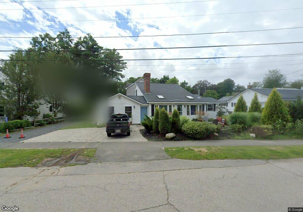
42 Ocean St Unit 2 Ogunquit, ME 03907
Ogunquit NeighborhoodEstimated Value: $679,000 - $937,000
3
Beds
2
Baths
1,738
Sq Ft
$460/Sq Ft
Est. Value
About This Home
This home is located at 42 Ocean St Unit 2, Ogunquit, ME 03907 and is currently estimated at $799,605, approximately $460 per square foot. 42 Ocean St Unit 2 is a home located in York County with nearby schools including Wells Junior High School, Wells Elementary School, and Wells High School.
Ownership History
Date
Name
Owned For
Owner Type
Purchase Details
Closed on
Oct 21, 2024
Sold by
Stout Lt and Stout
Bought by
Stout Edward B and Mcelroy Gladys G
Current Estimated Value
Purchase Details
Closed on
Jul 20, 2017
Sold by
Chaplick Daniel
Bought by
Stout Lt and Stout
Home Financials for this Owner
Home Financials are based on the most recent Mortgage that was taken out on this home.
Original Mortgage
$217,900
Interest Rate
3.89%
Mortgage Type
New Conventional
Purchase Details
Closed on
Jun 3, 2013
Sold by
Fnma
Bought by
Chaplick Daniel
Purchase Details
Closed on
Mar 12, 2013
Sold by
Driscoll Deborah A and One West Bank Fsb
Bought by
Federal National Mortgage Association
Create a Home Valuation Report for This Property
The Home Valuation Report is an in-depth analysis detailing your home's value as well as a comparison with similar homes in the area
Home Values in the Area
Average Home Value in this Area
Purchase History
| Date | Buyer | Sale Price | Title Company |
|---|---|---|---|
| Stout Edward B | -- | None Available | |
| Stout Edward B | -- | None Available | |
| Stout Edward B | -- | None Available | |
| Stout Edward B | -- | None Available | |
| Stout Lt | -- | -- | |
| Stout Lt | -- | -- | |
| Stout Lt | -- | -- | |
| Stout Lt | -- | -- | |
| Stout Lt | -- | -- | |
| Stout Lt | -- | -- | |
| Chaplick Daniel | -- | -- | |
| Chaplick Daniel | -- | -- | |
| Chaplick Daniel | -- | -- | |
| Chaplick Daniel | -- | -- | |
| Federal National Mortgage Association | -- | -- | |
| Federal National Mortgage Association | -- | -- | |
| Federal National Mortgage Association | -- | -- | |
| Federal National Mortgage Association | -- | -- |
Source: Public Records
Mortgage History
| Date | Status | Borrower | Loan Amount |
|---|---|---|---|
| Previous Owner | Stout Lt | $217,900 |
Source: Public Records
Tax History
| Year | Tax Paid | Tax Assessment Tax Assessment Total Assessment is a certain percentage of the fair market value that is determined by local assessors to be the total taxable value of land and additions on the property. | Land | Improvement |
|---|---|---|---|---|
| 2024 | $3,314 | $513,000 | $131,300 | $381,700 |
| 2023 | $3,314 | $513,000 | $131,300 | $381,700 |
| 2022 | $3,242 | $513,000 | $131,300 | $381,700 |
| 2021 | $2,534 | $311,300 | $17,900 | $293,400 |
| 2020 | $2,490 | $311,300 | $17,900 | $293,400 |
| 2019 | $2,490 | $311,300 | $17,900 | $293,400 |
| 2018 | $1,640 | $311,300 | $17,900 | $293,400 |
| 2017 | $2,360 | $311,300 | $17,900 | $293,400 |
| 2016 | $3,337 | $412,500 | $4,400 | $408,100 |
| 2015 | $3,329 | $412,500 | $4,400 | $408,100 |
| 2014 | $3,201 | $412,500 | $4,400 | $408,100 |
Source: Public Records
Map
Nearby Homes
- 488 Main St Unit 7
- 31 Rebecca Rd
- 22 Adams Ln
- 76 Post Rd Unit 21M
- 9 Bourne Ave Unit B6
- 191 Tatnic Rd Unit 73
- 168 Ocean Ave
- 14 Valleybrook Rd Unit 14
- 25 Shore Rd Unit A
- 1 Old County Rd Unit 165
- 1 Old County Rd Unit 155
- 20 Shore Rd Unit 2A,B,C,D
- 69 Cottage St
- 47 Village Green Dr
- 412 Post Rd Unit 304
- 412 Post Rd Unit 145
- 55 Israel Head Rd Unit 203
- 200 Shore Rd
- 14 Maple St
- 310 Furbish Rd
- 42 Ocean St Unit 36
- 42 Ocean St Unit 35
- 42 Ocean St Unit 1
- 19 Ocean St Unit 6
- 19 Ocean St Unit 5
- 19 Ocean St Unit 4
- 19 Ocean St Unit 3
- 13 Ocean St Unit 13
- 668 Main St
- 30 Ocean St Unit 34
- 30 Ocean St Unit 33
- 30 Ocean St Unit 32
- 30 Ocean St Unit 31
- 17 Ocean St Unit 56
- 17 Ocean St Unit 55
- 17 Ocean St Unit 54
- 17 Ocean St Unit 53
- 14 Ocean St
- 18 Ocean St Unit 52
- 18 Ocean St Unit 51
Your Personal Tour Guide
Ask me questions while you tour the home.