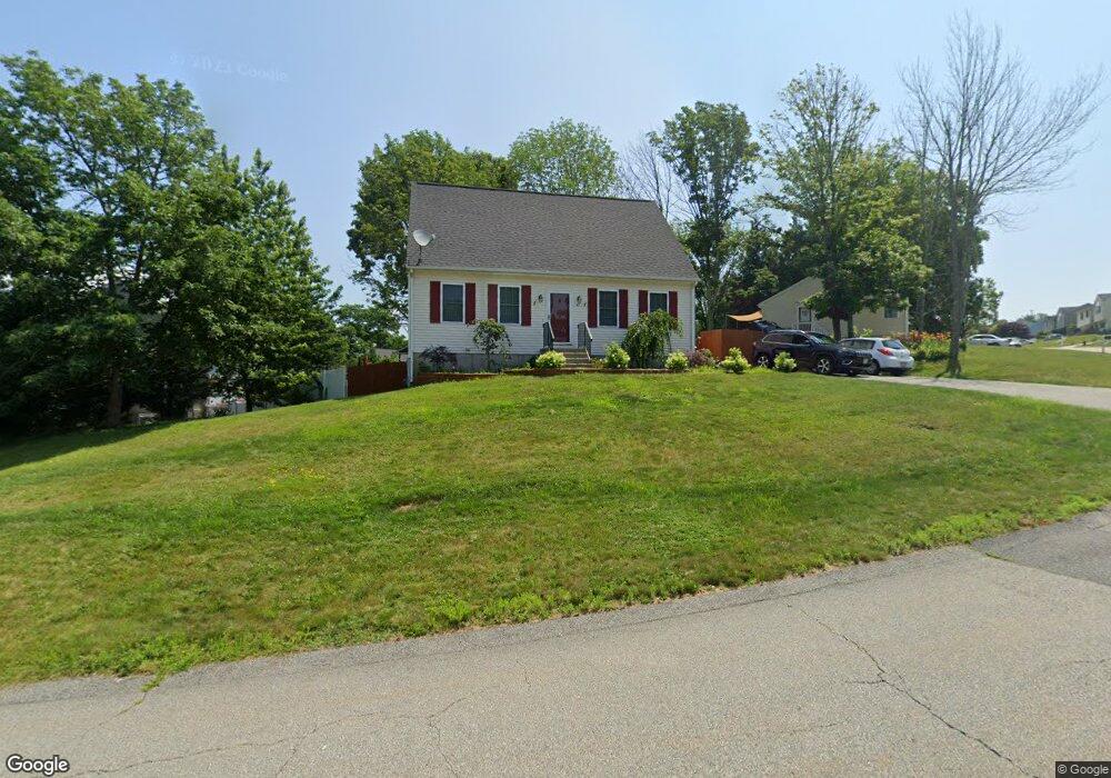
42 Point West Dr Fall River, MA 02720
Western Fall River NeighborhoodEstimated Value: $484,262 - $635,000
3
Beds
2
Baths
1,562
Sq Ft
$352/Sq Ft
Est. Value
About This Home
This home is located at 42 Point West Dr, Fall River, MA 02720 and is currently estimated at $550,066, approximately $352 per square foot. 42 Point West Dr is a home located in Bristol County with nearby schools including North End Elementary School, Morton Middle School, and B M C Durfee High School.
Ownership History
Date
Name
Owned For
Owner Type
Purchase Details
Closed on
Oct 26, 1999
Sold by
Steen Steven B
Bought by
Medeiros Stephen and Medeiros Kelly A
Current Estimated Value
Home Financials for this Owner
Home Financials are based on the most recent Mortgage that was taken out on this home.
Original Mortgage
$131,575
Interest Rate
7.83%
Mortgage Type
Purchase Money Mortgage
Create a Home Valuation Report for This Property
The Home Valuation Report is an in-depth analysis detailing your home's value as well as a comparison with similar homes in the area
Home Values in the Area
Average Home Value in this Area
Purchase History
| Date | Buyer | Sale Price | Title Company |
|---|---|---|---|
| Medeiros Stephen | $138,500 | -- |
Source: Public Records
Mortgage History
| Date | Status | Borrower | Loan Amount |
|---|---|---|---|
| Open | Medeiros Stephen | $211,200 | |
| Closed | Medeiros Stephen | $195,500 | |
| Closed | Medeiros Stephen | $131,575 |
Source: Public Records
Tax History
| Year | Tax Paid | Tax Assessment Tax Assessment Total Assessment is a certain percentage of the fair market value that is determined by local assessors to be the total taxable value of land and additions on the property. | Land | Improvement |
|---|---|---|---|---|
| 2025 | $4,826 | $421,500 | $120,700 | $300,800 |
| 2024 | $4,564 | $397,200 | $118,400 | $278,800 |
| 2023 | $4,683 | $381,700 | $106,600 | $275,100 |
| 2022 | $4,152 | $329,000 | $100,600 | $228,400 |
| 2021 | $3,930 | $284,200 | $96,100 | $188,100 |
| 2020 | $3,646 | $252,300 | $91,700 | $160,600 |
| 2019 | $3,651 | $250,400 | $95,900 | $154,500 |
| 2018 | $3,532 | $241,600 | $94,300 | $147,300 |
| 2017 | $3,345 | $238,900 | $94,300 | $144,600 |
| 2016 | $3,217 | $236,000 | $99,300 | $136,700 |
| 2015 | $3,133 | $239,500 | $99,300 | $140,200 |
| 2014 | $3,013 | $239,500 | $99,300 | $140,200 |
Source: Public Records
Map
Nearby Homes
- 5065 N Main St Unit 2
- 22 Apple Creek Ln
- 5455 N Main St Unit 10B
- 5455 N Main St Unit 2C
- 4234 N Main St Unit 103
- 0 Palmer St
- 3753 N Main St Unit 1
- 3682 N Main St Unit 6
- 3636 N Main St Unit 5
- 145 Mount Hope Rd
- 2714 Riverside Ave
- 72 Ida Ln
- 30 Gray St
- 2396 Riverside Ave
- 485 Whetstone Hill Rd
- 560 North St
- 111 Almy Rd
- 4 Narrows Rd
- 107 Manchester Ave
- 46 Lilac Ave
- 10 Point West Dr
- 78 Point West Dr
- 141 Horizon Way
- 55 Point West Dr
- 73 Point West Dr
- 27 Point West Dr
- 73 Point West Dr
- 100 Point West Dr
- 49 Point West Dr
- 163 Horizon Way
- 33 Point West Dr
- 11 Point Dr W
- 11 Point West Dr
- 95 Point West Dr
- 120 Horizon Way
- 41 Point West Dr
- 138 Horizon Way
- 120 Point West Dr
- 185 Horizon Way
- 115 Point West Dr
Your Personal Tour Guide
Ask me questions while you tour the home.