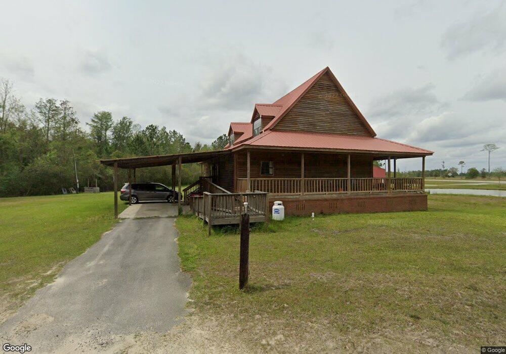
42 Rice Farm Rd Du Pont, GA 31630
Estimated Value: $199,000 - $253,000
3
Beds
3
Baths
2,296
Sq Ft
$100/Sq Ft
Est. Value
About This Home
This home is located at 42 Rice Farm Rd, Du Pont, GA 31630 and is currently estimated at $230,106, approximately $100 per square foot. 42 Rice Farm Rd is a home located in Clinch County with nearby schools including Clinch County Elementary School, Clinch County Middle School, and Clinch County High School.
Ownership History
Date
Name
Owned For
Owner Type
Purchase Details
Closed on
Mar 15, 2013
Sold by
Farmers & Merchants Bank
Bought by
Bramlett Walter T
Current Estimated Value
Home Financials for this Owner
Home Financials are based on the most recent Mortgage that was taken out on this home.
Original Mortgage
$86,996
Outstanding Balance
$60,578
Interest Rate
3.25%
Mortgage Type
FHA
Estimated Equity
$169,528
Purchase Details
Closed on
Oct 31, 2011
Sold by
Griffis George L
Bought by
Farmers & Merchants Bank
Create a Home Valuation Report for This Property
The Home Valuation Report is an in-depth analysis detailing your home's value as well as a comparison with similar homes in the area
Home Values in the Area
Average Home Value in this Area
Purchase History
| Date | Buyer | Sale Price | Title Company |
|---|---|---|---|
| Bramlett Walter T | $90,000 | -- | |
| Farmers & Merchants Bank | -- | -- |
Source: Public Records
Mortgage History
| Date | Status | Borrower | Loan Amount |
|---|---|---|---|
| Open | Bramlett Walter T | $86,996 |
Source: Public Records
Tax History Compared to Growth
Tax History
| Year | Tax Paid | Tax Assessment Tax Assessment Total Assessment is a certain percentage of the fair market value that is determined by local assessors to be the total taxable value of land and additions on the property. | Land | Improvement |
|---|---|---|---|---|
| 2024 | $1,623 | $55,920 | $6,280 | $49,640 |
| 2023 | $1,623 | $55,920 | $6,280 | $49,640 |
| 2022 | $1,623 | $55,920 | $6,280 | $49,640 |
| 2021 | $1,623 | $55,920 | $6,280 | $49,640 |
| 2020 | $1,624 | $55,920 | $6,280 | $49,640 |
| 2019 | $1,624 | $55,920 | $6,280 | $49,640 |
| 2018 | $1,893 | $55,920 | $6,280 | $49,640 |
Source: Public Records
Map
Nearby Homes