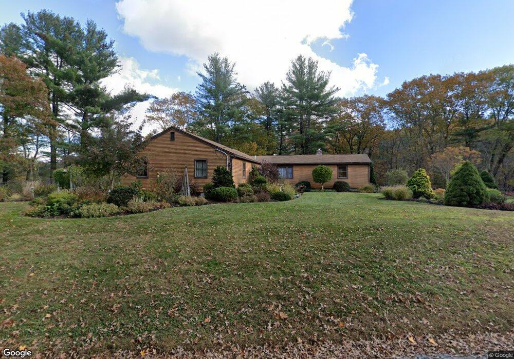
42 River Rd Rutland, MA 01543
Estimated Value: $487,000 - $610,000
3
Beds
2
Baths
2,336
Sq Ft
$238/Sq Ft
Est. Value
About This Home
This home is located at 42 River Rd, Rutland, MA 01543 and is currently estimated at $555,571, approximately $237 per square foot. 42 River Rd is a home located in Worcester County with nearby schools including Wachusett Regional High School.
Ownership History
Date
Name
Owned For
Owner Type
Purchase Details
Closed on
Jan 9, 1998
Sold by
Mtg Guaranty Ins Corp
Bought by
Annetts Philip J and Mccauley Tracey E
Current Estimated Value
Home Financials for this Owner
Home Financials are based on the most recent Mortgage that was taken out on this home.
Original Mortgage
$109,800
Interest Rate
7.09%
Mortgage Type
Purchase Money Mortgage
Purchase Details
Closed on
Mar 31, 1997
Sold by
Russell Scott K and Fnma
Bought by
Federal National Mortgage Association
Create a Home Valuation Report for This Property
The Home Valuation Report is an in-depth analysis detailing your home's value as well as a comparison with similar homes in the area
Home Values in the Area
Average Home Value in this Area
Purchase History
| Date | Buyer | Sale Price | Title Company |
|---|---|---|---|
| Annetts Philip J | $122,000 | -- | |
| Federal National Mortgage Association | $89,807 | -- |
Source: Public Records
Mortgage History
| Date | Status | Borrower | Loan Amount |
|---|---|---|---|
| Open | Federal National Mortgage Association | $86,030 | |
| Closed | Federal National Mortgage Association | $109,800 |
Source: Public Records
Tax History
| Year | Tax Paid | Tax Assessment Tax Assessment Total Assessment is a certain percentage of the fair market value that is determined by local assessors to be the total taxable value of land and additions on the property. | Land | Improvement |
|---|---|---|---|---|
| 2025 | $5,992 | $420,800 | $101,700 | $319,100 |
| 2024 | $6,361 | $428,900 | $97,500 | $331,400 |
| 2023 | $5,813 | $423,700 | $92,200 | $331,500 |
| 2022 | $5,640 | $357,200 | $78,500 | $278,700 |
| 2021 | $5,033 | $316,700 | $78,500 | $238,200 |
| 2020 | $4,836 | $274,600 | $74,700 | $199,900 |
| 2019 | $4,798 | $268,200 | $71,300 | $196,900 |
| 2018 | $4,482 | $255,000 | $71,300 | $183,700 |
| 2017 | $4,532 | $247,400 | $71,300 | $176,100 |
| 2016 | $4,042 | $232,700 | $68,000 | $164,700 |
| 2015 | $3,774 | $213,800 | $68,000 | $145,800 |
| 2014 | $3,658 | $213,800 | $68,000 | $145,800 |
Source: Public Records
Map
Nearby Homes
- 4 Intervale Rd
- 34 Simonds Hill Rd
- 569 E County Rd
- 45 Old Colony Rd
- 35 Brintnal Dr
- 75 Barre Rd
- 9 Old Princeton Road Cut-Off
- 56 Hubbardston Rd
- 14 Grizzly Dr
- 36 Healdville Rd
- 1 Barre Road Cut Off
- 16 Richards Ave
- 147 E County Rd Unit 149
- 139 E County Rd Unit 139
- 7 Williamsville Rd
- 5 Miles Rd
- 90 Woodside Ave
- 100 Brooks Station Rd
- 30 Woodside Ave
- 13 Woodside Ave
Your Personal Tour Guide
Ask me questions while you tour the home.