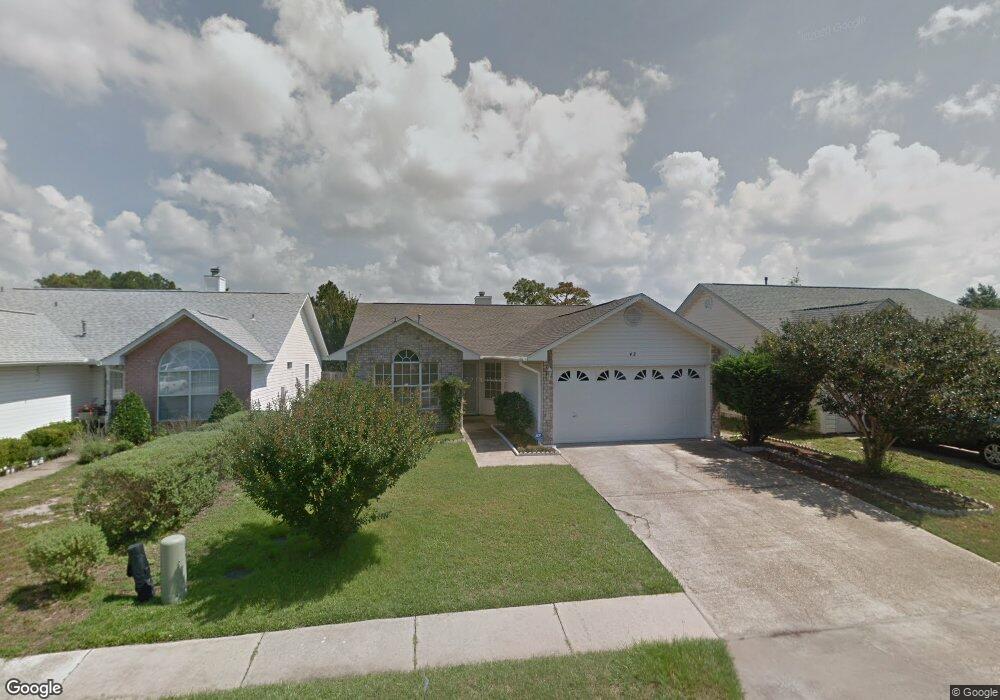
42 Ruby Cir Mary Esther, FL 32569
Estimated Value: $292,593 - $343,000
3
Beds
2
Baths
1,415
Sq Ft
$223/Sq Ft
Est. Value
About This Home
This home is located at 42 Ruby Cir, Mary Esther, FL 32569 and is currently estimated at $315,898, approximately $223 per square foot. 42 Ruby Cir is a home located in Okaloosa County with nearby schools including Mary Esther Elementary School, Max Bruner Junior Middle School, and Fort Walton Beach High School.
Ownership History
Date
Name
Owned For
Owner Type
Purchase Details
Closed on
Nov 25, 2019
Sold by
Bridy Nancy Hai and Bridy Nancy H
Bought by
Bridy Nancy Hai and Coker Theresa Bridy
Current Estimated Value
Purchase Details
Closed on
May 30, 2002
Sold by
Wesley Montie
Bought by
Bridy William J and Bridy Nancy H
Home Financials for this Owner
Home Financials are based on the most recent Mortgage that was taken out on this home.
Original Mortgage
$70,000
Interest Rate
6.92%
Create a Home Valuation Report for This Property
The Home Valuation Report is an in-depth analysis detailing your home's value as well as a comparison with similar homes in the area
Home Values in the Area
Average Home Value in this Area
Purchase History
| Date | Buyer | Sale Price | Title Company |
|---|---|---|---|
| Bridy Nancy Hai | -- | Accommodation | |
| Bridy William J | $110,000 | Old South Land Title |
Source: Public Records
Mortgage History
| Date | Status | Borrower | Loan Amount |
|---|---|---|---|
| Closed | Bridy William J | $70,000 |
Source: Public Records
Tax History
| Year | Tax Paid | Tax Assessment Tax Assessment Total Assessment is a certain percentage of the fair market value that is determined by local assessors to be the total taxable value of land and additions on the property. | Land | Improvement |
|---|---|---|---|---|
| 2025 | $748 | $134,531 | -- | -- |
| 2024 | $632 | $130,740 | -- | -- |
| 2023 | $632 | $125,292 | $0 | $0 |
| 2022 | $653 | $121,643 | $0 | $0 |
| 2021 | $634 | $118,100 | $0 | $0 |
| 2020 | $618 | $116,469 | $0 | $0 |
| 2019 | $1,044 | $113,850 | $0 | $0 |
| 2018 | $979 | $111,727 | $0 | $0 |
| 2017 | $964 | $109,429 | $0 | $0 |
| 2016 | $917 | $107,178 | $0 | $0 |
| 2015 | $915 | $106,433 | $0 | $0 |
| 2014 | $872 | $105,588 | $0 | $0 |
Source: Public Records
Map
Nearby Homes
- 223 Oxford Ct
- 301 Dawn Ln
- 208 Elliott Rd
- 900 Bryn Mawr Blvd
- 641 Cornwall Terrace
- 206 Baker St NW
- 25 Azalea Dr
- 118 Jonquil Ave NW
- 607 E Hollywood Blvd
- 30 Palmetto Dr
- 100 King St NW
- 2847 Us Highway 98
- 0000 US Highway 98
- 1602 Trent St
- 4 Plantation Oaks
- 1619 Fenwick Ave
- 113 N Audrey Cir NW
- 139 Bryn Mawr Blvd
- 38 Poulton Dr NW
- 303 Patricia Ln
Your Personal Tour Guide
Ask me questions while you tour the home.