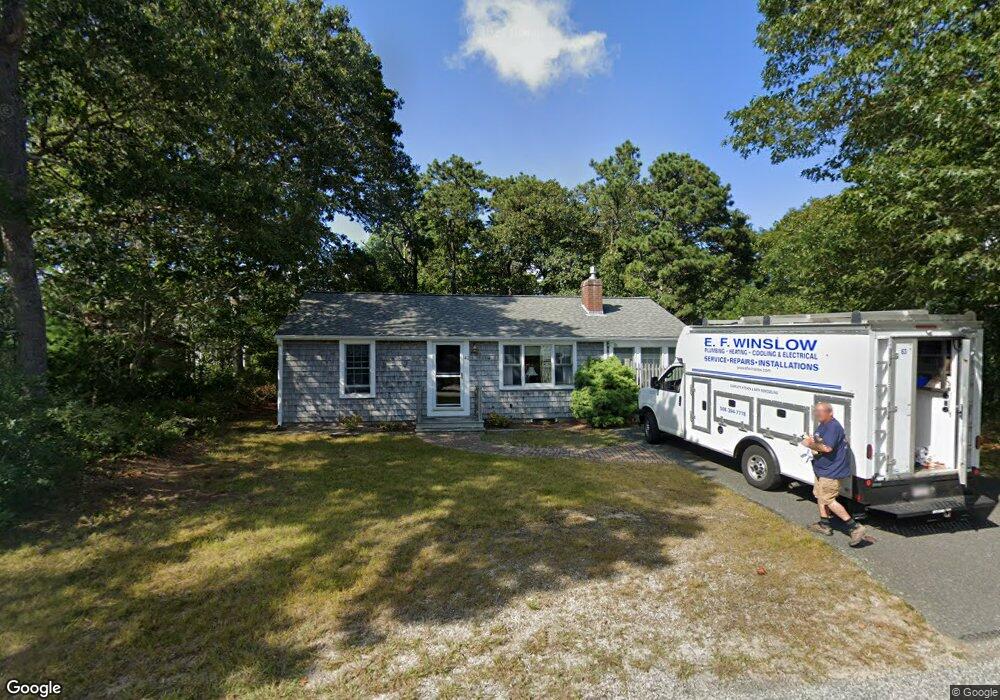
42 Salt Meadows Rd West Dennis, MA 2670
West Dennis NeighborhoodEstimated Value: $593,000 - $708,000
2
Beds
1
Bath
1,028
Sq Ft
$618/Sq Ft
Est. Value
About This Home
This home is located at 42 Salt Meadows Rd, West Dennis, MA 2670 and is currently estimated at $634,933, approximately $617 per square foot. 42 Salt Meadows Rd is a home located in Barnstable County with nearby schools including Dennis-Yarmouth Regional High School and St. Pius X. School.
Ownership History
Date
Name
Owned For
Owner Type
Purchase Details
Closed on
Mar 6, 2018
Sold by
Costa Michael T and Costa Patricia A
Bought by
Michael T Costa 2018 T
Current Estimated Value
Purchase Details
Closed on
Jul 27, 2007
Sold by
Flynn Mary Elizabeth
Bought by
Costa Michael T
Home Financials for this Owner
Home Financials are based on the most recent Mortgage that was taken out on this home.
Original Mortgage
$250,000
Interest Rate
6.78%
Mortgage Type
Purchase Money Mortgage
Purchase Details
Closed on
May 26, 1994
Sold by
42 Salt Meadows Rd Rt and Newman Jeffrey A
Bought by
Flynn Mary Elizabeth
Home Financials for this Owner
Home Financials are based on the most recent Mortgage that was taken out on this home.
Original Mortgage
$70,000
Interest Rate
8.22%
Mortgage Type
Purchase Money Mortgage
Create a Home Valuation Report for This Property
The Home Valuation Report is an in-depth analysis detailing your home's value as well as a comparison with similar homes in the area
Home Values in the Area
Average Home Value in this Area
Purchase History
| Date | Buyer | Sale Price | Title Company |
|---|---|---|---|
| Michael T Costa 2018 T | -- | -- | |
| Costa Michael T | $315,000 | -- | |
| Flynn Mary Elizabeth | $91,500 | -- |
Source: Public Records
Mortgage History
| Date | Status | Borrower | Loan Amount |
|---|---|---|---|
| Previous Owner | Costa Michael T | $250,000 | |
| Previous Owner | Flynn Mary Elizabeth | $70,000 |
Source: Public Records
Tax History Compared to Growth
Tax History
| Year | Tax Paid | Tax Assessment Tax Assessment Total Assessment is a certain percentage of the fair market value that is determined by local assessors to be the total taxable value of land and additions on the property. | Land | Improvement |
|---|---|---|---|---|
| 2025 | $2,443 | $564,200 | $216,700 | $347,500 |
| 2024 | $2,334 | $531,600 | $208,400 | $323,200 |
| 2023 | $2,257 | $483,200 | $189,400 | $293,800 |
| 2022 | $2,053 | $366,600 | $147,900 | $218,700 |
| 2021 | $1,965 | $325,800 | $145,000 | $180,800 |
| 2020 | $1,855 | $304,100 | $156,100 | $148,000 |
| 2019 | $1,834 | $297,300 | $164,000 | $133,300 |
| 2018 | $1,701 | $268,300 | $145,700 | $122,600 |
| 2017 | $1,627 | $264,500 | $145,700 | $118,800 |
| 2016 | $1,647 | $252,200 | $150,900 | $101,300 |
| 2015 | $1,620 | $253,200 | $150,900 | $102,300 |
| 2014 | $1,608 | $253,200 | $150,900 | $102,300 |
Source: Public Records
Map
Nearby Homes
- 15 Woodside Park Rd
- 61 Trotters Ln
- 80 Michaels Ave
- 27 Mayflower Ln
- 26 Center St
- 3 Pinefield Ln
- 19 Standish Way
- 71 Main St
- 4 Coffey Ln
- 95 Center St
- 467 Main St
- 428 Main St Unit 1-11
- 401 Main St Unit 201
- 401 Main St Unit 101
- 37 Ocean Dr Unit 2
- 31 Easy St
- 10 Grindell Ave
- 6 Baker Way
- 64 Beaten Rd
- 178 School St
- 42 Salt Meadow Rd
- 46 Salt Meadows Rd
- 41 Salt Meadows Rd
- 4 College Dr
- 38 Arrowhead Dr
- 53 Salt Meadow Rd
- 53 Salt Meadows Rd
- 27 Princeton Cir
- 34 Salt Meadows Rd
- 50 Salt Meadows Rd
- 31 Princeton Cir
- 34 Arrowhead Dr
- 15 Princeton Cir
- 27 Salt Meadows Rd
- 37 Arrowhead Dr
- 54 Salt Meadows Rd
- 54 Salt Meadow Rd
- 63 Salt Meadows Rd
- 28 Salt Meadows Rd
- 43 Arrowhead Dr