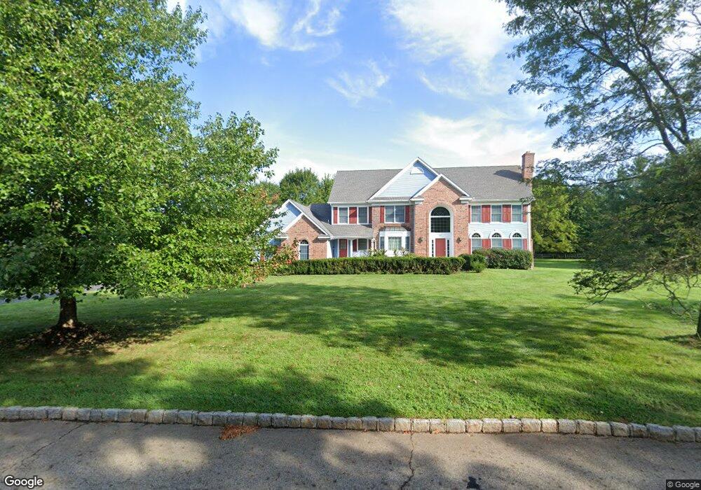
42 Shannon Hill Rd Basking Ridge, NJ 07920
Estimated Value: $1,644,000 - $1,841,000
--
Bed
--
Bath
3,913
Sq Ft
$445/Sq Ft
Est. Value
About This Home
This home is located at 42 Shannon Hill Rd, Basking Ridge, NJ 07920 and is currently estimated at $1,742,815, approximately $445 per square foot. 42 Shannon Hill Rd is a home located in Somerset County with nearby schools including Liberty Corner Elementary School, William Annin Middle School, and Ridge High School.
Ownership History
Date
Name
Owned For
Owner Type
Purchase Details
Closed on
Sep 24, 2014
Sold by
Sun Juemin and Bao Yuhe
Bought by
Bao Yuhe
Current Estimated Value
Purchase Details
Closed on
Jul 31, 1997
Sold by
Bossart Jeff
Bought by
Sun Juemin and Yune Bao
Home Financials for this Owner
Home Financials are based on the most recent Mortgage that was taken out on this home.
Original Mortgage
$435,000
Outstanding Balance
$64,972
Interest Rate
7.5%
Estimated Equity
$1,677,843
Purchase Details
Closed on
Jul 27, 1994
Sold by
Shannon Hill Farms Dev Corp
Bought by
Bossart Jeff and Bossart Paula
Home Financials for this Owner
Home Financials are based on the most recent Mortgage that was taken out on this home.
Original Mortgage
$428,000
Interest Rate
8.4%
Create a Home Valuation Report for This Property
The Home Valuation Report is an in-depth analysis detailing your home's value as well as a comparison with similar homes in the area
Home Values in the Area
Average Home Value in this Area
Purchase History
| Date | Buyer | Sale Price | Title Company |
|---|---|---|---|
| Bao Yuhe | -- | None Available | |
| Sun Juemin | $593,000 | -- | |
| Bossart Jeff | $500,000 | -- |
Source: Public Records
Mortgage History
| Date | Status | Borrower | Loan Amount |
|---|---|---|---|
| Open | Sun Juemin | $435,000 | |
| Previous Owner | Bossart Jeff | $428,000 |
Source: Public Records
Tax History Compared to Growth
Tax History
| Year | Tax Paid | Tax Assessment Tax Assessment Total Assessment is a certain percentage of the fair market value that is determined by local assessors to be the total taxable value of land and additions on the property. | Land | Improvement |
|---|---|---|---|---|
| 2025 | $22,326 | $1,369,300 | $515,900 | $853,400 |
| 2024 | $22,326 | $1,255,000 | $435,900 | $819,100 |
| 2023 | $21,946 | $1,163,600 | $410,900 | $752,700 |
| 2022 | $21,461 | $1,067,200 | $410,900 | $656,300 |
| 2021 | $21,479 | $1,018,000 | $410,900 | $607,100 |
| 2020 | $21,223 | $1,013,500 | $410,900 | $602,600 |
| 2019 | $21,229 | $1,043,700 | $423,200 | $620,500 |
| 2018 | $21,959 | $1,095,200 | $438,200 | $657,000 |
| 2017 | $22,179 | $1,115,100 | $413,200 | $701,900 |
| 2016 | $22,210 | $1,138,400 | $423,200 | $715,200 |
| 2015 | $21,844 | $1,140,100 | $423,200 | $716,900 |
| 2014 | -- | $1,125,100 | $408,200 | $716,900 |
Source: Public Records
Map
Nearby Homes
- 234 Liberty Corner Rd
- 213 Liberty Corner Rd
- 10 Baldwin Ave
- 27 Parkwood Ln
- 49 Liberty Corner Rd
- 22 Woodward Ln
- 14 Woodward Ln
- 167 Douglas Rd
- 267 English Place
- 67 Woodward Ln
- 279 English Place
- 41 Dickinson Rd
- 341 Penns Way Unit D2
- 144 Liberty Corner Rd
- 12 Wayne Terrace
- 14 Hadley Ct
- 227 Arrowood Way
- 10 Nancy Ln
- 32 Mayflower Dr Unit E1
- 247 Lyons Rd
- 36 Shannon Hill Rd
- 50 Shannon Hill Rd
- 45 Shannon Hill Rd
- 28 Shannon Hill Rd
- 31 Shannon Hill Rd
- 57 Shannon Hill Rd
- 62 Shannon Hill Rd
- 451 Somerville Rd
- 20 Shannon Hill Rd
- 17 Shannon Hill Rd
- 441 Somerville Rd
- 67 Shannon Hill Rd
- 433 Somerville Rd
- 12 Shannon Hill Rd
- 70 Shannon Hill Rd
- 435 Somerville Rd
- 455 Somerville Rd
- 465 Somerville Rd
- 76 Shannon Hill Rd
- 80 Shannon Hill Rd