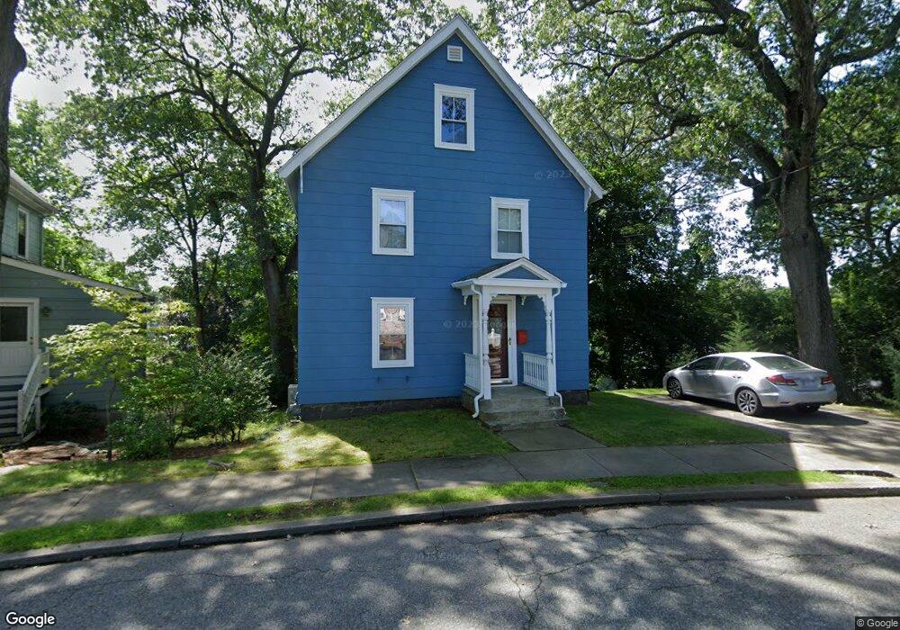
42 Sheridan Cir Winchester, MA 01890
North Main NeighborhoodEstimated Value: $1,050,000 - $1,101,000
3
Beds
2
Baths
1,671
Sq Ft
$646/Sq Ft
Est. Value
About This Home
This home is located at 42 Sheridan Cir, Winchester, MA 01890 and is currently estimated at $1,079,811, approximately $646 per square foot. 42 Sheridan Cir is a home located in Middlesex County with nearby schools including Lynch Elementary School, McCall Middle School, and Winchester High School.
Ownership History
Date
Name
Owned For
Owner Type
Purchase Details
Closed on
Sep 23, 1971
Bought by
Lord Catherine J
Current Estimated Value
Create a Home Valuation Report for This Property
The Home Valuation Report is an in-depth analysis detailing your home's value as well as a comparison with similar homes in the area
Home Values in the Area
Average Home Value in this Area
Purchase History
| Date | Buyer | Sale Price | Title Company |
|---|---|---|---|
| Lord Catherine J | -- | -- |
Source: Public Records
Mortgage History
| Date | Status | Borrower | Loan Amount |
|---|---|---|---|
| Open | Lord Catherine J | $185,000 |
Source: Public Records
Tax History Compared to Growth
Tax History
| Year | Tax Paid | Tax Assessment Tax Assessment Total Assessment is a certain percentage of the fair market value that is determined by local assessors to be the total taxable value of land and additions on the property. | Land | Improvement |
|---|---|---|---|---|
| 2025 | $108 | $976,600 | $666,800 | $309,800 |
| 2024 | $10,259 | $905,500 | $631,700 | $273,800 |
| 2023 | $9,999 | $847,400 | $579,100 | $268,300 |
| 2022 | $9,843 | $786,800 | $526,400 | $260,400 |
| 2021 | $9,082 | $707,900 | $447,500 | $260,400 |
| 2020 | $5,401 | $707,900 | $447,500 | $260,400 |
| 2019 | $7,509 | $620,100 | $359,700 | $260,400 |
| 2018 | $7,346 | $602,600 | $342,200 | $260,400 |
| 2017 | $4,963 | $561,300 | $324,600 | $236,700 |
| 2016 | $6,357 | $544,300 | $324,600 | $219,700 |
| 2015 | $6,235 | $513,600 | $293,900 | $219,700 |
| 2014 | $5,824 | $460,000 | $254,400 | $205,600 |
Source: Public Records
Map
Nearby Homes
- 9 Sylvester Ct
- 149 Horn Pond Brook Rd
- 14 Cross St
- 44 Main St
- 380 Cross St
- 62 Richardson St
- 32 Woodside Rd
- 20 Arthur St
- 14 Ash St
- 237 Swanton St
- 18 Middlesex St
- 200 Swanton St Unit 636
- 200 Swanton St Unit T28
- 200 Swanton St Unit T11
- 171 Swanton St Unit 73
- 162 Swanton St Unit 162
- 6 Ivy Cir
- 2 George Rd Unit 2
- 7 Conant Rd Unit 20
- 44 Cabot St
- 129 Sylvester Ave
- 40 Sheridan Cir
- 37 Sheridan Cir
- 50 Sheridan Cir Unit 52
- 49 Sheridan Cir
- 28 Glenwood Ave
- 137 Sylvester Ave
- 137 Sylvester Ave
- 121 Sylvester Ave
- 117 Sylvester Ave
- 52 Sheridan Cir Unit 52
- 33 Sheridan Cir
- 111 Sylvester Ave
- 141 Sylvester Ave
- 130 Sylvester Ave
- 136 Sylvester Ave
- 5 Sylvester Ct
- 116 Sylvester Ave
- 122 Sylvester Ave
- 126 Sylvester Ave