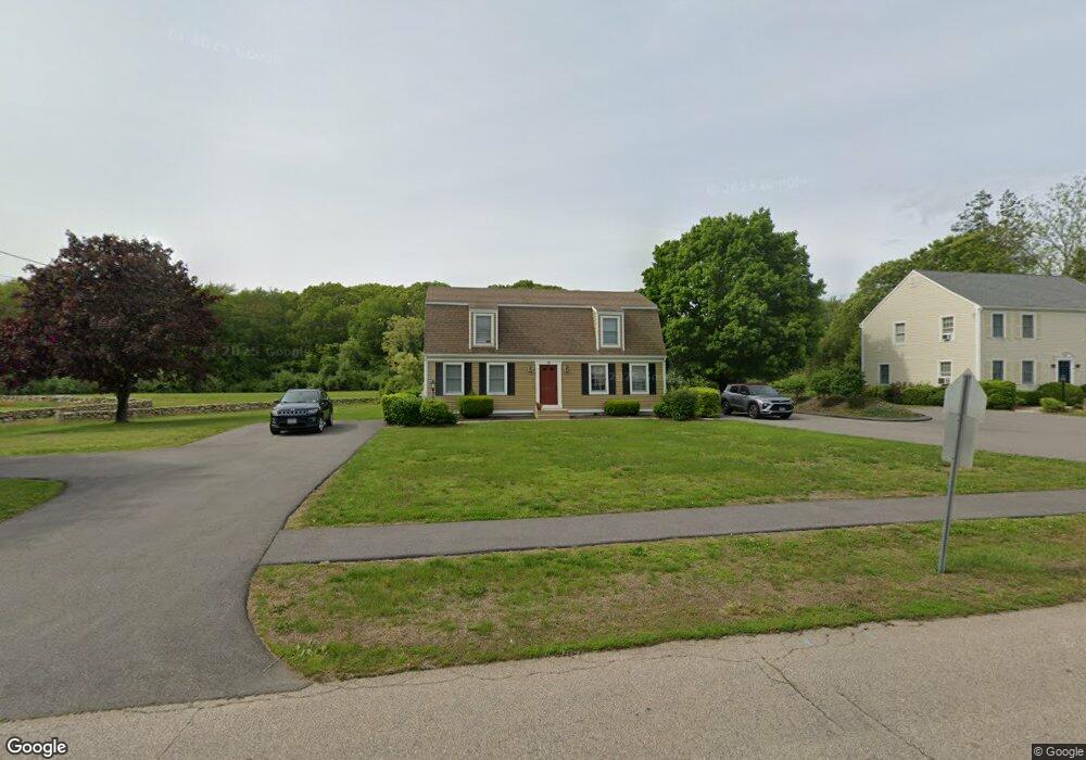
42 Springbrook Rd Unit B Westerly, RI 02891
Estimated Value: $295,000 - $357,000
2
Beds
2
Baths
1,120
Sq Ft
$288/Sq Ft
Est. Value
About This Home
This home is located at 42 Springbrook Rd Unit B, Westerly, RI 02891 and is currently estimated at $322,393, approximately $287 per square foot. 42 Springbrook Rd Unit B is a home located in Washington County with nearby schools including Westerly High School, North Stonington Christian Academy, and St. Michael School.
Ownership History
Date
Name
Owned For
Owner Type
Purchase Details
Closed on
Feb 1, 2018
Sold by
Smith Kevin T and Smith Kristin R
Bought by
Woerner Paul C
Current Estimated Value
Home Financials for this Owner
Home Financials are based on the most recent Mortgage that was taken out on this home.
Original Mortgage
$131,200
Outstanding Balance
$110,459
Interest Rate
3.94%
Mortgage Type
Purchase Money Mortgage
Estimated Equity
$211,934
Purchase Details
Closed on
Dec 29, 2006
Sold by
Morgan Lyn C
Bought by
Smith Kevin T and Roederer Kristin N
Home Financials for this Owner
Home Financials are based on the most recent Mortgage that was taken out on this home.
Original Mortgage
$170,000
Interest Rate
6.29%
Mortgage Type
Purchase Money Mortgage
Create a Home Valuation Report for This Property
The Home Valuation Report is an in-depth analysis detailing your home's value as well as a comparison with similar homes in the area
Home Values in the Area
Average Home Value in this Area
Purchase History
| Date | Buyer | Sale Price | Title Company |
|---|---|---|---|
| Woerner Paul C | $164,000 | -- | |
| Smith Kevin T | $214,000 | -- |
Source: Public Records
Mortgage History
| Date | Status | Borrower | Loan Amount |
|---|---|---|---|
| Open | Woerner Paul C | $131,200 | |
| Previous Owner | Smith Kevin T | $156,940 | |
| Previous Owner | Smith Kevin T | $170,000 |
Source: Public Records
Tax History
| Year | Tax Paid | Tax Assessment Tax Assessment Total Assessment is a certain percentage of the fair market value that is determined by local assessors to be the total taxable value of land and additions on the property. | Land | Improvement |
|---|---|---|---|---|
| 2025 | $1,802 | $253,400 | $0 | $253,400 |
| 2024 | $2,025 | $206,400 | $0 | $206,400 |
| 2023 | $1,986 | $206,400 | $0 | $206,400 |
| 2022 | $1,973 | $206,400 | $0 | $206,400 |
| 2021 | $2,049 | $177,900 | $0 | $177,900 |
| 2020 | $2,012 | $177,900 | $0 | $177,900 |
| 2019 | $1,992 | $177,900 | $0 | $177,900 |
| 2018 | $2,432 | $204,700 | $0 | $204,700 |
| 2017 | $2,372 | $204,700 | $0 | $204,700 |
| 2016 | $2,391 | $204,700 | $0 | $204,700 |
| 2015 | $2,297 | $212,300 | $0 | $212,300 |
| 2014 | $2,259 | $212,300 | $0 | $212,300 |
Source: Public Records
Map
Nearby Homes
- 42 Springbrook Rd Unit A
- 42 Springbrook Rd
- 42 Springbrook Rd Unit 42B
- 44 - B Springbrook Rd Unit B
- 44 Springbrook Rd Unit A
- 44 Springbrook Rd Unit B
- 44 Springbrook Rd
- 44 Springbrook Rd Unit 44B
- 41 Springbrook Rd Unit A
- 41 Springbrook Rd Unit B
- 41 Springbrook Rd
- 41 Springbrook Rd Unit 41A
- 40 Springbrook Rd Unit A
- 40 Springbrook Rd Unit B
- 40 Springbrook Rd Unit 40A
- 40 Springbrook Rd Unit 40B
- 43 Springbrook Rd Unit 43A
- 43 Springbrook Rd Unit B
- 43 Springbrook Rd Unit A
- 43 Springbrook Rd Unit 43Z
Your Personal Tour Guide
Ask me questions while you tour the home.