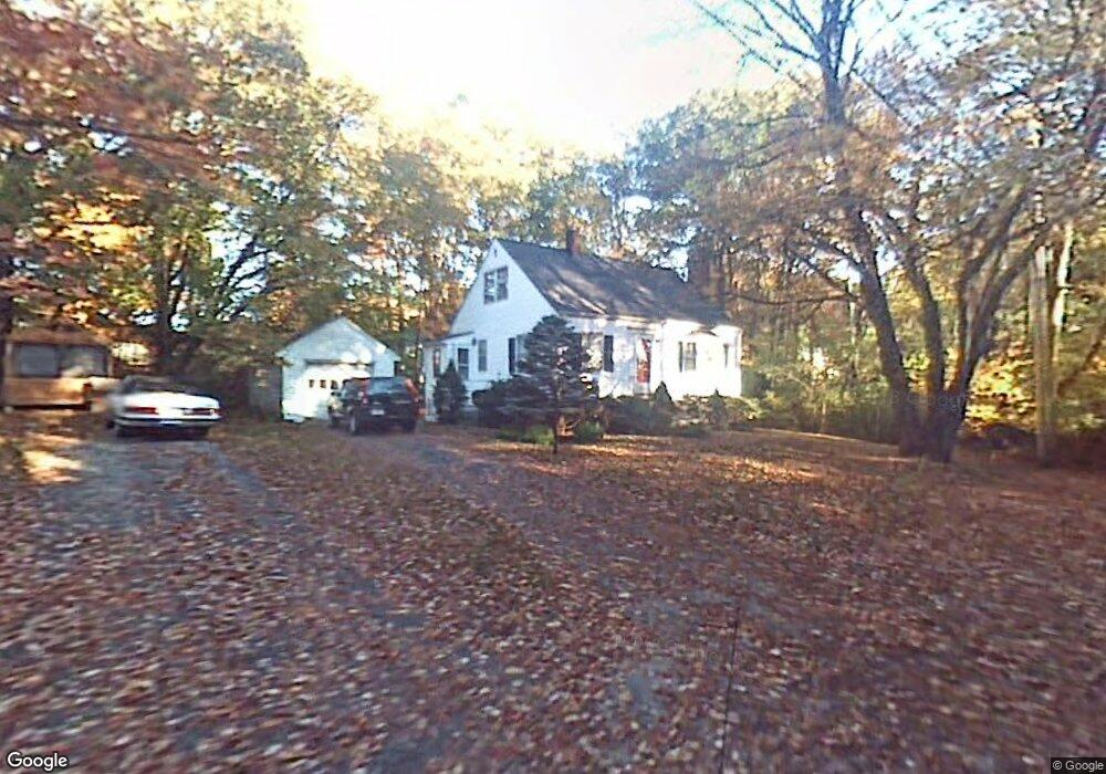
42 Standish Rd Arlington, MA 02476
Arlington Heights NeighborhoodEstimated Value: $995,000 - $1,314,000
3
Beds
3
Baths
1,998
Sq Ft
$568/Sq Ft
Est. Value
About This Home
This home is located at 42 Standish Rd, Arlington, MA 02476 and is currently estimated at $1,133,980, approximately $567 per square foot. 42 Standish Rd is a home located in Middlesex County with nearby schools including Dallin Elementary School, Ottoson Middle School, and Arlington High School.
Ownership History
Date
Name
Owned For
Owner Type
Purchase Details
Closed on
May 16, 2002
Sold by
Durning Timothy A and Wagner Barbara C
Bought by
Irizarry Gilbert and Buitargo Maria C
Current Estimated Value
Home Financials for this Owner
Home Financials are based on the most recent Mortgage that was taken out on this home.
Original Mortgage
$294,400
Outstanding Balance
$126,236
Interest Rate
7.15%
Mortgage Type
Purchase Money Mortgage
Estimated Equity
$1,007,744
Purchase Details
Closed on
Mar 13, 1987
Sold by
Mackie Walter F
Bought by
Durning Timothy A
Home Financials for this Owner
Home Financials are based on the most recent Mortgage that was taken out on this home.
Original Mortgage
$120,000
Interest Rate
9.01%
Mortgage Type
Purchase Money Mortgage
Create a Home Valuation Report for This Property
The Home Valuation Report is an in-depth analysis detailing your home's value as well as a comparison with similar homes in the area
Home Values in the Area
Average Home Value in this Area
Purchase History
| Date | Buyer | Sale Price | Title Company |
|---|---|---|---|
| Irizarry Gilbert | $368,000 | -- | |
| Durning Timothy A | $188,000 | -- |
Source: Public Records
Mortgage History
| Date | Status | Borrower | Loan Amount |
|---|---|---|---|
| Open | Irizarry Gilbert | $294,400 | |
| Previous Owner | Durning Timothy A | $114,000 | |
| Previous Owner | Durning Timothy A | $25,000 | |
| Previous Owner | Durning Timothy A | $120,000 |
Source: Public Records
Tax History Compared to Growth
Tax History
| Year | Tax Paid | Tax Assessment Tax Assessment Total Assessment is a certain percentage of the fair market value that is determined by local assessors to be the total taxable value of land and additions on the property. | Land | Improvement |
|---|---|---|---|---|
| 2025 | $10,979 | $1,019,400 | $538,600 | $480,800 |
| 2024 | $10,343 | $976,700 | $538,600 | $438,100 |
| 2023 | $9,858 | $879,400 | $479,500 | $399,900 |
| 2022 | $9,540 | $835,400 | $459,800 | $375,600 |
| 2021 | $9,359 | $825,300 | $459,800 | $365,500 |
| 2020 | $9,128 | $825,300 | $459,800 | $365,500 |
| 2019 | $8,209 | $729,000 | $459,800 | $269,200 |
| 2018 | $7,956 | $655,900 | $387,500 | $268,400 |
| 2017 | $6,894 | $548,900 | $354,700 | $194,200 |
| 2016 | $6,353 | $496,300 | $302,100 | $194,200 |
| 2015 | $6,035 | $445,400 | $262,700 | $182,700 |
Source: Public Records
Map
Nearby Homes
- 70 Birch Hill Rd
- 64 Browning Rd
- 53 Crestview Rd
- 56 Valentine Rd
- 19 Wilbur Ave
- 135 Marsh St
- 789 Concord Turnpike
- 37 Fountain Rd Unit 2
- 37 Fountain Rd
- 6 Linc Cole Ln
- 10 Colonial Village Dr Unit 2
- 58 Westminster Ave Unit 58
- 9 Stanley Rd
- 14 Park Avenue Extension
- 51 Lowell St
- 1 Watermill Place Unit 304
- 1 Watermill Place Unit 308
- 11 Lowell St Unit B
- 6 Appleton Place
- 181 Lowell St
- 122 Stony Brook Rd
- 38 Standish Rd
- 112 Stony Brook Rd
- 35 Indian Hill Rd
- 34 Standish Rd
- 104 Stony Brook Rd
- 128 Stony Brook Rd
- 98 Stony Brook Rd
- 31 Indian Hill Rd
- 92 Stony Brook Rd
- 92 Stony Brook Rd Unit SF
- 30 Indian Hill Rd
- 119 Stony Brook Rd
- 134 Stony Brook Rd
- 134 Stony Brook Rd Unit 1
- 111 Stony Brook Rd
- 125 Stony Brook Rd
- 26 Standish Rd
- 27 Indian Hill Rd
- 103 Stony Brook Rd