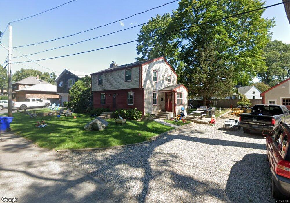
42 Star Ave Riverside, RI 02915
Riverside NeighborhoodEstimated Value: $446,094 - $491,000
4
Beds
2
Baths
1,432
Sq Ft
$321/Sq Ft
Est. Value
About This Home
This home is located at 42 Star Ave, Riverside, RI 02915 and is currently estimated at $459,774, approximately $321 per square foot. 42 Star Ave is a home located in Providence County with nearby schools including East Providence High School, St Luke Elementary School, and Barrington Christian Academy.
Ownership History
Date
Name
Owned For
Owner Type
Purchase Details
Closed on
Aug 21, 2015
Sold by
Gannon James J
Bought by
George Joshua S
Current Estimated Value
Home Financials for this Owner
Home Financials are based on the most recent Mortgage that was taken out on this home.
Original Mortgage
$176,739
Outstanding Balance
$139,193
Interest Rate
4.07%
Mortgage Type
FHA
Estimated Equity
$320,581
Purchase Details
Closed on
Apr 26, 2001
Sold by
Page George C
Bought by
Gagnon James J
Create a Home Valuation Report for This Property
The Home Valuation Report is an in-depth analysis detailing your home's value as well as a comparison with similar homes in the area
Home Values in the Area
Average Home Value in this Area
Purchase History
| Date | Buyer | Sale Price | Title Company |
|---|---|---|---|
| George Joshua S | $180,000 | -- | |
| Gagnon James J | $160,000 | -- | |
| George Joshua S | $180,000 | -- | |
| Gagnon James J | $160,000 | -- |
Source: Public Records
Mortgage History
| Date | Status | Borrower | Loan Amount |
|---|---|---|---|
| Open | Gagnon James J | $176,739 | |
| Closed | Gagnon James J | $176,739 | |
| Previous Owner | Gagnon James J | $160,000 | |
| Previous Owner | Gagnon James J | $128,000 |
Source: Public Records
Tax History
| Year | Tax Paid | Tax Assessment Tax Assessment Total Assessment is a certain percentage of the fair market value that is determined by local assessors to be the total taxable value of land and additions on the property. | Land | Improvement |
|---|---|---|---|---|
| 2025 | $4,527 | $346,400 | $83,900 | $262,500 |
| 2024 | $4,630 | $302,000 | $69,900 | $232,100 |
| 2023 | $4,458 | $302,000 | $69,900 | $232,100 |
| 2022 | $4,637 | $212,100 | $42,100 | $170,000 |
| 2021 | $4,560 | $212,100 | $39,800 | $172,300 |
| 2020 | $4,367 | $212,100 | $39,800 | $172,300 |
| 2019 | $4,246 | $212,100 | $39,800 | $172,300 |
| 2018 | $3,963 | $173,200 | $42,600 | $130,600 |
| 2017 | $3,874 | $173,200 | $42,600 | $130,600 |
| 2016 | $3,855 | $173,200 | $42,600 | $130,600 |
| 2015 | $4,271 | $186,100 | $42,100 | $144,000 |
| 2014 | $4,271 | $186,100 | $42,100 | $144,000 |
Source: Public Records
Map
Nearby Homes
Your Personal Tour Guide
Ask me questions while you tour the home.