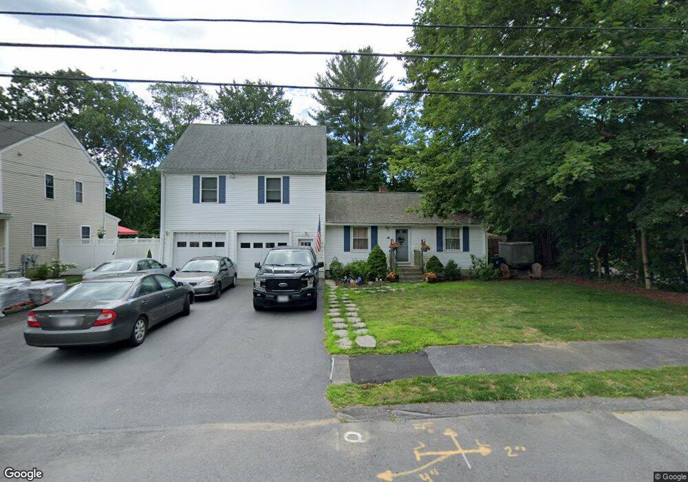
42 Sylvester Rd Natick, MA 01760
Estimated Value: $965,420 - $1,103,000
3
Beds
2
Baths
2,284
Sq Ft
$465/Sq Ft
Est. Value
About This Home
This home is located at 42 Sylvester Rd, Natick, MA 01760 and is currently estimated at $1,062,855, approximately $465 per square foot. 42 Sylvester Rd is a home located in Middlesex County with nearby schools including Natick High School, J F Kennedy Middle School, and Johnson Elementary School.
Ownership History
Date
Name
Owned For
Owner Type
Purchase Details
Closed on
Dec 1, 1994
Sold by
Lewis Rita M
Bought by
Bianco William J and Bianco Tracie A
Current Estimated Value
Create a Home Valuation Report for This Property
The Home Valuation Report is an in-depth analysis detailing your home's value as well as a comparison with similar homes in the area
Home Values in the Area
Average Home Value in this Area
Purchase History
| Date | Buyer | Sale Price | Title Company |
|---|---|---|---|
| Bianco William J | $138,000 | -- |
Source: Public Records
Mortgage History
| Date | Status | Borrower | Loan Amount |
|---|---|---|---|
| Open | Bianco William J | $332,000 | |
| Closed | Bianco William J | $10,000 |
Source: Public Records
Tax History Compared to Growth
Tax History
| Year | Tax Paid | Tax Assessment Tax Assessment Total Assessment is a certain percentage of the fair market value that is determined by local assessors to be the total taxable value of land and additions on the property. | Land | Improvement |
|---|---|---|---|---|
| 2025 | $9,121 | $762,600 | $433,100 | $329,500 |
| 2024 | $8,789 | $716,900 | $407,600 | $309,300 |
| 2023 | $8,599 | $680,300 | $391,600 | $288,700 |
| 2022 | $8,383 | $628,400 | $355,300 | $273,100 |
| 2021 | $8,279 | $608,300 | $335,000 | $273,300 |
| 2020 | $6,176 | $593,100 | $319,800 | $273,300 |
| 2019 | $7,538 | $593,100 | $319,800 | $273,300 |
| 2018 | $7,482 | $573,300 | $304,600 | $268,700 |
| 2017 | $5,193 | $524,600 | $260,700 | $263,900 |
| 2016 | $6,800 | $501,100 | $239,700 | $261,400 |
| 2015 | $6,625 | $479,400 | $239,700 | $239,700 |
Source: Public Records
Map
Nearby Homes
- 1 Fern St
- 4 Sylvia Ave
- 91 Speen St
- 26 Walden Dr Unit 4
- 46 Silver Hill Ln Unit 1
- 40 Silver Hill Ln Unit 4
- 9 Silver Hill Ln Unit 19
- 32 Silver Hill Ln Unit 1
- 12 Walden Dr Unit 19
- 2 Lodge Rd
- 57 Village Brook Ln Unit 5
- 50 Village Brook Ln Unit 4
- 16 West St
- 51 Village Brook Ln Unit 16
- 10 Kelsey Rd
- 4 Village Rock Ln Unit 9
- 6 Village Rock Ln Unit 17
- 5 Village Rock Ln Unit 24
- 38 Ranger Rd
- 1 Glen St Unit B