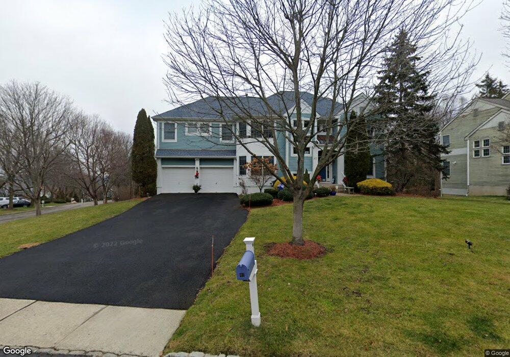
42 Timothy Field Rd Berkeley Heights, NJ 07922
Estimated Value: $1,333,216 - $1,814,000
--
Bed
--
Bath
3,635
Sq Ft
$419/Sq Ft
Est. Value
About This Home
This home is located at 42 Timothy Field Rd, Berkeley Heights, NJ 07922 and is currently estimated at $1,521,554, approximately $418 per square foot. 42 Timothy Field Rd is a home located in Union County with nearby schools including Columbia Middle School, Governor Livingston High School, and The Academy of Our Lady of Peace.
Ownership History
Date
Name
Owned For
Owner Type
Purchase Details
Closed on
Sep 6, 2000
Sold by
Brookes Michael and Brookes Carmen
Bought by
Pastro Alfredo J and Pastro Brooke Birely
Current Estimated Value
Home Financials for this Owner
Home Financials are based on the most recent Mortgage that was taken out on this home.
Original Mortgage
$550,000
Outstanding Balance
$193,629
Interest Rate
7.62%
Estimated Equity
$1,327,925
Purchase Details
Closed on
Aug 2, 1997
Sold by
Simmons Robert K and Simmons Maryann F
Bought by
Brookes Michael and Brookes Carmen
Home Financials for this Owner
Home Financials are based on the most recent Mortgage that was taken out on this home.
Original Mortgage
$400,000
Interest Rate
7.37%
Purchase Details
Closed on
Aug 21, 1995
Sold by
Nip Hill Lp
Bought by
Providence Development Group Inc
Create a Home Valuation Report for This Property
The Home Valuation Report is an in-depth analysis detailing your home's value as well as a comparison with similar homes in the area
Home Values in the Area
Average Home Value in this Area
Purchase History
| Date | Buyer | Sale Price | Title Company |
|---|---|---|---|
| Pastro Alfredo J | $790,000 | Old Republic Natl Title Ins | |
| Brookes Michael | $605,000 | Chicago Title Insurance Co | |
| Providence Development Group Inc | $55,000 | -- |
Source: Public Records
Mortgage History
| Date | Status | Borrower | Loan Amount |
|---|---|---|---|
| Open | Pastro Alfredo J | $550,000 | |
| Previous Owner | Brookes Michael | $400,000 |
Source: Public Records
Tax History Compared to Growth
Tax History
| Year | Tax Paid | Tax Assessment Tax Assessment Total Assessment is a certain percentage of the fair market value that is determined by local assessors to be the total taxable value of land and additions on the property. | Land | Improvement |
|---|---|---|---|---|
| 2025 | $26,326 | $614,100 | $237,500 | $376,600 |
| 2024 | $25,946 | $614,100 | $237,500 | $376,600 |
| 2023 | $25,946 | $614,100 | $237,500 | $376,600 |
| 2022 | $25,758 | $614,100 | $237,500 | $376,600 |
| 2021 | $25,645 | $614,100 | $237,500 | $376,600 |
| 2020 | $25,780 | $614,100 | $237,500 | $376,600 |
| 2019 | $25,651 | $614,100 | $237,500 | $376,600 |
| 2018 | $25,117 | $614,100 | $237,500 | $376,600 |
| 2017 | $24,810 | $614,100 | $237,500 | $376,600 |
| 2016 | $24,374 | $614,100 | $237,500 | $376,600 |
| 2015 | $24,239 | $614,100 | $237,500 | $376,600 |
| 2014 | $23,606 | $614,100 | $237,500 | $376,600 |
Source: Public Records
Map
Nearby Homes
- 33 Bristol Ct
- 25 Oechsner Ct
- 5 Berkeley Square Unit 5
- 62 Springholm Dr Unit 62
- 41 Meadowview Ln
- 86 Orion Rd
- 132 Fairview Ave
- 34 Meadowview Ln
- 30 Robbins Ave
- 78 Twin Falls Rd
- 19 Guenevere Way Ondo
- 45 Wilson Dr
- 28 Peacock Ln Unit 28
- 56 Valley Rd
- 12 Park Edge
- 25 Murray Hill Square
- 11 Earl Place
- 126 Snyder Ave
- 93 Park Edge Unit 3H
- 37 Oak Ridge Rd
- 40 Timothy Field Rd
- 2 Frost Ln
- 4 Frost Ln
- 43 Timothy Field Rd
- 10 Barnstable Rd
- 38 Timothy Field Rd
- 6 Frost Ln
- 8 Barnstable Rd
- 12 Barnstable Rd
- 41 Timothy Field Rd
- 36 Timothy Field Rd
- 17 Barnstable Rd
- 6 Barnstable Rd
- 39 Timothy Field Rd
- 14 Barnstable Rd
- 1 Frost Ln
- 8 Frost Ln
- 3 Frost Ln
- 32 Timothy Field Rd
- 37 Timothy Field Rd