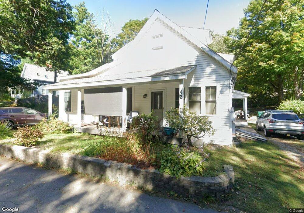
42 Townsend Rd Unit 44 Groton, MA 01450
Estimated Value: $344,000 - $776,000
5
Beds
3
Baths
2,987
Sq Ft
$194/Sq Ft
Est. Value
About This Home
This home is located at 42 Townsend Rd Unit 44, Groton, MA 01450 and is currently estimated at $578,133, approximately $193 per square foot. 42 Townsend Rd Unit 44 is a home located in Middlesex County with nearby schools including Groton Dunstable Regional High School, Groton Community School, and Seven Hills At Groton.
Ownership History
Date
Name
Owned For
Owner Type
Purchase Details
Closed on
Jun 19, 1995
Sold by
J&A Rt and Bresnahan John T
Bought by
Foley Michael J and Foley Wendy Lj
Current Estimated Value
Home Financials for this Owner
Home Financials are based on the most recent Mortgage that was taken out on this home.
Original Mortgage
$108,100
Interest Rate
8.24%
Mortgage Type
Purchase Money Mortgage
Purchase Details
Closed on
Jun 24, 1994
Sold by
Est Whiting Penny L and Whiting Corey J
Bought by
J&A Rt and Bresnahan John T
Purchase Details
Closed on
Jun 23, 1993
Sold by
J&A Rt and Bresnahan John T
Bought by
Whiting Penny L
Purchase Details
Closed on
Sep 8, 1992
Sold by
Crawford William H
Bought by
J&A Rt
Create a Home Valuation Report for This Property
The Home Valuation Report is an in-depth analysis detailing your home's value as well as a comparison with similar homes in the area
Home Values in the Area
Average Home Value in this Area
Purchase History
| Date | Buyer | Sale Price | Title Company |
|---|---|---|---|
| Foley Michael J | $106,000 | -- | |
| Foley Michael J | $106,000 | -- | |
| J&A Rt | $75,000 | -- | |
| Bresnahan Jr | $75,000 | -- | |
| Whiting Penny L | $95,000 | -- | |
| Whiting Penny L | $95,000 | -- | |
| J&A Rt | $41,100 | -- | |
| J & A Rt | $41,100 | -- |
Source: Public Records
Mortgage History
| Date | Status | Borrower | Loan Amount |
|---|---|---|---|
| Closed | J & A Rt | $108,100 |
Source: Public Records
Tax History Compared to Growth
Tax History
| Year | Tax Paid | Tax Assessment Tax Assessment Total Assessment is a certain percentage of the fair market value that is determined by local assessors to be the total taxable value of land and additions on the property. | Land | Improvement |
|---|---|---|---|---|
| 2025 | $7,349 | $481,900 | $155,300 | $326,600 |
| 2024 | $7,272 | $481,900 | $155,300 | $326,600 |
| 2023 | $6,731 | $430,400 | $155,300 | $275,100 |
| 2022 | $5,965 | $347,000 | $133,500 | $213,500 |
| 2021 | $5,632 | $320,000 | $128,800 | $191,200 |
| 2020 | $4,943 | $284,400 | $127,500 | $156,900 |
| 2019 | $4,964 | $274,100 | $126,200 | $147,900 |
| 2018 | $4,794 | $256,800 | $123,600 | $133,200 |
| 2017 | $4,799 | $262,800 | $122,300 | $140,500 |
| 2016 | $4,796 | $255,400 | $124,200 | $131,200 |
| 2015 | $4,666 | $255,400 | $124,200 | $131,200 |
Source: Public Records
Map
Nearby Homes
- 37 Pepperell Rd
- 55 W Main St
- 65 W Main St
- 59 Squannacook Rd
- 111 Squannacook Rd
- 346 Townsend Rd
- 354 Townsend Rd
- 43 Longley Rd
- 22 Townsend Rd
- 147 Shirley St
- 49 Parker Rd
- 7a Lilac Cir Unit B
- 21 Magnolia Ln
- 49 Magnolia Ln Unit 49
- Lot 10 Christian Cir
- 90 South Rd
- 521 Main St Unit D
- 124 Hazen Rd
- 111 Farmers Row
- 44 Nod Rd
- 22 Townsend Rd
- 48 Townsend Rd
- 40 Townsend Rd
- 56 Townsend Rd
- 39 Pepperell Rd
- 30 Townsend Rd Unit 40
- 51 Pepperell Rd
- 38 Cannery Row
- 28 Townsend Rd
- 60 Townsend Rd
- 19 Pepperell Rd
- 25 Pepperell Rd
- 66 Townsend Rd
- 16 Townsend Rd
- 55 Pepperell Rd
- 17 Pepperell Rd
- 32 St James Ave
- 40 Pepperell Rd
- 13 Pepperell Rd
- 32 Pepperell Rd