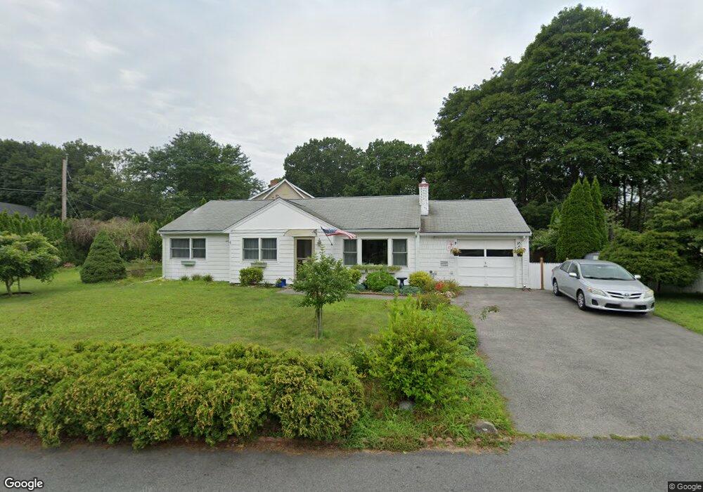
42 Wethersfield Rd Natick, MA 01760
Estimated Value: $735,000 - $967,000
3
Beds
2
Baths
1,421
Sq Ft
$604/Sq Ft
Est. Value
About This Home
This home is located at 42 Wethersfield Rd, Natick, MA 01760 and is currently estimated at $858,074, approximately $603 per square foot. 42 Wethersfield Rd is a home located in Middlesex County with nearby schools including Natick High School, Bennett-Hemenway (Ben-Hem) Elementary School, and Wilson Middle School.
Ownership History
Date
Name
Owned For
Owner Type
Purchase Details
Closed on
Jul 28, 2022
Sold by
Badea Rodica and Badea Emilian
Bought by
R & Emilian Badea Lt
Current Estimated Value
Purchase Details
Closed on
Jan 3, 1994
Sold by
Donahue James G and Wenger Edward J
Bought by
Badea Rodica and Badea Emilian
Home Financials for this Owner
Home Financials are based on the most recent Mortgage that was taken out on this home.
Original Mortgage
$124,450
Interest Rate
7%
Mortgage Type
Purchase Money Mortgage
Purchase Details
Closed on
Nov 21, 1991
Sold by
Donahue James L and Donahue Mary L
Bought by
Donahue James G and Wenger Joan M
Create a Home Valuation Report for This Property
The Home Valuation Report is an in-depth analysis detailing your home's value as well as a comparison with similar homes in the area
Home Values in the Area
Average Home Value in this Area
Purchase History
| Date | Buyer | Sale Price | Title Company |
|---|---|---|---|
| R & Emilian Badea Lt | -- | None Available | |
| Badea Rodica | $131,000 | -- | |
| Donahue James G | $125,000 | -- |
Source: Public Records
Mortgage History
| Date | Status | Borrower | Loan Amount |
|---|---|---|---|
| Previous Owner | Donahue James G | $124,450 |
Source: Public Records
Tax History
| Year | Tax Paid | Tax Assessment Tax Assessment Total Assessment is a certain percentage of the fair market value that is determined by local assessors to be the total taxable value of land and additions on the property. | Land | Improvement |
|---|---|---|---|---|
| 2025 | $6,506 | $544,000 | $450,800 | $93,200 |
| 2024 | $6,331 | $516,400 | $425,700 | $90,700 |
| 2023 | $6,118 | $484,000 | $400,600 | $83,400 |
| 2022 | $5,964 | $447,100 | $365,500 | $81,600 |
| 2021 | $5,563 | $434,300 | $345,500 | $88,800 |
| 2020 | $5,907 | $434,000 | $330,400 | $103,600 |
| 2019 | $6,255 | $434,000 | $330,400 | $103,600 |
| 2018 | $4,526 | $390,500 | $300,400 | $90,100 |
| 2017 | $4,854 | $359,800 | $265,500 | $94,300 |
| 2016 | $4,667 | $343,900 | $250,500 | $93,400 |
| 2015 | $4,632 | $335,200 | $250,500 | $84,700 |
Source: Public Records
Map
Nearby Homes
- 24 Terrane Ave
- 44 Wethersfield Rd
- 43 Wethersfield Rd
- 19 Terrane Ave
- 41 Wethersfield Rd
- 22 Terrane Ave
- 48 Wethersfield Rd
- 17 Terrane Ave
- 3 Irving Rd
- 39 Wethersfield Rd
- 38 Wethersfield Rd
- 45 Wethersfield Rd
- 49 Wethersfield Rd
- 15 Terrane Ave
- 50 Wethersfield Rd
- 51 Wethersfield Rd
- 37 Wethersfield Rd
- 47 Wethersfield Rd
- 20 Terrane Ave
- 2 Westlake Rd