Estimated Value: $903,000 - $989,000
4
Beds
3
Baths
2,712
Sq Ft
$350/Sq Ft
Est. Value
About This Home
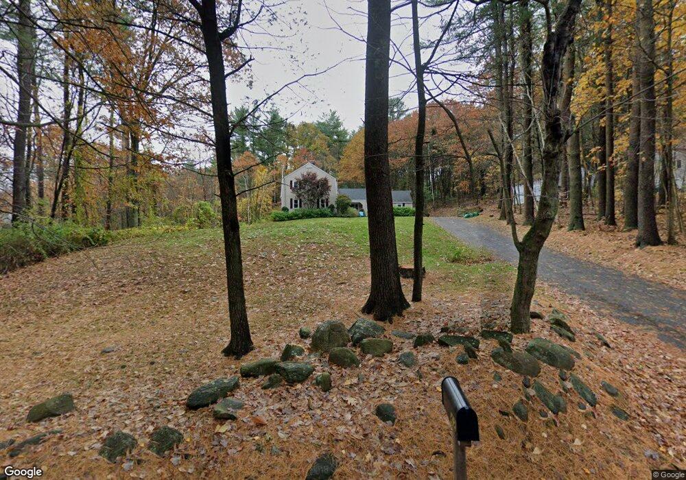
This home is located at 42 Whitman St, Stow, MA 01775 and is currently estimated at $949,589, approximately $350 per square foot. 42 Whitman St is a home located in Middlesex County with nearby schools including Center School, Hale Middle School, and Nashoba Regional High School.
Ownership History
Date
Name
Owned For
Owner Type
Purchase Details
Closed on
Sep 30, 2004
Sold by
Blaszak David and Blaszak Patricia
Bought by
Mckenna James P and Mckenna Kara A
Current Estimated Value
Home Financials for this Owner
Home Financials are based on the most recent Mortgage that was taken out on this home.
Original Mortgage
$333,700
Interest Rate
5.81%
Mortgage Type
Purchase Money Mortgage
Purchase Details
Closed on
Nov 23, 1998
Sold by
Vitale Marilyn and Vitale Alphonse J
Bought by
Blaszak David and Blaszak Patricia
Home Financials for this Owner
Home Financials are based on the most recent Mortgage that was taken out on this home.
Original Mortgage
$239,000
Interest Rate
6.49%
Mortgage Type
Purchase Money Mortgage
Create a Home Valuation Report for This Property
The Home Valuation Report is an in-depth analysis detailing your home's value as well as a comparison with similar homes in the area
Home Values in the Area
Average Home Value in this Area
Purchase History
| Date | Buyer | Sale Price | Title Company |
|---|---|---|---|
| Mckenna James P | $495,000 | -- | |
| Blaszak David | $299,500 | -- |
Source: Public Records
Mortgage History
| Date | Status | Borrower | Loan Amount |
|---|---|---|---|
| Open | Blaszak David | $308,000 | |
| Closed | Mckenna James P | $333,700 | |
| Previous Owner | Blaszak David | $239,000 |
Source: Public Records
Tax History Compared to Growth
Tax History
| Year | Tax Paid | Tax Assessment Tax Assessment Total Assessment is a certain percentage of the fair market value that is determined by local assessors to be the total taxable value of land and additions on the property. | Land | Improvement |
|---|---|---|---|---|
| 2025 | $12,913 | $741,300 | $405,400 | $335,900 |
| 2024 | $12,290 | $724,200 | $388,300 | $335,900 |
| 2023 | $12,542 | $691,800 | $307,000 | $384,800 |
| 2022 | $11,087 | $566,800 | $269,000 | $297,800 |
| 2021 | $11,215 | $561,300 | $281,800 | $279,500 |
| 2020 | $11,651 | $565,300 | $288,200 | $277,100 |
| 2019 | $11,112 | $552,000 | $288,200 | $263,800 |
| 2018 | $11,142 | $531,100 | $288,200 | $242,900 |
| 2017 | $10,785 | $523,800 | $275,500 | $248,300 |
| 2016 | $10,474 | $524,200 | $284,000 | $240,200 |
| 2015 | $9,323 | $466,600 | $208,700 | $257,900 |
Source: Public Records
Map
Nearby Homes
- 40 Saw Mill Rd
- 94 Hudson Rd
- 424 Great Rd
- 28 Mcintosh Dr Unit 22
- 260 Great Rd
- 13 High St
- 210 Barton Rd
- 14 Faxon Dr Unit 14G
- 33 Whispering Way
- 34 Meeting House Ln Unit 208
- 34 Meeting House Ln Unit 111
- 30-6 Taylor Rd
- 51 Hale Rd
- 0 Worcester Ave
- 3 Shore Ave
- 12 Old County Rd
- 12 Old County Rd Unit 20
- 12 Temple Ave
- 6 Bertha St
- 304 Cox St
- 34 Whitman St
- 52 Whitman St
- 43 Whitman St
- 56 Whitman St
- 28 Whitman St
- 51 Whitman St
- 25 Treaty Elm Ln
- 00 Pennie Ln
- Lot 5 Pennie Ln
- 21 Treaty Elm Ln
- 60 Whitman St
- 59 Whitman St
- 105 Birch Hill Rd
- 18 Whitman St
- 27 Treaty Elm Ln
- 45 Treaty Elm Ln
- 68 Whitman St
- 67 Whitman St
- 109 Birch Hill Rd
- 99 Birch Hill Rd