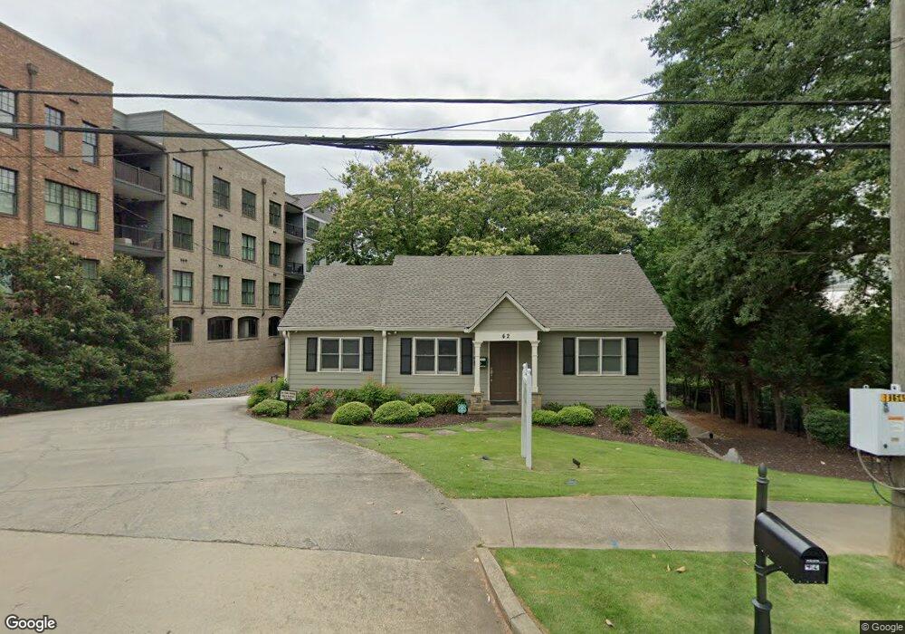
42 Woodstock Rd Roswell, GA 30075
Estimated Value: $640,000 - $1,158,000
2
Beds
1
Bath
948
Sq Ft
$873/Sq Ft
Est. Value
About This Home
This home is located at 42 Woodstock Rd, Roswell, GA 30075 and is currently estimated at $827,756, approximately $873 per square foot. 42 Woodstock Rd is a home located in Fulton County with nearby schools including Roswell North Elementary School, Crabapple Middle School, and Roswell High School.
Ownership History
Date
Name
Owned For
Owner Type
Purchase Details
Closed on
Jan 31, 2024
Sold by
Humanae Vitae Llc
Bought by
Tire Swing Properties Llc
Current Estimated Value
Home Financials for this Owner
Home Financials are based on the most recent Mortgage that was taken out on this home.
Original Mortgage
$165,000
Outstanding Balance
$118,513
Interest Rate
6.62%
Mortgage Type
New Conventional
Estimated Equity
$709,243
Purchase Details
Closed on
Sep 18, 2015
Sold by
Coleman House Llc
Bought by
Humanae Vitae Llc
Create a Home Valuation Report for This Property
The Home Valuation Report is an in-depth analysis detailing your home's value as well as a comparison with similar homes in the area
Home Values in the Area
Average Home Value in this Area
Purchase History
| Date | Buyer | Sale Price | Title Company |
|---|---|---|---|
| Tire Swing Properties Llc | -- | -- | |
| Tire Swing Properties Llc | $765,000 | -- | |
| Humanae Vitae Llc | $500,000 | -- |
Source: Public Records
Mortgage History
| Date | Status | Borrower | Loan Amount |
|---|---|---|---|
| Open | Tire Swing Properties Llc | $165,000 |
Source: Public Records
Tax History Compared to Growth
Tax History
| Year | Tax Paid | Tax Assessment Tax Assessment Total Assessment is a certain percentage of the fair market value that is determined by local assessors to be the total taxable value of land and additions on the property. | Land | Improvement |
|---|---|---|---|---|
| 2025 | $756 | $140,360 | $77,760 | $62,600 |
| 2023 | $3,833 | $135,800 | $55,920 | $79,880 |
| 2022 | $2,321 | $88,200 | $30,920 | $57,280 |
| 2021 | $404 | $85,640 | $30,000 | $55,640 |
| 2020 | $2,641 | $80,640 | $28,960 | $51,680 |
| 2019 | $347 | $70,040 | $23,400 | $46,640 |
| 2018 | $1,930 | $68,360 | $22,840 | $45,520 |
| 2017 | $5,835 | $200,000 | $85,240 | $114,760 |
| 2016 | $5,837 | $200,000 | $85,240 | $114,760 |
| 2015 | $1,295 | $44,200 | $18,840 | $25,360 |
| 2014 | $1,355 | $44,200 | $18,840 | $25,360 |
Source: Public Records
Map
Nearby Homes
- 52 Woodstock Rd
- 54 Woodstock Rd
- 49 Thompson Place
- 35 Woodstock Rd
- 57 Thompson Place
- 56 Woodstock Rd
- 41 Thompson Place
- 41 Woodstock Rd
- 37 Thompson Place
- 1180 Canton St Unit 2C1
- 1180 Canton St Unit 2B2
- 1180 Canton St Unit 2B
- 1180 Canton St Unit 2E
- 1180 Canton St Unit 3B
- 1180 Canton St Unit 104
- 1180 Canton St Unit 3C
- 1180 Canton St Unit 215
- 1180 Canton St Unit 2A
- 1180 Canton St Unit 3D
- 1180 Canton St Unit Ivy (3AA)