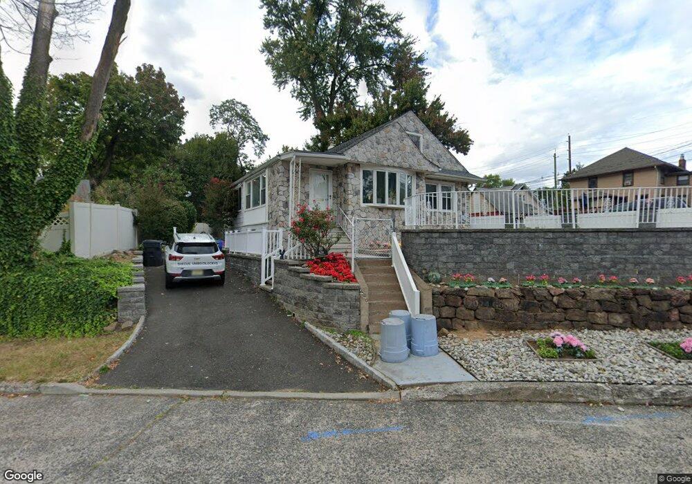
420 Broad Ave Englewood, NJ 07631
Estimated Value: $454,338 - $596,000
--
Bed
--
Bath
1,093
Sq Ft
$488/Sq Ft
Est. Value
About This Home
This home is located at 420 Broad Ave, Englewood, NJ 07631 and is currently estimated at $533,085, approximately $487 per square foot. 420 Broad Ave is a home located in Bergen County with nearby schools including Dr J Grieco Elementary School, Dr Mccloud Elementary School, and J.E. Dismus Middle School.
Ownership History
Date
Name
Owned For
Owner Type
Purchase Details
Closed on
May 2, 1994
Sold by
Est Elise Feulner
Bought by
Wilford Donald
Current Estimated Value
Home Financials for this Owner
Home Financials are based on the most recent Mortgage that was taken out on this home.
Original Mortgage
$85,000
Interest Rate
7.7%
Create a Home Valuation Report for This Property
The Home Valuation Report is an in-depth analysis detailing your home's value as well as a comparison with similar homes in the area
Home Values in the Area
Average Home Value in this Area
Purchase History
| Date | Buyer | Sale Price | Title Company |
|---|---|---|---|
| Wilford Donald | $90,000 | -- |
Source: Public Records
Mortgage History
| Date | Status | Borrower | Loan Amount |
|---|---|---|---|
| Closed | Wilford Donald | $85,000 |
Source: Public Records
Tax History Compared to Growth
Tax History
| Year | Tax Paid | Tax Assessment Tax Assessment Total Assessment is a certain percentage of the fair market value that is determined by local assessors to be the total taxable value of land and additions on the property. | Land | Improvement |
|---|---|---|---|---|
| 2025 | $6,957 | $226,400 | $179,600 | $46,800 |
| 2024 | $6,747 | $226,400 | $179,600 | $46,800 |
| 2023 | $6,677 | $226,400 | $179,600 | $46,800 |
| 2022 | $6,677 | $226,400 | $179,600 | $46,800 |
| 2021 | $6,121 | $226,400 | $179,600 | $46,800 |
| 2020 | $6,373 | $226,400 | $179,600 | $46,800 |
| 2019 | $6,314 | $226,400 | $179,600 | $46,800 |
| 2018 | $6,163 | $226,400 | $179,600 | $46,800 |
| 2017 | $5,979 | $226,400 | $179,600 | $46,800 |
| 2016 | $5,789 | $226,400 | $179,600 | $46,800 |
| 2015 | $5,739 | $226,400 | $179,600 | $46,800 |
| 2014 | $5,692 | $226,400 | $179,600 | $46,800 |
Source: Public Records
Map
Nearby Homes
- 135 Rockwood Place
- 229 Allison Ct
- 110 Phelps Ave
- 290 Van Nostrand Ave
- 300 Van Nostrand Ave
- 278 Fountain Rd
- 285 Arch Rd
- 14 Regency Cir Unit 14
- 14 Mallard Ct Unit 105
- 18 Mallard Ct
- 105B Meadowbrook Rd
- 105 Meadowbrook Rd Unit B
- 9 Pheasant Run Unit 137
- 56 Fox Run Dr
- 306 Hutchinson Rd
- 181 Lakeview Ave
- 576 Ridgeland Terrace
- 119 Lakeview Ave
- 800 Grand Ave
- 21D Lakeview Ave Unit 21D
- 179 Walton St
- 175 Walton St
- 188 Van Nostrand Ave
- 184 Van Nostrand Ave
- 173 Walton St
- 180 Van Nostrand Ave
- 169 Walton St
- 176 Van Nostrand Ave
- 413 Broad Ave
- 411 Broad Ave
- 172 Van Nostrand Ave
- 200 Van Nostrand Ave
- 165 Walton St
- 207 Walton St
- 170 Van Nostrand Ave
- 161 Walton St
- 161 Walton St Unit 2
- 210 Van Nostrand Ave
- 399 Broad Ave
- 392 Broad Ave