420 Driver St Mobile, AL 36617
Midtown Mobile NeighborhoodEstimated Value: $45,478 - $52,000
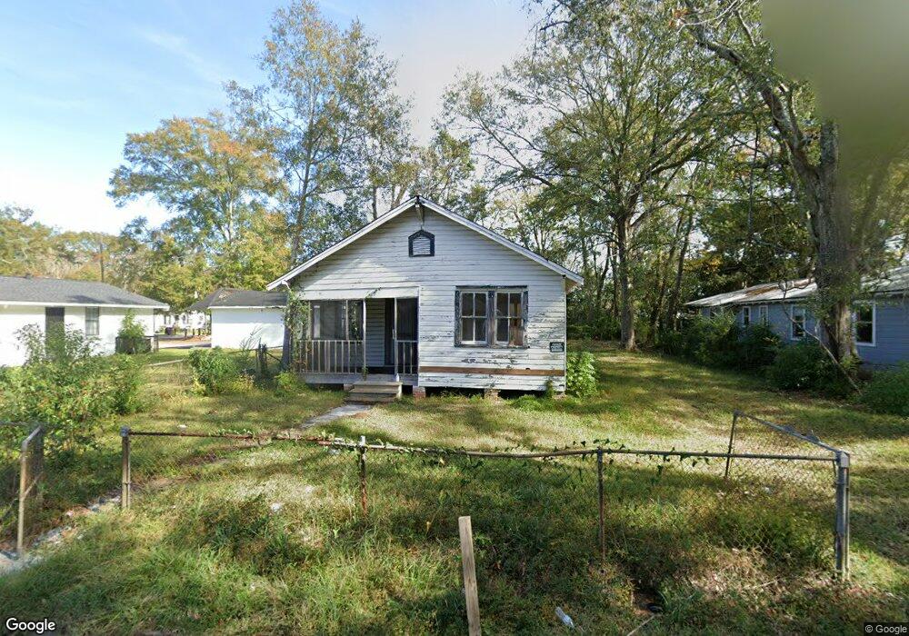
About This Home
This home is located at 420 Driver St, Mobile, AL 36617 and is currently estimated at $49,620, approximately $71 per square foot. 420 Driver St is a home located in Mobile County with nearby schools including Holloway Elementary School, Booker T. Washington Middle School, and LeFlore High School.
Ownership History
We collect this data history from publicly available records. To have your information removed, we recommend requesting removal directly through your county’s website.
Purchase Details
Purchase Details
Purchase Details
Home Values in the Area
Average Home Value in this Area
Purchase History
We collect this data history from publicly available records. To have your information removed, we recommend requesting removal directly through your county’s website.
| Date | Buyer | Sale Price | Title Company |
|---|---|---|---|
| $13,301 | None Listed On Document | ||
| $13,301 | None Available | ||
| $18,000 | -- |
Tax History
We collect this data history from publicly available records. To have your information removed, we recommend requesting removal directly through your county’s website.
| Year | Tax Paid | Tax Assessment Tax Assessment Total Assessment is a certain percentage of the fair market value that is determined by local assessors to be the total taxable value of land and additions on the property. | Land | Improvement |
|---|---|---|---|---|
| 2025 | $231 | $3,480 | $1,200 | $2,280 |
| 2024 | $231 | $3,480 | $1,200 | $2,280 |
| 2023 | $236 | $3,720 | $1,200 | $2,520 |
| 2022 | $236 | $3,720 | $1,200 | $2,520 |
| 2021 | $236 | $3,720 | $1,200 | $2,520 |
| 2020 | $0 | $3,720 | $1,200 | $2,520 |
| 2019 | $0 | $3,560 | $920 | $2,640 |
| 2018 | $0 | $1,780 | $0 | $0 |
| 2017 | $0 | $1,780 | $0 | $0 |
| 2016 | -- | $1,840 | $0 | $0 |
| 2013 | -- | $1,780 | $0 | $0 |
Map
- 2064 Andrews St
- 415 Devon Dr
- 562 Leamore Ct
- 1917 Andrews St
- 0 Andrews St
- 2257 Roberta Dr
- 1950 Pleasant Ave
- 2303 Rushing Dr
- 555 E Downing St
- 2007 Levert Dr N
- 306 Levert St
- 1858 Martin Place
- 1863 N Mott Dr
- 301 E Indian Creek Dr
- 2355 Bullen St
- 1806 N Mott Dr
- 2511 Myrtle St
- 1825 Springhill Ave
- 152 Tuscaloosa St
- 1825 Spring Hill Ave
- 452 Driver St
- 450 Driver St
- 454 Driver St
- 456 Driver St
- 2114 Andrews St
- 2112 Andrews St
- 422 Driver St
- 458 Driver St
- 453 Driver St
- 455 Driver St
- 2110 Andrews St
- 457 Driver St
- 2101 Andrews St
- 2127 Felix St
- 462 Driver St
- 427 Driver St
- 461 Driver St Unit 2
- 461 Driver St Unit 1
- 425 Driver St
- 418 Driver St
Ask me questions while you tour the home.