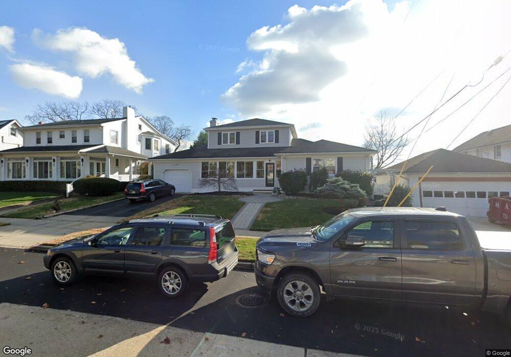
420 Euclid Ave Allenhurst, NJ 07711
Estimated Value: $1,840,000 - $3,116,000
4
Beds
4
Baths
2,215
Sq Ft
$1,050/Sq Ft
Est. Value
About This Home
This home is located at 420 Euclid Ave, Allenhurst, NJ 07711 and is currently estimated at $2,325,185, approximately $1,049 per square foot. 420 Euclid Ave is a home located in Monmouth County with nearby schools including Ocean Township High School, Hope Academy Charter School, and St. Mary of the Assumption School.
Ownership History
Date
Name
Owned For
Owner Type
Purchase Details
Closed on
Jun 28, 2022
Sold by
Codispodi Tanya M
Bought by
Codispodi Alfred and Codispodi Joan
Current Estimated Value
Purchase Details
Closed on
Aug 27, 2020
Sold by
Codispodi Alfred and Codispodi Joan
Bought by
Codispodi Alfred and Codispodi Joan
Purchase Details
Closed on
Feb 13, 1996
Sold by
Weintraub Claire
Bought by
Codispodi Alfred and Docispodi Joan
Home Financials for this Owner
Home Financials are based on the most recent Mortgage that was taken out on this home.
Original Mortgage
$133,000
Interest Rate
7.04%
Mortgage Type
VA
Create a Home Valuation Report for This Property
The Home Valuation Report is an in-depth analysis detailing your home's value as well as a comparison with similar homes in the area
Home Values in the Area
Average Home Value in this Area
Purchase History
| Date | Buyer | Sale Price | Title Company |
|---|---|---|---|
| Codispodi Alfred | -- | Arcomano Keith N | |
| Codispodi Alfred | -- | Arcomano Keith N | |
| Codispodi Alfred | -- | None Available | |
| Codispodi Alfred | $152,900 | -- |
Source: Public Records
Mortgage History
| Date | Status | Borrower | Loan Amount |
|---|---|---|---|
| Previous Owner | Codispodi Alfred | $133,000 |
Source: Public Records
Tax History Compared to Growth
Tax History
| Year | Tax Paid | Tax Assessment Tax Assessment Total Assessment is a certain percentage of the fair market value that is determined by local assessors to be the total taxable value of land and additions on the property. | Land | Improvement |
|---|---|---|---|---|
| 2025 | $7,695 | $2,452,200 | $1,587,500 | $864,700 |
| 2024 | $7,120 | $2,125,700 | $1,434,200 | $691,500 |
| 2023 | $7,120 | $1,849,300 | $1,246,900 | $602,400 |
| 2022 | $8,438 | $1,467,400 | $993,800 | $473,600 |
| 2021 | $8,438 | $1,288,300 | $816,100 | $472,200 |
| 2020 | $8,573 | $1,217,800 | $778,600 | $439,200 |
| 2019 | $8,692 | $942,700 | $609,300 | $333,400 |
| 2018 | $9,352 | $920,500 | $596,100 | $324,400 |
| 2017 | $11,588 | $771,000 | $482,600 | $288,400 |
| 2016 | $13,528 | $630,100 | $497,300 | $132,800 |
| 2015 | $12,927 | $626,600 | $497,300 | $129,300 |
| 2014 | $12,591 | $625,500 | $497,300 | $128,200 |
Source: Public Records
Map
Nearby Homes
- 15 Buena Vista Ct
- 312 Hume St
- 309 Hume St
- 500 Deal Lake Dr Unit 1E
- 500 Deal Lake Dr Unit 3B
- 400 Deal Lake Dr Unit 3J
- 400 Deal Lake Dr Unit 8F
- 400 Deal Lake Dr Unit 3K
- 400 Deal Lake Dr Unit 4G
- 400 Deal Lake Dr Unit 5F
- 400 Deal Lake Dr Unit 7H & 7G
- 400 Deal Lake Dr Unit 3F
- 1702 Grand Ave
- 505 8th Ave
- 205 Edgemont Dr Unit 3
- 205 Edgemont Dr Unit 1
- 309 Spier Ave
- 222 Cedar Ave
- 104 Lake Dr
- 505 6th Ave
- 418 Euclid Ave
- 427 Edgemont Dr
- 416 Euclid Ave
- 421 Edgemont Dr
- 419 Edgemont Dr
- 414 Euclid Ave
- 409 Euclid Ave
- 407 Euclid Ave
- 407 Euclid Ave Unit Summer 2024 rear
- 407 Euclid Ave Unit Summer 2024
- 407 Euclid Ave Unit REAR
- 407 Euclid Ave Unit WINTER
- 407 Euclid Ave Unit B
- 407 Euclid Ave Unit Summer 2022
- 417 Edgemont Dr
- 405 Euclid Ave
- 412 Euclid Ave
- 16 Buena Vista Ct
- 415 Edgemont Dr
- 401 Euclid Ave