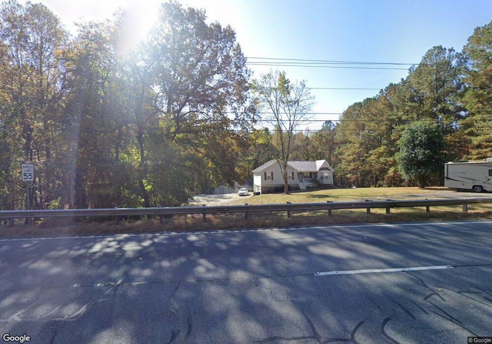
420 Knox Bridge Hwy White, GA 30184
Sutallee NeighborhoodEstimated Value: $381,000 - $395,000
3
Beds
2
Baths
1,340
Sq Ft
$290/Sq Ft
Est. Value
About This Home
This home is located at 420 Knox Bridge Hwy, White, GA 30184 and is currently estimated at $388,906, approximately $290 per square foot. 420 Knox Bridge Hwy is a home located in Cherokee County with nearby schools including J. Knox Elementary School, Teasley Middle School, and Cherokee High School.
Ownership History
Date
Name
Owned For
Owner Type
Purchase Details
Closed on
Sep 7, 2021
Sold by
Wolfe Michael L
Bought by
Torres Guillermo and Ciardi Torres Felicia
Current Estimated Value
Purchase Details
Closed on
Nov 25, 2015
Sold by
Lewis Betty D
Bought by
Wolfe Michael L
Home Financials for this Owner
Home Financials are based on the most recent Mortgage that was taken out on this home.
Original Mortgage
$176,200
Interest Rate
3.83%
Mortgage Type
New Conventional
Purchase Details
Closed on
Jun 13, 2001
Sold by
Lewis Wesley V
Bought by
Lewis Wesley V and Lewis Betty D
Home Financials for this Owner
Home Financials are based on the most recent Mortgage that was taken out on this home.
Original Mortgage
$36,378
Interest Rate
7.11%
Mortgage Type
Stand Alone Refi Refinance Of Original Loan
Create a Home Valuation Report for This Property
The Home Valuation Report is an in-depth analysis detailing your home's value as well as a comparison with similar homes in the area
Home Values in the Area
Average Home Value in this Area
Purchase History
| Date | Buyer | Sale Price | Title Company |
|---|---|---|---|
| Torres Guillermo | $272,500 | -- | |
| Wolfe Michael L | $185,500 | -- | |
| Lewis Wesley V | -- | -- |
Source: Public Records
Mortgage History
| Date | Status | Borrower | Loan Amount |
|---|---|---|---|
| Previous Owner | Wolfe Michael L | $176,200 | |
| Previous Owner | Lewis Wesley V | $36,378 |
Source: Public Records
Tax History Compared to Growth
Tax History
| Year | Tax Paid | Tax Assessment Tax Assessment Total Assessment is a certain percentage of the fair market value that is determined by local assessors to be the total taxable value of land and additions on the property. | Land | Improvement |
|---|---|---|---|---|
| 2024 | $3,662 | $140,924 | $39,680 | $101,244 |
| 2023 | $3,714 | $142,924 | $39,680 | $103,244 |
| 2022 | $2,865 | $109,000 | $33,039 | $75,961 |
| 2021 | $2,016 | $71,004 | $21,120 | $49,884 |
| 2020 | $1,916 | $67,444 | $21,120 | $46,324 |
| 2019 | $1,962 | $69,040 | $21,120 | $47,920 |
| 2018 | $1,931 | $67,560 | $21,120 | $46,440 |
| 2017 | $1,853 | $171,800 | $21,120 | $47,600 |
| 2016 | $1,853 | $159,100 | $17,800 | $45,840 |
| 2015 | $1,903 | $161,800 | $17,800 | $46,920 |
| 2014 | $1,362 | $115,600 | $16,680 | $29,560 |
Source: Public Records
Map
Nearby Homes
- 27 Rose Brooke Cir
- 2307 Ellie Way
- 315 Rhine Rd SE
- 10 Clydesdale Trail
- 132 Amberleigh Dr
- 302 Amberleigh Ct
- 460 Mount Olive Church Ln
- 426 Mount Olive Church Ln
- 466 Mount Olive Church Ln
- 16 Hawks Branch Ln
- 16 Hawks Branch Ln Unit 123
- 1355 White Rd
- 1166 Upper Sweetwater Trail SE
- 30 Crolley Ln
- 127 Spring Lake Trail
- 427 Spring Lake Hills
- 123 Spring Lake Trail
- 420 Knox Bridge Hwy
- 250 Knox Bridge Hwy
- 1139 Rhine Rd SE
- 1139 Rhine Rd SE
- 232 Knox Bridge Hwy
- 320 Sutallee Place
- 244 Sutallee Place
- 125 Clearwater Trail NE
- 1111 Rhine Rd SE
- 0 Sutallee Place Unit 7463902
- 0 Sutallee Place Unit 7240303
- 0 Sutallee Place Unit 7079831
- 0 Sutallee Place Unit 8238065
- 0 Sutallee Place Unit 7049187
- 0 Sutallee Place Unit 7213105
- 0 Sutallee Place Unit 7140689
- 0 Sutallee Place
- 168 Knox Bridge Hwy
- 322 Sutallee Place
- 589 Knox Bridge Hwy
